Sunday, December 18, 2022

#19 of 100 trips - Gardens / Upper Junction / Blanket Bay / return to Dunedin Gardens 17 December 2022

Five intrepid trampers met at the Gardens corner to recreate one of the early tramping trips of the Otago Tramping Club which involved a lot of road walking which, for the early trampers, would have been on narrow, winding gravel roads but for us was on mostly narrow, winding sealed roads and a wide, flat, smooth cycleway.   We were quietly confident that the sea fog would lift by the time we had reached Upper Junction so that we would be able to see the views, little did we realise how wrong we were.  Meeting at the Gardens corner we set off walking up North Road towards Upper Junction.
The first two and a half kilometers has only a mild gradient and the time went quickly as we walked and chatted our way up North East Valley.  Once we reached Normanby the gradient increased and the sea fog seemed to come lower down the hill so that it felt like it wouldn't be long before we walked into it.  It was a nice surprise to meet my father out for his morning walk and we stopped for a brief chat before continuing on.  Only a short distance on the footpath ran out and we were walking along the edge of the road. 
One of the reasons for the early start to the walk was to avoid the traffic on this part of the road and for the most part it worked with only spasmodic traffic. The higher we climbed the thicker the fog became and by keeping well to the side of the road, we didn't disrupt any traffic.  One of the good things about road walking is that the slower pace means that you get time to see things that you'd normally miss when driving past which is exactly what we did - chatting to passing cyclists, listening to the birds, spying bugs in the long grass, watching the sheep and cows (who were watching us), admiring the flowers and our most unusual find was one new, unused boot. 
The higher we climbed the thicker the fog/mist became so that when we reached the highest point at Upper Junction, disappointingly there was no view.  Instead of admiring the view of North East Valley and the city that was hidden to us, we took a small detour to visit the war memorial on the site of the former Upper Junction School that was destroyed by fire in 1945.  There are 17 beech trees planted beside plaques in remembrance of former pupils who were killed during the first world war. This is a particularly poignant war memorial for me as my fathers uncle has a plaque and beech tree planted in his memory here.  John Williams was 17 when he signed up, lying about his age so that he would be accepted into the army and killed at the Somme, aged just 19 years.  It seemed very fitting with the muted light from the  mist swirling around the hundred year old giant macrocarpa trees creating an ethereal atmosphere during our visit of this site.
What goes up must then come down and that is exactly what we did, heading 300 metres down hill on Upper Junction Road, all the way to sea level.  It seemed almost impossible but the mist seemed to grow thicker and we were barely able to see each other at times.  The striking views were non-existent so had to keep an ear open for cars to avoid being hit on the narrow, winding road.
As we dropped lower the mist slowly started to thin until we dropped below it and finally got our first views of the surrounding farmland and down to the harbour. We stopped on a sweeping bend where we could get well off the road for a morning tea break.  Replenishing ourselves with a drink and snack while admiring all that we could see.  With the hills on the opposite side of the harbour and most of the city being shrouded in fog, we were only able to see down to Blanket Bay and Roseneath. 
Knowing that most of the hill was behind us, we continued down the hill where we eventually met up with the main road to Port Chalmers, State Highway 88.  We admired the yet to be completed new cycleway/walkway including the blue surface from a distance. Despite the cycleway looks like it is completed, there are large fences stopping access  so we continued walking along St Leonards Drive.
A lunch stop was called at St Leonards Park where Mandy found a swing to sit while the rest of us opted for the picnic table.  Lindsay arrived with his dog and a box of cherries which he shared while we watched a large ship sail past on it's way to the inner harbour.  By now we were over halfway through our walk and were about to start on the 'easy' part of our walk, along the flat cycle/walkway which runs beside the railway line.  This proved to be more difficult than first thought as the 8km of flat, hard surface made for tired legs and feet.  The fog was lifting with the views of the harbour opening out and we were able to distract each other by seeing who could spot the most interesting sight.  Some of the interesting things we saw were kayakers getting tooted at by the harbour tug for being in the main shipping channel, swimmers jumping off the harbour channel markers, a speedboat jumping the tug boats wake, a grey spoonbill, a few sad, rotting boats, some exercise equipment, lots of walkers and only a handful of cyclists but no trains. 
Once we reached the stadium we turned off the cycle/walkway and continued past the University, skirted around a cricket match in progress and wandered through the student housing until we reached the Water of Leith. We followed the Water of Leith through the Gardens and back to the main gates where we had started 5.5 hours and 21km earlier.

Tuesday, December 13, 2022

#18 of 100 trips for 100 years - Burns Track / Mountain Road (Track) / Rongomai / Evansdale Glen 11 December 2022

With heavy rain the night before and then waking up to low cloud this morning, it wasn't surprising that only three hardy souls turned up for what can only be described as a trip of many parts.  The results of last night's rain was obvious right from the start as the Pipeline Track, where we had walked on a dry surface only a month earlier during trip #9/100, was now slippery with a thin layer of mud.  After only 20 minutes walking on the Pipeline Track we reached the start of the Burns Track and from here the real work began. 

The Burns Track has always had a reputation of being muddy and while I'd not been on it for a number of years, I was pleasantly surprised to find that while there was plenty of mud to contend with, it wasn't difficult to avoid most of it.  The track has been well maintained with a number of channels dug to help drain the water and the vegetation has been cut back reasonably recently with one substantial section of 'board/branch walk'.  We made good progress and reached the Burns Saddle in around 40 minutes.  

It was on this section that we startled a couple of small pigs relaxing on the track.  The pigs were very quick to dive into the scrub as soon as they became aware of our presence.  The track follows the contour around and crosses the Burns Creek before climbing up a short but steep section to the junction of Rustlers Ridge where a morning tea stop was called and we got to have a short break (we had crossed here about a month ago on trip #9/100).

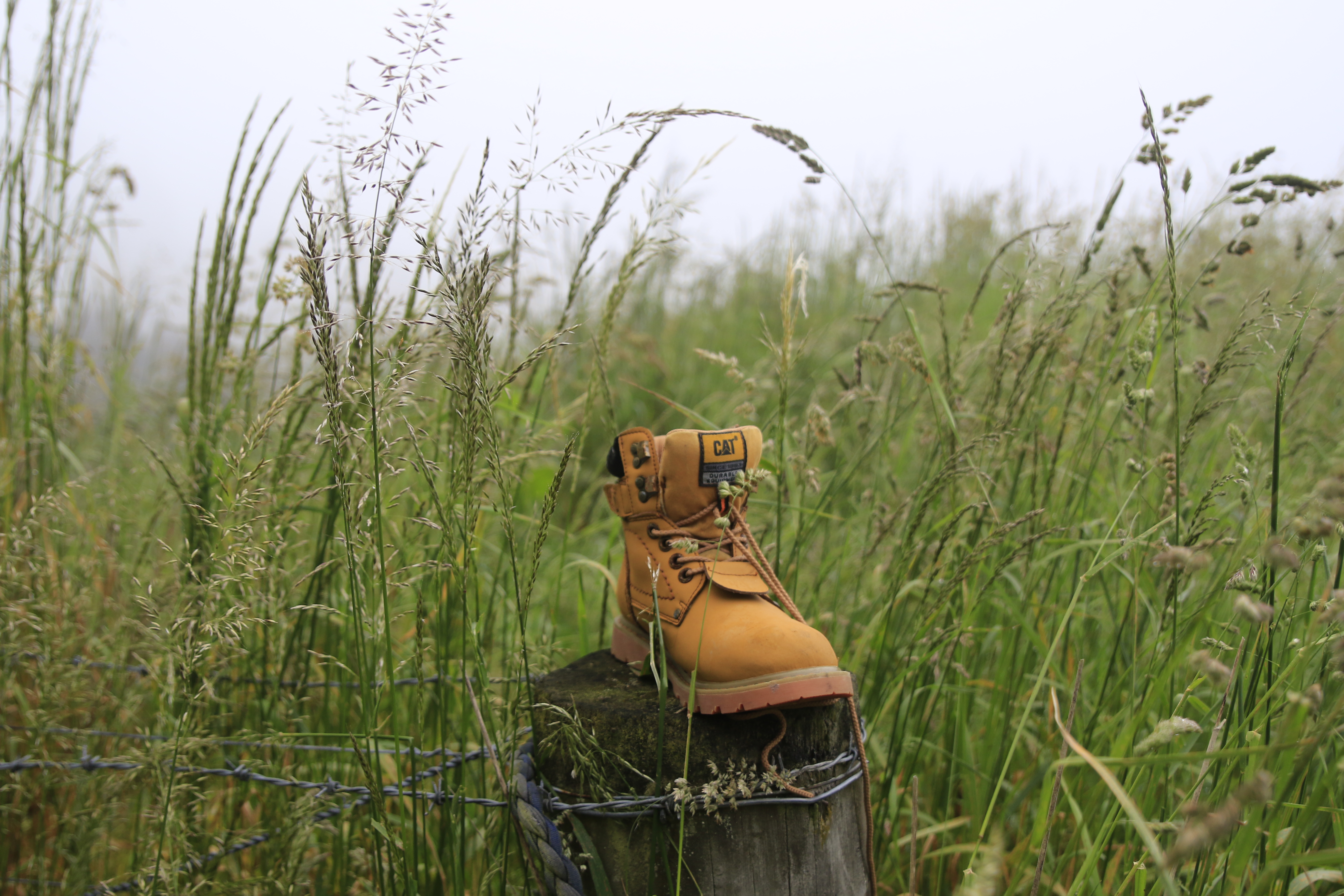
Continuing on the Burns Track, we headed towards Swampy Ridge with the track starting to deteriorate with larger and deeper patches of mud but mostly we were able to skirt around the edges of it.  On this section we had another encounter with wild life, this time we surprised a family of goats which took off in all directions and for some time we could hear them crashing through the undergrowth trying to regroup and move away from us at the same time.  We passed the steel stile to no where and continued onto Swampy Ridge where we turned towards Sleepy Hollow and the Silver Peaks. This is where we really encountered the mud, making anything we had already been through on the Burns Track seem insignificant.  It felt like the mud went on and on with some hilarity along the way, seeing who could avoid the worst of the mud and who would go in the deepest. 

 Everything must end eventually and so too did the mud. As we got nearer to Hightop, it was with relief when we entered the golden tussock.  This was a really enjoyable part of the track to walk along as it reminded me a lot of what the Silver Peaks looked like 25+ years ago when the all the tops were covered in this tussock and we were able to wander at will down any of the ridges. A bonus was that we were past the mud and were able to walk along without having to be careful of every step taken. 

We made a small detour off the track and up to Hightop where we stopped for an early lunch at 11.30am in the sun. We nestled amongst the golden tussock looking towards the tops of the Silver Peaks and reminisced about some of the trips we'd been on over the years into the Silver Peaks and some of the people that had been on those trips.  It was during lunch that Rob discovered he had left his cup at home and his tea was too hot to drink straight from the thermos.  Feeling sorry for him having carried his hot tea all this way and still with quite a distance to go,  I donated my lunch box to him to use as a cup and Rob was able to enjoy his hot tea.  
Feeling replenished we shouldered our bags and continued on our journey.  Finding our way down from Hightop involved a small amount of bush bashing as the track is overgrown and difficult to follow in places but all to soon we found ourselves on Mountain Road. This next part of the trip was the section that I was least looking forward to as it involved about 6km of walking along Mountain Road.  I must confess that it wasn't as monotonous as it has been in the past due to the fact that all the pine trees have been harvested which meant we weren't walking in a tunnel of trees but instead had good views and were able to amuse ourselves by picking out distant landmarks as we walked. 
After about an hour of road walking we reached the Rongomai track which starts off on a gentle slope then descends steeply down a defined ridge.  Thankfully there were a few well placed trees to hold onto but mostly it was a careful descent making sure to stick to the track as there was no room for error with extremely steep sides.  At one stage we heard a snuffly snort almost under our feet and not wanting to see what made the noise we quickened our pace and eventually we had dropped 300m to emerge at Careys Creek.  The final stretch of track involved a 3.5km walk along the grassy bank of Careys Creek winding in and out of the bush. This part was what we affectionately named the 'boot cleaner' section as the long grass wiped all the mud off our boots and we emerged from the track looking a lot cleaner than we might have otherwise been.  All in all a fun day out where we walked 19.2km in a little over 6 hours.  

Monday, December 12, 2022

#16 of 100 trips for 100 years - Tunnel Beach 8 December 2022 (by Jade Pettinger)


This day trip was in place of a club Thursday night talk and is part of the 100 trips because the third weekend of the Otago Tramping Club in 1923 included two trips from the St Clair tram terminus to Blackhead via Cargill’s Castle. Similar trips appeared sporadically through the trip programme up until 1983, but urbanisation and more private owners of the land now make the original trip impossible and hence this trip was added to the 100 trip list.  

Being a windy evening and with the threat of rain, it was very heartening to see 19 people turn up at 6pm for the 1km wander 150m down the hill to Tunnel Beach. It was a reasonably fast walk down with a short stop for a team photo.

 The magnificent sculptured sandstone cliffs and arches provide a stunning backdrop for the turbulent waves that slam into the cliffs.  It's an impressive place to be to see how ferociously the waves are thrust into any small crevices in the rock, creating a larger crack which eventually breaks off from the main cliff.  There was plenty of evidence of the power of the water with large slabs of sandstone littering the base of the cliffs and  billowing plumes of water crashing into the rugged cliff face.

Turning our attention away from the surging sea we descended the 72 steps down the hand carved tunnel that gives Tunnel Beach it's name.  The tunnel was commissioned by a local politician, John Cargill  in the 1870's for his family to access their own secluded beach near the family home of Cargills Castle.  The tunnel is sloped and steep but easy to navigate and at the bottom we were rewarded by being able to see up close some of the large sandstone boulders that had fallen from the surrounding craggy cliffs. The boulders are a variety of  shapes and sizes with most being easy to clamber up onto. 

The tide was on it's way out so more sand was slowly being exposed and if you were quick, you were able to run around a small headland to a sheltered cave without getting wet.  A few people were not quite as quick as they should have been and ended up with wet feet. The cave is also a favourite overnight retreat for sea lions and some of our group were lucky to see one come surfing into the safety of the cave. 
All too soon it was time to retrace our steps back up through the tunnel and then continue following the track up the hill.  The climb up the hill was much slower than the descent but we all made good time, with only the occasional short rest and arrived at the cars about 1 hour after leaving.  
Written by Jade Pettinger

Sunday, December 11, 2022

#15 of 100 trips for 100 years - Leith Saddle - Morrison Burn 4 December 2022


With the promise of good weather and even better views, 11 people enthusiastically started the 300m slog up the Leith Saddle Walkway towards Swampy Summit.  The first part of the track is benched and graveled and while it makes for easy walking, it is also the steepest part of the uphill to the lookout.  Maybe I am getting fitter with these 100 trips or maybe it was the good company and conversations but the walk up didn't seem to take long or feel too difficult.  A quick breather and we continued up the hill with the gradient relenting slightly as the track climbed out of the bush and into the tussock.  This gave us the opportunity to have short stops and look back at the view of the coastline from Blueskin Bay to Karitane as it opened out behind us. 
Having walked down this track last week, I had been apprehensive about the 300m climb today but the walk up the hill was pleasant and I enjoyed seeing the views from a different perspective. About an hour after starting we were at our highest point, Swampy Summit for a drink and snack before taking the turn off to the Power Line Track and then onto the Morrison Burn.  This is the part of the trip that I was most looking forward to as I have never been down either of these tracks.  At first the Power Line track is enjoyable as it is a wide, slightly overgrown grassy four wheel drive track with good views looking towards the city. 

As we descended downhill, the broom and gorse started to encroach onto the track and we were forced to wind our way between the head high  bushes before turning onto the Morrison Burn track as we entered the native bush. This is where the track changes becoming steep and muddy in places.  It was a game of slipping and sliding down the slippery track and over tree roots seeing who can stay on their feet, although there were plenty of trees to grab and hold on the way past. After about half an hour of this slippery fun we emerged onto Leith Valley Road where it was almost a let down to then walk the 2km up the gravel road beside the motorway to Sullivans Dam where it was a unanimous decision to stop for lunch.
Sullivans Dam is a Dunedin City Reservoir nestled amongst native forest.  Today the dam is only a back up water supply for the city, however when it was open in 1916 it was a main supply for the rapidly growing city.   The reservoir has a number of popular walking tracks and is stocked with trout and is a good place for families to come and learn to fish.  It was a perfect spot for us to spot a few birds, watch children learning to fish and look across the reservoir to the hill we were going to climb next. 
Shouldering our backpacks, we completed a half circuit of the reservoir to The Cloud Forest of Leith track -  a track that we had walked the top part of on trip #13 last Sunday.  The 150m climb to the rock outlook took about 35 minutes and, despite being a little muddy was easy to follow.  The reward of reaching the rocky outcrop was being able to see the whole route that we'd walk today, from starting at Leith Saddle Walkway, Swampy Summit, the silhouette of the power lines on the skyline, Leith Valley Road and Sullivans Dam.
The last part of the trip was reasonably straightforward being down the hill with only a little mud to emerge form the bush onto the side of the motorway and back to the cars after 11.8km and four and half hours after starting. 


Saturday, December 10, 2022

#14 of 100 trips for 100 years - Hawksbury Lagoon and Waikouaiti Beach 3 December 2022 (by Jade Pettinger)

What had started as a beautiful sunny Saturday morning had turned to some light rain as we 

headed to Woodhaugh Gardens for Trip 014, an impromptu Saturday afternoon trip to 

Hawksbury Lagoon and Waikouaiti Beach to make up for the cancelled Routeburn in a Day 

trip. As the clock ticked closer to 1pm, we were starting to think it would just be the three of 

us when Lindsay pulled up. We bundled into the car and headed north, our spirits lifting as 

the weather improved the further out of the city we got. 

Four of us quickly turned into six as just as we locked the car and were heading down the 

track Tina and Laurence turned up. We set off to Hawksbury Lagoon from Scotia Street 

North in Waikouaiti, crossing the unusual land bridge whilst happily chatting away. 

It soon became apparent that Hawksbury Lagoon was a bird watcher's paradise and we were kept thoroughly entertained as we wandered through the lagoon. There was an abundance of Black Swan/Kakīānau, and we were delighted to see some cygnets (baby swans) bobbing around the place. Other highlights included Royal Spoonbill and Plovers, the photographers in the group spent a great deal of time capturing the winning photo for the ‘Flora and Fauna’ category of the photo competition. 

Before long we arrived at the northern end of Waikouaiti Beach and were soon making 

good time along the beach. We were relieved at the lack of wind, which combined with 

the firm sand made for easy walking for the 4½km to the southern end of the beach. 

The next 45 minutes or so passed quickly as we walked along chatting. 

The sun had started to peek through by the time we reached the southern end of Waikouaiti 

Beach, opposite to Karitane. The crazy ones amongst us enjoyed some time paddling in 

the cold sea while the more sensible ones stayed firmly on dry land. Having stood at 

Karitane multiple times looking over the channel to the beach, it was really cool to be on 

the other side. While we were enjoying some jet planes (thanks Lindsay) we saw two 

figures approaching in the distance and soon were joined by Barry and Helen. 

With the thought of another long slog along the beach ahead of us, we decided to be 

adventurous and head back along the beach on the inlet side. This soon turned into quite 

the workout as the sand was incredibly soft and each step took immense effort. The rest 

of the group quickly learnt to follow in the footsteps of the first person which made their

 journey much easier - not so much for me in the front! 

Once it became apparent that the beach was running out and would no longer be a viable 

option, we went bush to try to find our way back to the main beach. Although we all started 

out following Antony, we somehow ended up going our own ways as we battled the head 

high grass. Thankfully we all made it safely to the beach and regrouped for the last few km 

back to the road. 

Having refueled on jet planes and with good company the walk back whizzed by and in no 

time we were at the road. A quick 1km or so up Beach Street to where we left the vehicles 

and we were soon headed back home. It was a really enjoyable Saturday afternoon trip to 

somewhere I hadn’t been before. We covered 11km in just under three hours, slowed down 

a bit by the soft sinky sand at the southern end of the beach but a great afternoon out 

nonetheless. 

written by Jade Pettinger 


Friday, December 2, 2022

#13 of 100 trips for 100 years - Complete Northern Skyline, Bull Ring to Organ Pipes 27 November 2022


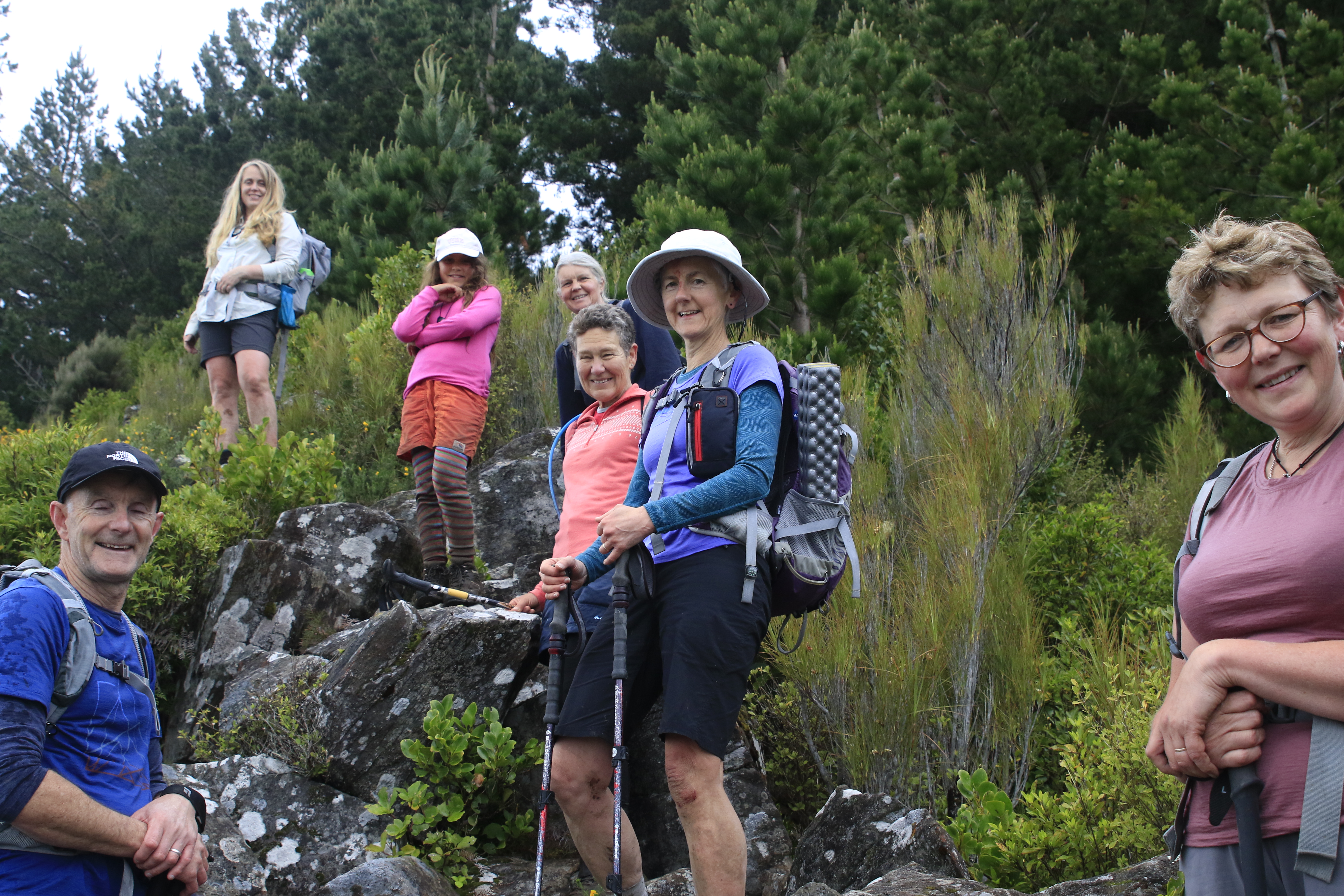
The day was warm when eight energetic trampers took on the challenge of walking the Complete Northern Skyline which links Flagstaff, Swampy Summit, Mt Cargill and Buttar's Peak over seven tracks from the Bull Ring to the Organ Pipes. Starting with a steep up hill climb up the well graveled track to the first 'summit' of the day, Flagstaff was a good way to get the lungs working and also a taste of things to come. Taking about half an hour to reach Flagstaff, we stopped for a chance to catch our breath and take in one of the views of the city.  

It was only a brief stop before we continued on our way along the graveled Pineapple Track before taking the shortcut in the dip to the Fire Break Track and then turning right to head towards Swampy Summit.  From a distance, looking at the skyline, this part of the track appears reasonably flat but in reality is anything but flat.  There is about 100m drop along the ridge before the slope steepens and  gains 160m of height to Swampy Summit.  While the walking is easy along an old, overgrown four wheel track, the last 1.5km of track is a relentless climb up  to Swampy for a well deserved morning tea break.

At 739m Swampy Summit is our second summit of the trip and is also the highest point on our journey.  It offers stunning views of Blueskin Bay, Warrington and up the coast to Karitane and Huriawa Peninsula.  Our ultimate destination of Mt. Cargill, which still looked to be quite a distance to go, attracted our attention and after refueling with a drink and snacks, we headed down the Leith Saddle Track which we had walked down two weeks ago on #9/100 trips.  This track is steep in places and drops around 300m through tussock before entering native forest and eventually emerging on the side of the Northern Motorway. 

We regrouped to safely cross the Northern Motorway and enter the Cloud Forest of Leith Track.  The track winds it's way through native bush for 600m to a large outcrop of boulders with a good look out over the Northern Motorway and Swampy Summit.  Here was a good lunch spot where we were entertained with jokes from Emilie, who at 8 years was the youngest member of our group. 


Lunch was over too soon and we headed back into the native bush to follow the track through remnants of a cedar forest and over a small creek continually making our way up hill until we reached the power lines. From the power lines we entered another track, the Escarpment Track and this is the most challenging of all the tracks.  The Escarpment Track is a basic track with tree roots, fallen logs and small creek crossings.  It is barely maintained with a lot of regrowth obscuring the track and ankle deep mud.  The condition of the track made for slow going with most of us having some blood drawn from encounters with bush lawyer and scrapes with branches hidden amongst the ferns that hid the track. After a climbing 150m from the power lines we reached the obstacle of Pigeon Rock which required a scramble and well placed tree to reach  great views looking towards Swampy Summit and around to the northern Silver Peaks, Mt Watkin and the Kakanuis being visible in the distance.  This was another perfect place to stop, rest and have a drink.
From the top of Pigeon Rock we entered the edge of the pine forest and encountered some of the muddiest part of the track yet (and that is saying something!).  It's a short, sharp climb up to Pigeon Hill then across the pine plantation to Cowan Road.  The pine trees have grown quite high since I was last here and it is impossible to see ahead very far so we wandered, what felt like aimless circles, around the pine trees in an easterly direction until we reached Cowan Road.  Now that the hard part was done it was a reasonably fast walk up Cowan Road to the AH Read track which took us to our third summit, Mt Cargill. 

We could see the end was close so down Mt Cargill to the turn off to Buttar's Peak.  Ignoring the 'no exit' sign we clambered up the rocky outcrops of Buttar's Peak for another stunning view, this time of the harbour. Buttar's Peak is often overlooked as most people head to the higher Mt. Cargill or the more famous Organ Pipes but the interesting rock formations of Buttar's Peak are well worth taking the time over.  We continued over the top of Buttar's Peak, effectively making this our forth summit, to rejoin the Mt Cargill track. 
Once onto the well graveled Mt Cargill track we followed the ridge to the Organ Pipes which are jointed columnar basalt.  There are lots of  'pipes' to scramble over, however there are still plenty standing further up the hill, looking very much like the pipes of an organ.  The 'pipes' are scattered throughout the surrounding bush with the uniform dimensions and unusual shape offering the opportunity for some great photography without too much effort.  We didn't have time to explore these unusual rock formations for long and reluctantly turned back onto the graveled track and a short  minutes down hill to the car park.
This trip is one I have always enjoyed as it traverses the city skyline over a variety of terrain from well graveled tracks through to challenging overgrown bush with plenty of mud.  The views are spectacular in all directions and really show what a beautiful city Dunedin is and how lucky we are to have such easy access to the surrounding hills.  Total distance walked was 17.5km taking us 7 hours 5 minutes. 

Otago Harbour Cycleway 30 October 2023

With my sister in town, it seemed a shame to waste a calm, sunny day so the two of us hopped on a bike each to enjoy the recently opened 32k...