Showing posts with label Leith Saddle. Show all posts

Sunday, December 11, 2022

#15 of 100 trips for 100 years - Leith Saddle - Morrison Burn 4 December 2022


With the promise of good weather and even better views, 11 people enthusiastically started the 300m slog up the Leith Saddle Walkway towards Swampy Summit.  The first part of the track is benched and graveled and while it makes for easy walking, it is also the steepest part of the uphill to the lookout.  Maybe I am getting fitter with these 100 trips or maybe it was the good company and conversations but the walk up didn't seem to take long or feel too difficult.  A quick breather and we continued up the hill with the gradient relenting slightly as the track climbed out of the bush and into the tussock.  This gave us the opportunity to have short stops and look back at the view of the coastline from Blueskin Bay to Karitane as it opened out behind us. 
Having walked down this track last week, I had been apprehensive about the 300m climb today but the walk up the hill was pleasant and I enjoyed seeing the views from a different perspective. About an hour after starting we were at our highest point, Swampy Summit for a drink and snack before taking the turn off to the Power Line Track and then onto the Morrison Burn.  This is the part of the trip that I was most looking forward to as I have never been down either of these tracks.  At first the Power Line track is enjoyable as it is a wide, slightly overgrown grassy four wheel drive track with good views looking towards the city. 

As we descended downhill, the broom and gorse started to encroach onto the track and we were forced to wind our way between the head high  bushes before turning onto the Morrison Burn track as we entered the native bush. This is where the track changes becoming steep and muddy in places.  It was a game of slipping and sliding down the slippery track and over tree roots seeing who can stay on their feet, although there were plenty of trees to grab and hold on the way past. After about half an hour of this slippery fun we emerged onto Leith Valley Road where it was almost a let down to then walk the 2km up the gravel road beside the motorway to Sullivans Dam where it was a unanimous decision to stop for lunch.
Sullivans Dam is a Dunedin City Reservoir nestled amongst native forest.  Today the dam is only a back up water supply for the city, however when it was open in 1916 it was a main supply for the rapidly growing city.   The reservoir has a number of popular walking tracks and is stocked with trout and is a good place for families to come and learn to fish.  It was a perfect spot for us to spot a few birds, watch children learning to fish and look across the reservoir to the hill we were going to climb next. 
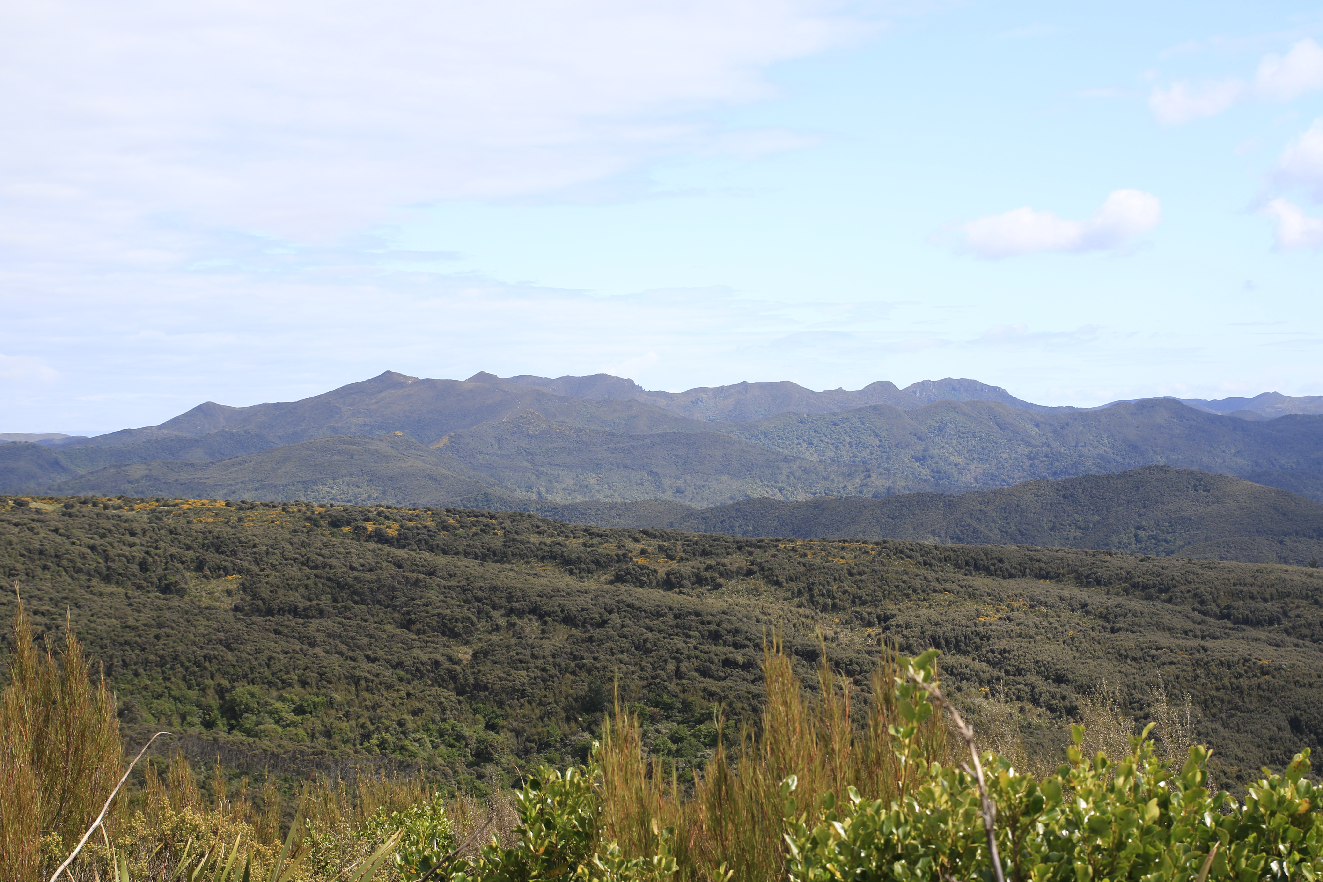
Shouldering our backpacks, we completed a half circuit of the reservoir to The Cloud Forest of Leith track -  a track that we had walked the top part of on trip #13 last Sunday.  The 150m climb to the rock outlook took about 35 minutes and, despite being a little muddy was easy to follow.  The reward of reaching the rocky outcrop was being able to see the whole route that we'd walk today, from starting at Leith Saddle Walkway, Swampy Summit, the silhouette of the power lines on the skyline, Leith Valley Road and Sullivans Dam.
The last part of the trip was reasonably straightforward being down the hill with only a little mud to emerge form the bush onto the side of the motorway and back to the cars after 11.8km and four and half hours after starting. 


Wednesday, November 16, 2022

#9 of 100 trips for 100 years - Pipeline Track - Rustlers Ridge - Swampy Lagoons - Leith Saddle Walkway 13 November 2022

The weather forecast was for afternoon rain so it was pleasing when 10 of us arrived at the Leith Saddle Walkway carpark in sunshine and warm temperatures. Leaving the carpark we followed the Waitati Valley Road for about 500m to the Pipeline Track and from here it was a nice easy stroll for about half an hour following the pipeline which traverses around the same contour line to the Rustlers Ridge track. The pipeline once supplied water to the Northern suburbs of Dunedin. Once at Rustlers Ridge the track makes a sharp turn up the hill with a steady climb on a well-defined and sometimes steep-sided ridge through the native bush. We stopped for a brief rest and drink at the edge of the bush where we had uninterrupted views of the Silver Peaks including The Gap, Pulpit Rock and Rocky Ridge. This is the area that we had been walking two weeks ago on trip #5 of 100 trips for 100 years.
After our rest, we continued up Rustlers Ridge and onto Swampy Summit where we noticed the clouds were starting to obscure the sun and the temperatures were cooling. Not to be deterred we left the track to wander over the peat bog that has formed a wetlands in a hollow on Swampy Summit. It is an interesting area covered in subalpine vegetation, bogs and tarns and is not often visited as there are no tracks through this fragile wetlands.
Heading in an Easterly direction it didn't take long before we came across the first of the tarns. It's hard to judge the depth of the tarns as the water appears black. We found a number of black tarns varying in size. Thankfully the weather had been good over the past few weeks and the peat bog surrounding the tarns was not overly wet which made for pleasant walking.
The peat bog is very different to the surrounding vegetation and is a fascinating place to explore. The area of peat bog surrounding the black tarns is reported to have been where Moa gizzard stones were found in the late 1800/early 1900's. Sadly we didn't find any gizzard stones but this might have had more to do with the fact that none of us knew what a gizzard stone looked like. The colours of the vegetation in the peat bog surrounding the black tarns is quite stunning ranging from bright green through to yellow and orange
We could see the clouds were getting darker and the wind was picking up so we didn't linger at the black tarns as long as we would have liked and we made our way through the scrub towards the telecomunication tower. This proved to be tricker than first thought as the scrub was much denser than where we had entered the bog and some of us emerged dripping blood after doing battle with the scrub. Sheltering behind the telecomunication building to eat lunch and clean up some of the battle wounds, we were well aware that the weather was changing rapidly. We were chased down the Leith Saddle Walkway by a cold wind and the first few drops of rain. Traditionally the views from the Leith Saddle Walkway are worth taking your time over but today our main intention was to beat the rain so we powered down the hill, stopping only briefly at the lookout and reaching the road and carpark about 4 hours and 11km after leaving. We couldn't have timed it better as the rain arrived just as we were driving out of the carpark.

Otago Harbour Cycleway 30 October 2023

With my sister in town, it seemed a shame to waste a calm, sunny day so the two of us hopped on a bike each to enjoy the recently opened 32k...