Showing posts with label Sullivans Dam. Show all posts

Saturday, September 23, 2023

#92 of 100 trips for 100 years - Dunedin to Waitati to Dunedin 17 September 2023

Today's trip follows on from trip #22 which was to recreate some of the ways that the early Otago Tramping Club members got to their tramping destination - with a long road walk.  This time we recreated the walk from Dunedin to Waitati and return.  It was an early start at 7am because we wanted to avoid most of the traffic on the narrow Mt Cargill Road and not surprisingly there were only four of us undaunted in the rain, sheltering under the veranda at the Gardens Mall at 7am.  By the time we started walking, the rain had stopped and we enjoyed an easy gradient for the first two and half kilometres up North East Valley.  Once at Normanby, we followed in the early trampers footsteps by continuing along the flat of Norwood Street before taking our jackets off and starting the steep 200m climb to Upper Junction.
The higher we climbed, the more the views of farmland opened out around us.  We passed a couple of paddocks of curious cows who watched us with the hopeful look of being fed.  On we continued until we reached historic Upper Junction where we visited the site of the Upper Junction School and war memorial site in memory of former pupils killed during the first World War  as we had done on trip #19.  Knowing that the roads from here are narrow and wanting to get as much of this section of road done before the traffic started, we didn't stop for long.  This part of the walk was quite enjoyable as the gradient continues to climb slowly while the road traverses around the side of the hill with wonderful views, looking over the Otago Harbour,  Harbour Cone and Mt Charles.
We stopped at top of the Grahams Bush track for a morning tea break and were happy with our progress and especially the lack of traffic on the narrow road.  By now we had done all the climbing on this section of the trip so we were able to relax a little as we started on the gentle downhill, past the quarry and along the narrow road with only a couple of cars passing us.  During this part of the road walk we were rewarded with views of Rocky Ridge, the back bone of the Silver Peaks as it stood out against the skyline.
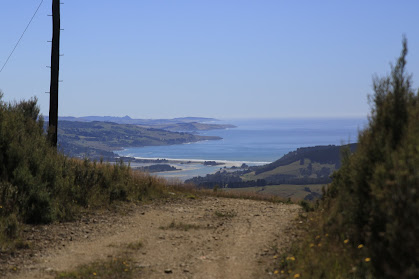
The further around the hill we walked and the lower we dropped the warmer it felt and we marveled at the change in weather from the cold rain first thing this morning,  Dunedin was living up to it's reputation of four seasons in one day.  As we dropped down towards Waitati we had good views of Warrington and Blueskin Bay where the tide was out, exposing the sandy bottom of the bay. 
We left the sealed road and started down on the gravel of Donalds Hill Road, where we could look across to the Northern Motorway which we would be crossing soon at the bottom of the hill before winding our way up Waitati Valley Road.  During this section of the walk, we were enchanted by the new born lambs gamboling about the paddocks on legs that looked too long and unsteady while their mothers kept a weary eye on us.
Once at the bottom of the hill, we had to watch for a gap in the traffic as it zoomed past on the motorway, waiting for our opportunity to dash across and on to the relative safety of the graveled Waitati Valley Road.  It was a nice surprise to realise that we were over half way in our journey and it had only taken us 3.5 hours.  With that happy thought in our heads, we elected to stop for a second morning tea break.  Once replenished with a snack and drink we started the long nearly 400m uphill climb to Leith Saddle over 6 km of road walking.  The gravel road hugs the hillside, winding in and out of the gully's as it climbs steadily forever up the hill.  
We started to have more cars passing us on this section of road and thankfully we could hear them coming so could move out of the way.  Apart from the constant climbing up, this section was quite pleasant to walk as we were serenaded up the hill with birdsong and there was plenty of farm life to look at as we passed.  As we climbed higher the views started to open again and we were able to look back down to Waitati and Blueskin Bay with the rolling farmland in front.

Reaching Leith Saddle was a milestone as it marked the end of our climbing for the day - it was all downhill from here and once we had crossed the motorway again, it also meant that we were on the home stretch. We stopped at Sullivans Dam for lunch and enjoyed the brief half hour sit down watching the light play on the water of the dam while filling our bellies.  The final 10km stretch saw us powering down Leith Valley Road until we reached the sealed Malvern Street where we were back onto city streets again and were able to admire some of the beautiful spring flowers,  magnolia and cherry blossom along the way.  We crossed over the Leith and into the Woodhaugh Gardens before reaching our cars 6.5 hours and 33.2 km after starting.


Wednesday, May 31, 2023

#59 of 100 trips for 100 years - Pine Hill Road - Leith Valley Road (via Cowan Road, Three Peaks, Cloud Forest Track) 28 May 2023


This day trip is mainly a road walk with the addition of the Cloud Forest of Leith Track and is part of the #100 trips as we follow in the footsteps of members of the OTC 100 years ago who would have walked similar distances  before they got to the start of the trip.  Like trip #22 we weren't sure how many would be keen for a road walking trip so were pleasantly surprised when 11 people gathered at Woodhaugh Gardens. 

Starting at only 20m above sea level we walked along the side of The Leith through Woodhaugh Gardens then along Malvern Street for a couple of kilometres before turning off onto Patmos Avenue. It is here that the real work began as we started on the 560m climb towards Mt Cargill/Kapukataumahaka.  Patmos Avenue winds it's way up the hill, passing from houses into farm land.  We managed to catch glimpses of Bishopsgrove which is a large historic home built in the 1880's for Dunedin's first bishop as we continued up the hill.  We only had a brief rest to admire the view of the city as we crossed the bridge over Dunedin's Northern Motorway.
After crossing the motorway there is a steep section of road before joining Pine Hill Road which marked the halfway point of the height we needed to climb. Luckily we didn't realise it at the time or maybe some of us would have turned around here but with the top of the hill beckoning we continued onwards and upwards.  Cowan Road was reached and this road is one of those roads that just keeps on giving with 250m of height gained over 2.5km on a straight road. It was deceiving as we thought we had reached the top but there was always another small rise to climb, eventually though at 560m we reached the turn off to the Three Peaks Track where we thankfully stopped for a drink and snack break. 
We had been down the Three Peaks and Cloud Forest tracks in February for trip #30 when the temperatures were over 30C, today it was much cooler with around 10C so the green tunnel of interlocking branches was not quite so welcoming as previously.  The track was slippery in places and required some concentration to stay upright but not to be deterred we plunged on down the track, coming out on a four wheel drive track that sidled around the hill to the power lines and a fantastic view overlooking Waitati, Warrington and down the coast to Karitane and inland to the Silver Peaks.
The next part of our trip took us down the Cloud Forest of Leith track which is a rough track through the forest, climbing over fallen logs, stepping around tree roots, forging through mud puddles and pushing through ferns.  This track has everything a forest in the clouds has to offer while winding it's way through the native forest, crossing a number of small streams with board walks covering some of the muddier sections. After a half hour of this fun, we emerged at Sullivans Dam covered in varying amounts of mud for a well deserved lunch break on the shore of the picturesque dam.
The final six or so kilometres is back to road walking with about half of that on a gravel road. The gravel road section follows the Leith down through a gorge with steeply forested sides allowing very little sunlight to reach the bottom during the shorter winter days while the sealed section is flatter with houses along the river bank.  As it is all downhill, a good pace was set and with very little traffic we could walk and talk with others in the group.  Eventually we had retraced our footsteps and arrived back at Woodhaugh where we had started about 5 hours and 18.6km of mainly road walking with around 680m of ascent.

Tuesday, February 7, 2023

#30 of 100 trips for 100 years - Cloud Forest Of Leith - Escarpment Track - Three Peaks Track 4 February 2023


When the thermometer hits more than 30°C the most sensible thing to do would be a swim at the beach, instead we opted for a walk - up a hill from Sullivans Dam up to Mt Cargill / Kapukataumahaka via the Cloud Forest and Escarpment Tracks and return via the Three Peaks Track. We had already been over the Cloud Forest and  Escarpment Tracks in November during the Trip #13 Complete Skyline and I was interested to see if our dry summer had any effect on how much mud we would encounter on the Escarpment Track.

Maybe it was the heat or maybe it was the reputation of the notoriously muddy Escarpment Track but whatever the reason, there ended up being only two of us brave enough to face both the heat and the Escarpment Track.  We started our adventure by walking around Sullivans Dam with the surrounding hills reflected in it's dark and tranquil waters. We stopped for a few minutes at the outlet of the dam where we had, had lunch on trip #15 Leith Saddle-Morrison Burn-Sullivans Dam  to enjoy the calm and peace of the place before following the track into the relative cool of the bush and continued around the side of the dam to the start of the Cloud Forest of Leith Track.

The Cloud Forest of Leith track has become overgrown in places with ferns covering the board walk making it difficult to see where to put your feet, although mostly this part of the track is relatively straightforward and easy to negotiate.  Despite being in the shade of the native bush the temperature was rising and the sweat was starting to flow with the constant uphill gradient. Emerging from the bush, into the full sun at the power lines we were rewarded with great views towards Waitati and Warrington and around to Mihiwaka and Mt Kettle. 

After a short drink stop we crossed the open ground under the power lines before heading back into the bush and onto the Escarpment Track.  The condition of the track hasn't improved much since our last visit in November.  The undergrowth of ferns is quite thick along the track, making it difficult to see your feet along with the track and the ever present obstacles of tree roots, fallen trees and mud. Thankfully with all the dry weather recently there was only minimal mud and what mud there is, is firm and porridge like so we clambered up Pigeon Rock with relatively clean boots.   As always Pigeon Rock is a perfect place to stop for a drink and snack while taking in the uninterrupted views of Swampy Summit and around to the northern Silver Peaks, Mt Watkin, Blueskin Bay and the Kakanuis in the distance. 

The next part of the track involves finding your way through the pine plantation which is not as easy as it once was.  The pine trees are now a few years old and being taller than a person means that you need to keep a close eye on the markers to ensure you continue in the right direction.  It feels a little like walking in circles but by sticking to the makers we were rewarded with arriving on the Mt Cargill road with no wrong turns. 

By now the sun was high in the sky and the temperature was pushing into the 30°C's and we had a kilometre or so of road walking ahead of us but on the plus side - we had done all the uphill and there was only downhill ahead of us now.  Not wanting to be longer than necessary in the full force of the sun we turned right and walked down the road 15 minutes to the Three Peaks track.  The first part of Three Peaks track is a lovely section with the trees interlocking branches overhead creating an open green tunnel to walk through. Eventually we reached the end of the tunnel and emerging back into the sun, on another four wheel drive road which we followed back to the power lines. 
Now we had completed a large loop and were on the final home stretch so we stopped for a short drink stop and then back into the shade of the bush.  Going down through the ferny undergrowth is no easier than going up, still can't see our feet but at least we had gravity on our side.  Before we knew it we had reached Sullivans Dam and then it was a short walk around the outside of the dam to complete another loop and we were back at the car, happy to finish a very hot 10.5 km walk in 3.5 hours. 

Sunday, December 11, 2022

#15 of 100 trips for 100 years - Leith Saddle - Morrison Burn 4 December 2022


With the promise of good weather and even better views, 11 people enthusiastically started the 300m slog up the Leith Saddle Walkway towards Swampy Summit.  The first part of the track is benched and graveled and while it makes for easy walking, it is also the steepest part of the uphill to the lookout.  Maybe I am getting fitter with these 100 trips or maybe it was the good company and conversations but the walk up didn't seem to take long or feel too difficult.  A quick breather and we continued up the hill with the gradient relenting slightly as the track climbed out of the bush and into the tussock.  This gave us the opportunity to have short stops and look back at the view of the coastline from Blueskin Bay to Karitane as it opened out behind us. 
Having walked down this track last week, I had been apprehensive about the 300m climb today but the walk up the hill was pleasant and I enjoyed seeing the views from a different perspective. About an hour after starting we were at our highest point, Swampy Summit for a drink and snack before taking the turn off to the Power Line Track and then onto the Morrison Burn.  This is the part of the trip that I was most looking forward to as I have never been down either of these tracks.  At first the Power Line track is enjoyable as it is a wide, slightly overgrown grassy four wheel drive track with good views looking towards the city. 

As we descended downhill, the broom and gorse started to encroach onto the track and we were forced to wind our way between the head high  bushes before turning onto the Morrison Burn track as we entered the native bush. This is where the track changes becoming steep and muddy in places.  It was a game of slipping and sliding down the slippery track and over tree roots seeing who can stay on their feet, although there were plenty of trees to grab and hold on the way past. After about half an hour of this slippery fun we emerged onto Leith Valley Road where it was almost a let down to then walk the 2km up the gravel road beside the motorway to Sullivans Dam where it was a unanimous decision to stop for lunch.
Sullivans Dam is a Dunedin City Reservoir nestled amongst native forest.  Today the dam is only a back up water supply for the city, however when it was open in 1916 it was a main supply for the rapidly growing city.   The reservoir has a number of popular walking tracks and is stocked with trout and is a good place for families to come and learn to fish.  It was a perfect spot for us to spot a few birds, watch children learning to fish and look across the reservoir to the hill we were going to climb next. 
Shouldering our backpacks, we completed a half circuit of the reservoir to The Cloud Forest of Leith track -  a track that we had walked the top part of on trip #13 last Sunday.  The 150m climb to the rock outlook took about 35 minutes and, despite being a little muddy was easy to follow.  The reward of reaching the rocky outcrop was being able to see the whole route that we'd walk today, from starting at Leith Saddle Walkway, Swampy Summit, the silhouette of the power lines on the skyline, Leith Valley Road and Sullivans Dam.
The last part of the trip was reasonably straightforward being down the hill with only a little mud to emerge form the bush onto the side of the motorway and back to the cars after 11.8km and four and half hours after starting. 

Otago Harbour Cycleway 30 October 2023

With my sister in town, it seemed a shame to waste a calm, sunny day so the two of us hopped on a bike each to enjoy the recently opened 32k...