Wednesday, May 31, 2023

#59 of 100 trips for 100 years - Pine Hill Road - Leith Valley Road (via Cowan Road, Three Peaks, Cloud Forest Track) 28 May 2023


This day trip is mainly a road walk with the addition of the Cloud Forest of Leith Track and is part of the #100 trips as we follow in the footsteps of members of the OTC 100 years ago who would have walked similar distances  before they got to the start of the trip.  Like trip #22 we weren't sure how many would be keen for a road walking trip so were pleasantly surprised when 11 people gathered at Woodhaugh Gardens. 

Starting at only 20m above sea level we walked along the side of The Leith through Woodhaugh Gardens then along Malvern Street for a couple of kilometres before turning off onto Patmos Avenue. It is here that the real work began as we started on the 560m climb towards Mt Cargill/Kapukataumahaka.  Patmos Avenue winds it's way up the hill, passing from houses into farm land.  We managed to catch glimpses of Bishopsgrove which is a large historic home built in the 1880's for Dunedin's first bishop as we continued up the hill.  We only had a brief rest to admire the view of the city as we crossed the bridge over Dunedin's Northern Motorway.
After crossing the motorway there is a steep section of road before joining Pine Hill Road which marked the halfway point of the height we needed to climb. Luckily we didn't realise it at the time or maybe some of us would have turned around here but with the top of the hill beckoning we continued onwards and upwards.  Cowan Road was reached and this road is one of those roads that just keeps on giving with 250m of height gained over 2.5km on a straight road. It was deceiving as we thought we had reached the top but there was always another small rise to climb, eventually though at 560m we reached the turn off to the Three Peaks Track where we thankfully stopped for a drink and snack break. 
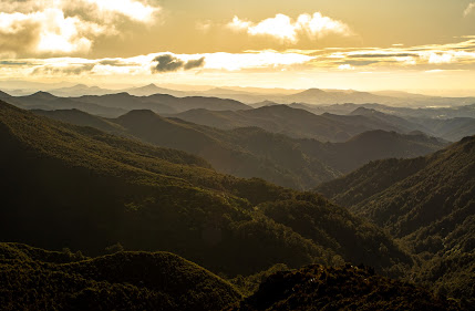
We had been down the Three Peaks and Cloud Forest tracks in February for trip #30 when the temperatures were over 30C, today it was much cooler with around 10C so the green tunnel of interlocking branches was not quite so welcoming as previously.  The track was slippery in places and required some concentration to stay upright but not to be deterred we plunged on down the track, coming out on a four wheel drive track that sidled around the hill to the power lines and a fantastic view overlooking Waitati, Warrington and down the coast to Karitane and inland to the Silver Peaks.
The next part of our trip took us down the Cloud Forest of Leith track which is a rough track through the forest, climbing over fallen logs, stepping around tree roots, forging through mud puddles and pushing through ferns.  This track has everything a forest in the clouds has to offer while winding it's way through the native forest, crossing a number of small streams with board walks covering some of the muddier sections. After a half hour of this fun, we emerged at Sullivans Dam covered in varying amounts of mud for a well deserved lunch break on the shore of the picturesque dam.
The final six or so kilometres is back to road walking with about half of that on a gravel road. The gravel road section follows the Leith down through a gorge with steeply forested sides allowing very little sunlight to reach the bottom during the shorter winter days while the sealed section is flatter with houses along the river bank.  As it is all downhill, a good pace was set and with very little traffic we could walk and talk with others in the group.  Eventually we had retraced our footsteps and arrived back at Woodhaugh where we had started about 5 hours and 18.6km of mainly road walking with around 680m of ascent.

Saturday, May 27, 2023

#58 of 100 trips for 100 years - Hermit's Cave (Silver Peaks) 21 May 2023


There have been a number of trips into the Silver Peaks during the #100 trips and we had been past the Hermit's Cave on trip #5 but today we were going to take a detour to visit one of the caves used by the hermit of the Silver Peaks in the late 1950's  While there have been around 20 trips to the Hermit's Cave since 1967, it is rarely visited these days so it was heartening to have 12 people arrive for the start of what was to be an adventure to a part of the Silver Peaks that only two or three people on the trip had been to before. 
The walk started as most trips to the Silver Peaks do, with a one hour walk into the Green Hut site. Despite the track being wet underfoot and quite sloppy with mud, we made good time to the hut site where we were pleased to see that there have been two recently installed seats.  Most of us took the opportunity to sit on these new seats and enjoy a snack before tackling the next uphill section. 
The track from the Green Hut site climbs up a number of extremely muddy steps through the last of the bush to the ridge where the views started to open up with Pulpit Rock ahead of us, Mosgiel and Saddle Hill to the left and Waitati and the coast line to the right. The climb towards Pulpit Rock is a steep 200m climb along an exposed ridge where the recent heavy rains had scoured out the track .  The pace up the hill was relentless and we regrouped at the base of Pulpit Rock giving us time to look around and admire the view.  From this great vantage point we were able to pick out places that we had recently been to during the #100 trips.
The next section of track is a sidle around the head of the Painted Forest to reach the turn off along Rocky Ridge.  The Painted Forest is another little visited part of the Silver Peaks and got its name because the green forest looked painted amongst the silvery/gold tussock of the Silver Peaks.  Today the tussock tops are being taken over by scrub and the painted forest doesn't look as out of place as it once did. 
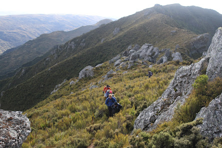
The turn off to Rocky Ridge is not marked and is often overlooked, however  it is obvious for those who know what to look for.  While most people on on this trip had not been along Rocky Ridge, no one showed any hesitation to take the indistinct trail and we were soon swallowed by the head high scrub as we tried our best to stick to the obscure and unmaintained track.  In places the track can be difficult to follow but once your feet find the track, it's best to trust them and just keep going while pushing through the scrub.
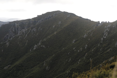
It was along Rocky Ridge that we started to really feel the cold wind blowing over the exposed ridge.  One way to keep warm was to simply keep moving.  Once amongst the Cat's Teeth we were able to shelter behind the large rock tors while waiting to regroup.  On a fine day such as today, the views all along the ridge are spectacular and. it is easy to see where the name Rocky Ridge came from. In places we were able to look a head to the rocks that are home to the Hermits Cave - that is if you know where to look.
 
Before we knew it, we had reached the turn off to Hermits Cave and again, this was another of those indistinct routes that you would miss if you didn't know where it was.  What can only be loosely described as a vague route drops steeply off the side of the ridge and requires both hands to keep yourself upright as you slip and slide your way down through the vegetation.  The best form of attack was to keep the person in front of you within sight but this was difficult as at times small trees appeared to swallow the person and it was a matter of pushing through and keeping moving.
 
The small cave about 30m down from the ridge is often mistaken for Hermits Cave but those of us who have been there before know to continue steeply down the hill for around 120m  before sidling to the right under the rock bluffs and eventually (after most have given up hope) you will stumble across the entrance to Hermits Cave.The descent to Hermits Cave requires a sense of adventure and confidence in your navigation skills.
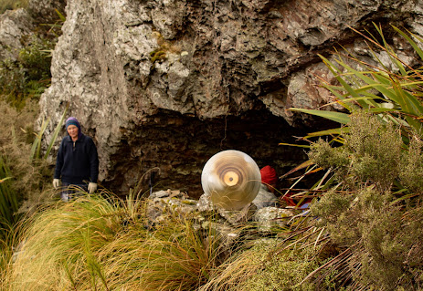
It is obvious that this is the real Hermits Cave because it is dry, very sheltered on all sides and has more 'home comforts' than any other cave in the immediate vicinity.  From my last visit here 4 years ago, the chimney is no longer standing but there are more  bottles and billies for water collection and there is the addition of an indoor plant.
Hermits Cave was a good place for lunch as it is sheltered and enough room inside and out for such the large group.  There was lots of discussion about what it would have been like living here for 3 years, including surviving 3 cold winters by yourself in this remote part of the Silver Peaks.  All too soon lunch was over and it was time to head back up the hill to the ridge.  What had seemed steep on the way down, was just as steep going up and required both hands to help pull yourself up the steepest parts.  After a lot of huffing and puffing, all 12 of us were happy to regain ridge.  The wind was still cold on the ridge and we didn't linger long before retracing our route as best we could along the indistinct track on Rocky Ridge.
After Rocky Ridge, reaching the main Silver Peaks track is like walking on a highway and while the track is still muddy in places and gouged out by recent rain, it is easy to follow and you have time to look around and appreciate your surroundings.  We made fast time down the main track to Green Hut Site where we took the opportunity to sit on the new seats and have an afternoon snack and while it was still cold, we were out of the wind. 
The final hour of walking is along Green Ridge from the hit site to Mountain Road and we have completed this part of the track a number of times over the #100 trips.  It has been interesting to see the changes of the track from a hard, dry surface in the summer to wet and muddy now. There has been some track maintenance with trees being cut back along the sides of the track and the colours of the manuka forest have changed with the different weather and progression of seasons. Over all it was an enjoyable day in the Silver Peaks where 18km and around 700m of ascent was covered in 7 hours. 

Sunday, May 21, 2023

#57 of 100 trips for 100 years - Buskin - Boulder Beach - Paradise Track 20 May 2023 (by Jade Pettinger)


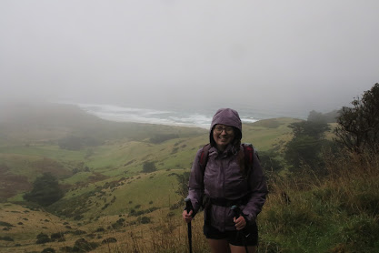
I guess a rainy trip was bound to happen one day, in fact I think we have all been surprised that 56 trips have been completed with good weather so far. Waking up to the gentle pattering of rain on the roof I knew our luck had run out, and so ensued the mental battle of “do I roll over, snuggle into my warm bed and go back to sleep OR do I drag myself out of bed, don my wet weather gear and go tramping?”. Obviously tramping was the winner, so despite the misty rain I headed to the designated meeting point, curious to see if any other OTMCers were crazy enough to join me.

Surprisingly by 9am there were seven of us huddled outside the clubrooms, which was six more people than I was expecting. We set off for Highcliff Road in good spirits, however these were soon dampened by the dense mist and relentless rain which only seemed to get thicker the closer we got to our destination. By the time we had disembarked the vehicles and got our gear sorted we were already a wet soggy mess.

The first kilometre or so of our walk took us along Highcliff Road to the start of the Buskin Track, which normally would give us panoramic views over the coast above Boulder Beach. However this was not the case today, instead we had our heads down battling through the stinging rain which felt like ice cold bullets hitting our exposed legs. We made record time along this section of road, reaching our destination in just over 10 minutes, motivated by the prospect of dropping down out of the wind and pelting rain.
This was one of those trips where those of us who need glasses were at a disadvantage, as it was impossible to see through wet, fogged up glasses yet equally impossible to see without them. Whoever invents window wipers for glasses will make a killing…
You certainly needed good eyesight as the first section of the Buskin Track descends over some deceivingly uneven terrain, which coupled with long wet grass created quite the hazard. As we lost height, the cloud started to clear (or maybe we were just dropping out of the cloud) and the views started to open up. Boulder Beach stretched out in the distance, surrounded by the rolling hills of the neighbouring farmland.
The track we were following through farmland soon changed as we reached a small cluster of trees. We traded long grass for a boggy track with slippery planks of wood to help us over the worst of it. This was no obstacle for the mighty OTMC so we quickly skipped our way across with no mishaps.
Our respite from the rain under the tall pine trees was short lived as we were soon back out in the open, with the beach much closer and the terrain flattening out. From here was a short meander to a private cottage which marked the crossroads between the Buskin Track, the Paradise track and the short route to Boulder Beach. As the rain was holding off, we opted to take the short detour to Boulder Beach, which wasn’t as straightforward as one would have thought.
There was no marked route onto the beach, but thankfully there was a track worn in by the multitudes of people who are sure to visit this remote beach each year. Some parts of this track involved pushing our way through thick, head high flax - if we weren’t wet before we were absolutely soaked now. We had to watch our footing as there were troublesome vines hiding in the undergrowth which could easily trip you up if you unknowingly got your foot caught in one, which more than one of us did.
In order to stand on the sand of the beach, we had to slip and slide our way over the slippery boulders (more like rocks) that bordered the sand dunes, giving Boulder Beach its name. Once on the beach some of us went for a wee wander along the water's edge to see if any wildlife could be spotted while others took the opportunity to have a snack and drink. Although it wasn’t raining on the beach, the wind was certainly chilly and we were mindful of the fact the weather was forecast to worsen in the afternoon so we hastily set off again.
Unfortunately we had made a mistake in our excitement to reach the beach and did not take notice of where exactly we had exited the sand dunes onto the beach. However, it only took a short while of wandering around the dunes before we found the track we had followed and thankfully none of us stumbled onto any sleeping sea lions! It was another quick stop in the shelter of the trees at the crossroads to re-energise ourselves before the climb up to Highcliff Road.
While the Buskin Track seemed to snake its way around the hills, the Paradise track took us straight up along the edge of some paddocks. Maybe it was the steeper terrain but the track up certainly seemed to be muddier, which made me glad we didn’t descend this way as it would have turned into a bit of a slip n slide in places.
Before long we left the coastal views behind as we ascended back up into the cloud, which surprisingly was quite dry. We were all pretty soaked by this point so perhaps it was the thought of a warm shower and dry clothes that helped us to make good time up the hill - 30 minutes from the crossroads to Highcliff Road, not bad for close to 300m of elevation gain! 
Maybe it was wishful thinking, but the rain seemed to intensify once we were safely back in the vehicles heading for home. The loop took us 2 ½ hours to complete, including stops with 6.7km traveled.

by Jade Pettinger

Monday, May 15, 2023

#56 of 100 trips for 100 years - McNally Track 14 May 2023


Nine people keen to see the sights of the McNally Track weren't put off by the threatening rain or the ominous start of leaving from a cemetery. After climbing over a stile and heading up through farm paddocks, the slope is reasonably gentle for the first 100m of climbing.  Following the markers, we hugged the fence line and scared only a few sheep to the other side of the paddock.   With lush green grass, the ground was dry underfoot and we made good time, passing through a number of gates along the way. 
After a half hour of this easy travel, we crossed through a gate and onto a four wheel drive track for a short distance before we needed to make our first decision of the trip. There are a couple of loops on the McNally Track and as we reached the first loop track, we opted to take the 'high route' which took us up a short, steep incline to a great view overlooking the township of Milton and the surrounding countryside.
We continued climbing up the hill, sticking close to the fence to dodge all the small pine trees that have recently been planted on the farm land.  It is disappointing to see how much of the surrounding farmland has now been converted to forestry as in a few years the views that we were enjoying will be hidden behind the trees.
At about the halfway point we came to our second loop track and our second decision of which way to go. The decision was to continue up the hill and take the nature walk through the bush.  This involved following the fence line until crossing a stile over the fence and into a stand of native bush.  The well benched track through the bush traverses the contour line where we were followed by a friendly piwakawaka who flitted along beside us, darting in and out catching the bugs that we stirred up as we passed.  After emerging from the native bush, it is a short but steep climb up the final 100m to reach the hill top where we were rewarded with views encompassing the Taieri plains, Tokomariro River and inland to the Blue Mountains. 
It was here that we made the unanimous decision for an early lunch so that we could take our time to admire the fantastic views that stretched out in front of us.  The only downside to this idyllic spot are the pine trees that have been planted to just below the summit of the hill, meaning that these wonderful views will be gone in a few years time.
From this great vantage point we could see storm clouds gathering to the south so we wasted no time in packing up after lunch and heading down the hill back to the cars.  We took the main track, down through the paddocks that are now full of small pine trees and were able to enjoy the views as we descended 140m  steeply down the ridge. 
We met up with the track again at the junction to the bush walk and once we had regrouped, we continued down the hill.  Unfortunately we weren't quite fast enough as the rain caught us about halfway down and we sheltered under some trees to don parkas before continuing down the lush green farm paddocks, scaling the stiles as we went.  As we reached the final fence and the cars were within sight, the light rain eased off and we made it back to the cemetery in good spirits.  A shorter trip of only 8.1km and 300m of climbing that took us around 3 hours. 

Sunday, May 14, 2023

#54 of 100 trips for 100 years - Nardoo Scientific Reserve (Nardoo 13) 7 May 2023 (by Jade Pettinger)

Nardoo is an area which has haunted the OTMC for many years as, out of 12 planned trips to the scientific reserve, not many were actually successful and there was always a reason - the weather was poor, high winds etc. Today was lucky number 13… and it was lucky! The summit was not only reached, it was done so in perfect conditions and on a day that felt more like summer than 3 weeks away from the official start of winter.
Despite the early start, 19 enthusiastic trampers were gathered outside the clubrooms at 8am on Sunday morning while the plan for the day was agreed upon. Piling into the cars, we set off in convoy for Nardoo - heading via Outram, Lee Stream and Lake Mahinerangi. Descending into Mosgiel we were greeted by the thick layer of morning fog for which the Taieri Plains are famous for. This wasn’t ideal and we anxiously peered out of our windows, desperately searching for glimpses of the sun and crossing our fingers and toes that it would burn off before long.

Thankfully as we got closer to our destination the fog was burning off and the landscape around us was opening up to reveal clear blue skies and miles upon miles of tussock on the surrounding hills. The landscape was not the only thing changing however - the road changed from a highway to a narrow windy tarseal road to gravel to a slightly less maintained gravel road to a farm track with hollows big enough to swallow a car. We were not going to let this stop us and after passing through some farm gates we soon found ourselves parking in a nondescript paddock. 

Instead of the usual pre-trip briefing, our leader, Antony Hamel, gave us a crash course in flag semaphore. We were relieved there were no bulls in the paddock, as surely our eager flag waving would have sent the wrong message and we would have accidentally recreated the Pamplona Bull Run. Once our leader was satisfied we were well trained and equipped to use our flags to communicate vital information to our fellow trampers - think “my hovercraft is full of eels” - we set off.
After battling through near head-high tussock to reach the DOC sign that marks the beginning of the reserve, it soon became apparent that the theme of the day was going to be long tussock with no track. Well, everyone else was grumbling about no track… being at the back of a line of 19 people I couldn’t work out what the problem was! One thing about tussock walking is it can be incredibly uneven and slippery, especially as the large clumps of grass were well above waist high in places which meant seeing exactly where you were putting your feet was impossible!
Being so focused on staying upright, we were shocked when we stopped for a breather and turned around to see how quickly we had gained height without even realising it. The view was just opening up in front of us, with Lake Mahinerangi as the centre piece, sparkling in the morning sun. Turning our backs to the view, we continued plodding upwards, knowing the view would only get better the higher we climbed.
The group was starting to spread out now and were no longer walking in a line, which meant I was now starting to understand what they meant when they said there was no track - there was NO track! It was very much a ‘follow the path of least resistance’ endeavour, which thankfully was straight forward enough and I soon found myself joining the others for a much needed morning tea break.
On a previous trip, another member commented to me “you don’t get a lot of time to eat on these OTMC trips!”, which is true as I barely had time to sit down and open my lunch box before we were packing up again! Grabbing a handful of crackers to nibble on as we walked, I hurriedly followed as I had learnt my lesson to stick with the group so I could follow in their footsteps rather than find my own way through the tussock.
We were now heading to a group of large rock tors on the skyline, and although the climb was steady, it didn’t prove too difficult. Our only obstacle was a band of spaniards and more than one of us fell victim to the prickly plants hiding beneath the tussock. We were so engaged in our various conversations that in what felt like no time at all, we had arrived at the base of a ginormous rock.
Turning around to face the view - wow! The golden tussock contrasted perfectly with the deep blue sky, a true representation of Otago’s blue and gold colours. In front of us were miles and miles of rolling hills, from the tussock covered hills of the Te Papanui Conservation Park to the dark green native bush of Manguatua in the distance.
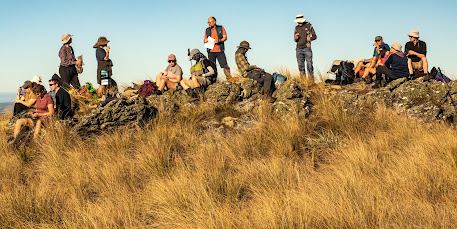
Lake Mahinerangi sat proudly in the middle, all of us marveling at how much larger it was than we had thought driving past earlier this morning.  Lunch was had with all 19 of us perched on a rock - yes that's how big the rocks were! As it was the day after the Coronation, it was only right that we toasted the King, as well as each of the past 12 trips to the area. Finally, our flags came to good use!
Those who had been to the area before were in awe of the weather conditions - not a breath of wind and close to 20°c. This is apparently very unusual for the area, and unsurprisingly no one seemed super keen to rush back down the hill. After lunch, we spent some time exploring the area. Some chose to keep heading up to the highest point while the majority of us decided to explore the rock tors.
After having a good look around, and taking the classic Instagram picture - a person on a rock with a gorgeous view behind them - we sadly had to begin our descent. Somehow the descent proved much trickier than the ascent as any semblance we had of a track on the way up was nowhere to be found!
One rock stood out in particular - Walrus Rock. I’m not quite sure why it’s named that as it didn’t look like a walrus to me but it certainly is magnificent. It was a large arch-shaped rock, with a small tarn in the middle of it. The day was so calm and still, which meant the reflections in the tarn were simply stunning. We all took turns getting creative and taking photos of one another through the arch while some of the more adventurous among us climbed up on top of the rock.

After many tumbles, cries of pain from unexpected spaniard attacks and nearly dislocating hips from the long strides needed to navigate over the tussock, we arrived at the bottom of the hill - Nardoo had been Nardone! 

by Jade Pettinger


Otago Harbour Cycleway 30 October 2023

With my sister in town, it seemed a shame to waste a calm, sunny day so the two of us hopped on a bike each to enjoy the recently opened 32k...