Monday, July 24, 2023

#73 of 100 trips for 100 years - Grahams Bush 23 July 2023


It had to happen - the weather gods have been so good to us with the #100 trips and waking up to rain had to happen.  There has been the odd trip with some rain threatening but nothing like the rain forecast for today's trip  - the only surprise was that it had taken to trip #73 for it to happen.  Originally trip #73 was going to Maungatua but with a 600m climb into the open tops on a day with rain overnight and steady rain in the morning, increasing to heavy in the afternoon meant today was not the day for Maungatua so onto Plan B.   Grahams Bush from Sawyers Bay is always a good backup plan on a wet day as it is sheltered and in the bush all the way.  Starting at the end of Hall Road in Sawyers Bay, the Grahams Bush track follows a paper road until the reserve.
Once off the paper road and onto the track, it is a steady climb along a well benched track.  There are a few muddy patches but nothing that couldn't be avoided.  The track initially climbs gently through native bush with the large gnarly, papery bark of the fushia tree often overhanging the track.  Once past the first crossing of Thompson's Creek which, despite the persistent rain, is an easy step across, the track gradient starts to increase.  We stopped at the large Rimu that guards the trail long enough to marvel at it's size and give it a hug before continuing on.  After the second creek crossing the track turns sharply to the right.  It was here that we stopped for a quick snack and drink break before tackling the increasing slope for the final push to climb 160m to Mt Cargill Road. 

Unsurprisingly we emerged onto the road from the bush into the mist and made the decision that there was no point in going any higher.  Thankfully it was only misty and the rain had so far stayed away.  We stopped for a brief rest before turning our thoughts to descending back the way we had come.  As often happens, the return journey down the track seemed to go quickly.  There are a number of large punga along the track with their large fronds protecting the track from the worst of the weather and we had the compulsory 'hug' a Rimu stop before reaching Hall Road in Sawyers Bay again.  The weather hadn't improved at all during our walk but at least it hadn't gotten any worse (which it did later in the afternoon).  A good walk 2.5 hour walk over 8.2km and gaining 300m in height. 


Sunday, July 23, 2023

Pineapple Point Seat Installation 22 July 2023


Pineapple Point was a well-frequented lookout point alongside the current Pineapple Track and is referenced in tramping reports that pre-date the club, as well as being mentioned as a resting place during the climb of Flagstaff on the OTC's inaugural trip on September 1, 1923.  Early reports talk of Pineapple Point having wonderful views of the city and was a good place to stop and eat pineapple.  As Dunedin is too far south to grow pineapple,  local Green Grocer (Oscar Balk, OTC first president) imported tins of pineapple and these were enjoyed while resting at the point with the empty tins being left on the fence posts as markers, hence the name Pineapple Track and Pineapple Point.  
 
Having been up the Pineapple Track many times over the years and never having seen Pineapple Point, we decided it was time to 'rediscover' it.  Having done some research we had an idea where it might be on the Pineapple Track and once we had reached the site it was easy to see why the point was no longer a lookout as the view was nonexistent with broom having grown over the point obscuring all views.
A plan was hatched to bring Pineapple Point back to it's former glory in time for the 100 year anniversary of the OTC's first official club trip on 1 September 2023.  Discussion was entered into with the Dunedin City Council and a plan was agreed to clear the broom from the point and permission was given to install a seat at the site.  The first club workparty was in August 2022 where we cleared about half the site of broom to bring the view back. A few hours work of cutting broom and dragging it out of the way by a handful of people proved that it was a worthwhile task and the view was restored to Pineapple Point.
Today a group of 10 came back to install the seat and remove the remaining broom from the point.  It was a real team effort to get all the materials to the site, which is about 30 minutes up the Pineapple Track. Thankfully another group had carried the 40kg of cement in and with the seat in four parts plus about 10L of water to mix the concrete and  tools to clear the broom, our progress up the track looked a little like a pilgrimage.
Once at Pineapple Point, those that knew about putting the seat together and concreting it into place were left to get onto with it while the other 7 turned their attention to the broom. Armed with pruning saws and loppers,  no time was lost in attacking the broom.  Some of the broom is very old and the trunks took quite some effort to cut through but the reward of seeing the view return kept the enthusiasm high.
A few of the group spent their time dragging the cut broom away and throwing it on the pile of old, dead broom from last year.  It was heartening to see the huge pile from nearly a year ago had compacted and started to rot so we reused the same pile and watched as the pile of cut broom grew higher.
While most of us were kept warm sawing or dragging broom away, a hardy few were left in the wind on the top of the point to dig the holes for the concrete and reassemble the seat.  Progress seemed to go quickly, although the cold temperatures meant the concrete took longer than hoped to dry. 
After about three hours of work, everyone was well pleased with their efforts and were very happy with the end result of a lovely, well made, wooden seat on Pineapple Point with the view of Dunedin City spreading out in front. The seat is now in place and the broom cleared leaving Pineapple Point ready for the official opening on 1 September 2023 which marks exactly 100 years of the first Otago Tramping Club trip.

Saturday, July 22, 2023

#72 of 100 trips for 100 years - Flagstaff Tracks 16 July 2023


Today's trip started like any of the other #100 trips but little did we know that it was to be like no other of trip so far.  The idea for the trip was to explore Flagstff using some of the lesser known tracks and it must have appealed because 12 of us left the Booth Road car park along a forestry road, past the McGowans Track to an indistinct trail on the right that could easily be overlooked if you didn't know it was there.  Right from the start we were given a taste of things to come as the native bush appeared to swallow us. The track was overgrown with trees pressing in around us and the ferns hiding the mud that threatened to engulf us.
There was a creek to negotiate before the track slopped upwards and here the fun really began.  It pays to bear in mind that it is mid-winter and there has been snow and rain recently which meant the track had a layer of mud on a harder surface below which made it difficult, at times, to keep the uphill momentum going, especially when it felt like we were walking with an inch of mud stuck to the tread of our boots.  At times it felt like one step forward then two back and it was only thanks to being able to grab the trees and pull ourselves up that we were able to keep moving forward.  Thankfully the mud didn't last for the whole 450m climb but it did continue for at least half of that height gain.   Eventually the Davies Track leveled out and the track condition improved meaning we were able to make good progress to the bush line where we emerged into the golden tussock with the top beckoning us on.
Despite a cold wind we decided this was a good spot for a snack break and we each found a sheltered spot amongst the tussock to nestle into and enjoy the great view of  Saddle Hill/Makamaka  and coast line towards Taieri Mouth while enjoying our snacks.  It wasn't long before the cold wind pushed us on and upwards to the top of the hill. 
The upper part of the Davies Track winds it's way through the tussock, over rocks and around giant flax bushes while continually gaining height.  The problem with walking through tussock is that you can't see your feet so it is easy to loose the obscure track.  There were a couple of times that we needed to caste around before finding the track again and we could continue on.  Eventually coming out on the Flagstaff Walkway, we were able to relax and turn our attention to the wonderful views of the city that had opened out before us. 
I have often felt that this is the best place to see Dunedin/Otepoti with harbour and city laid out so clearly and today that feeling was reinforced with views extending as far as Hereweka/Harbour Cone and Mt Charles/Poatiri in the distance. We had been up both these high points on the peninsula during the #100 trips in March and it was good to be able to see them standing out so clearly.
The biting cold wind pushed us on and we took the cross track onto the Firebreak Track where we turned right and followed it towards the Moon Track.  Despite the odd muddy patch we were able to make good time along the wide, easy to navigate track while taking the time to admire the views of Silver Stream and the Silver Peaks in the distance.  We could also see as far as the Rock & Pillar Range which had a sprinkling of snow on the top which would account for the bitterly cold wind,
It is a good couple of kilometres of this easy walking, being chased along by the cold wind, before we reached the Moon Track.  I am unsure of the reason behind the name of the Moon Track but the tranquil name does not reflect the true nature of the track because we were straight back into the mud although most of us didn't seem to mind too much as the upper part of the track is very picturesque as it follows an historic fence through the golden tussock. 
The Moon Track deteriorates for a bit before it connects with the newly built mountain bike track and the condition changes from a muddy, rutted track to a gravelled, slightly sloping bike track.  We stopped at a rocky view point to enjoy lunch and compare mud everyone had on their legs before the cold wind again, pushed us on.  We continued to follow the mountain bike track which gently zig zags down the hill past a number of lovely, large moss covered rocks.  The easy gradient gave us time to admire the views and took us into the sheltered side of the hill and we marveled at how warm it was in the sun, out of the wind. 
After easy walk on the mountain bike track, we took the Pepper Tree Track which is the first walking track on the right and we were straight back into the mud.  There were a couple of small streams to cross and plenty of mud to avoid as best as we could. The deceiving thing about the Pepper Tree Track is that drops almost 100m in height then has to regain that height to reach the Pineapple Track. Once on the Pineapple Track we took the small detour to Pineapple Point to admire the city view from this unique vantage point. 
From Pineapple Point the party split into two groups with one group opting to take the 'easy' way down by following the Pineapple Track while the other group elected to go down the 'Old Pineapple Track'  also known as The Ross Bush Track.  This track was not as muddy as we thought it might be but it was overgrown in places with your feet having to find the track through the ferns.  The lack of mud meant that the group moved quite fast dropping 200m to meet up with the other half of the group at the water treatment station.  Then it was an easy walk back to the cars.  With around 650m of climbing over 10.5km it was a memorable and muddy trip on some of the lesser traveled Flagstaff tracks. 


#71 of 100 trips for 100 years - Sandymount-Sandfly Beach 15 July 2023 (by Jade Pettinger)


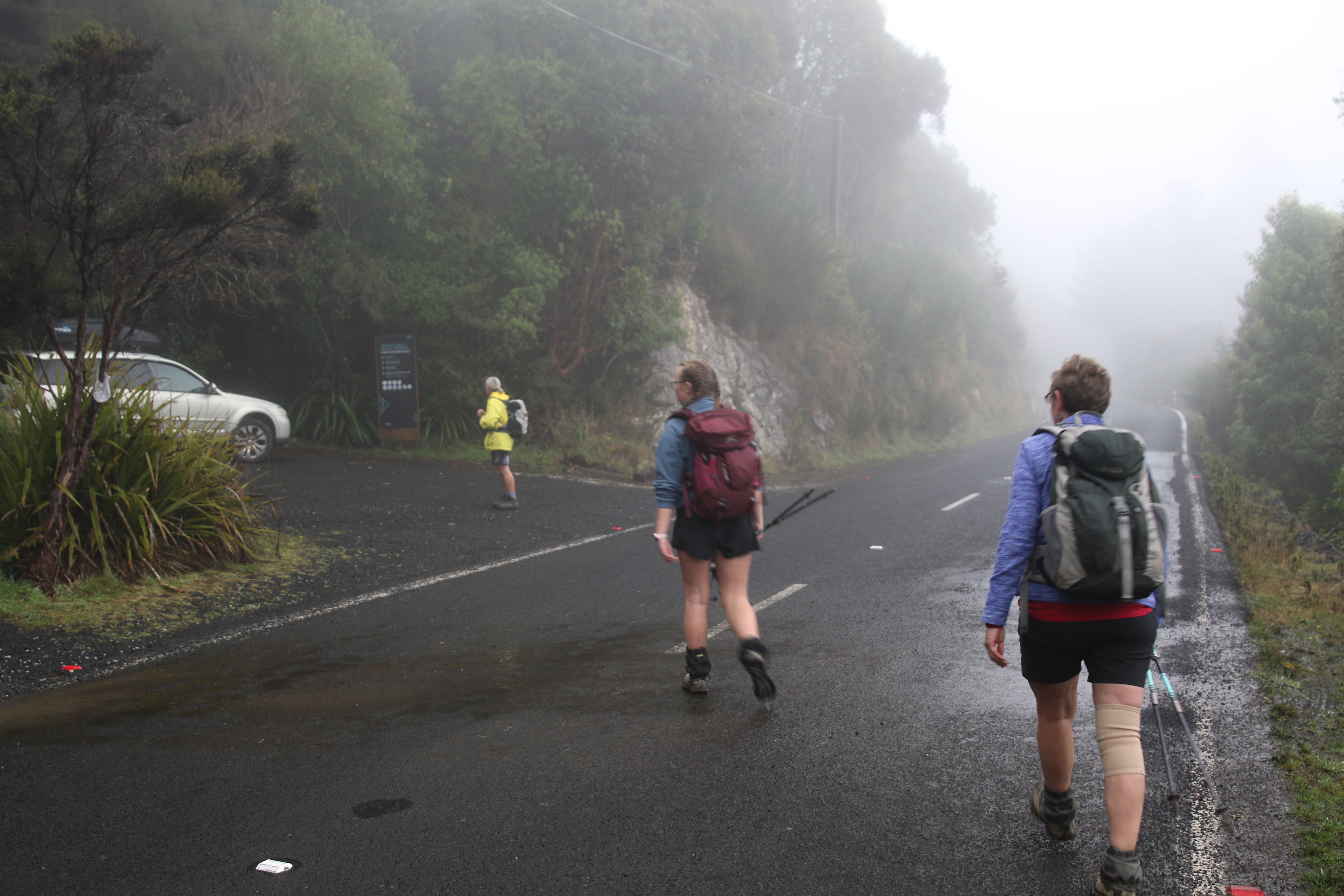
Midwinter is arguably the best time to visit Sandymount - there is just something about this time of year that makes this special place even more magical. After a week of Dunedin’s notorious cold, grey weather that hugged the hills, it was an absolute delight to draw back the curtains on Saturday morning to a clear sky with not a breath of wind. 11 of us met at the clubrooms, a pleasing amount for a long weekend. As this was a through trip, the arrangements were slightly more complicated as a car shuffle was needed to avoid unnecessary road walking. Those left waiting whilst the drivers rearranged the cars had no complaints as they enjoyed a stunning vista overlooking Hoopers Inlet from the car park. 

 It wasn’t long before the group was reunited, and we set off to circumnavigate Sandymount before tackling the climb up to the summit. We headed off in a clockwise direction, passing through a tunnel of towering macrocarpa trees. A few minutes later we emerged into farmland, evidenced by the muddy ruts on the road caused by various farm vehicles. 
Trying our best to avoid bogs, we made our way down to a relatively new lookout, recently installed by DOC (presumably to make up for the removal of the viewing platforms at the nearby Chasm and Lovers Leap). The views from here are some of the best on the Otago Peninsula, and they were made even more dreamier by the early morning light. The breathtaking scenery in front of us made stopping for morning tea an easy decision, despite being less than 10 minutes into the trip.
The panoramic views from here are simply stunning and highlights many predominant features of the Peninsula. Directly in front of us was Mt Charles/Poatiri, the highest point on the Peninsula, whose lower flanks were shrouded in the mist whilst the rising sun lit up the summit. Stretching out in front of Mt Charles were the pale sands of Allans Beach, contrasted by the sparkling turquoise waters of the Pacific Ocean. Further to the left was Hoopers Inlet encompassed by the rolling green and gold hills of the Peninsula, with the distant hills of the northern skyline on the horizon.
This turned into one of the longer morning tea stops, as we enjoyed chit chatting as much as we were enjoying the spectacular landscape. From here, we opted to head out towards the tussock covered headland, otherwise known as The Chasm. We admired the sheer cliffs that plummeted steeply into the raging ocean from a safe distance. It was exhilarating looking out over the endless Pacific Ocean and really made you feel like you were standing on the edge of the world.
Our circumnavigation around Sandymount continued through farmland, skirting the cliffs as we headed for the summit. As we reached the junction between Sandfly Bay and Sandymount, the terrain underfoot changed from soggy paddocks to sand. This made our 100m climb to the summit just a little bit tricker, as we slid backwards with every step. We were also battling a slightly overgrown track, which only made reaching the top more rewarding.
The summit of Sandymount is marked with a trig and a plane table, useful features as they provide a means to get above the head-high flaxes and shrubs that have taken over. The views from the summit provide a different perspective from earlier. We were treated to uninterrupted views of the coastline snaking from Sandfly Bay to Boulder Beach and further towards Dunedin. The clear skies meant we could see many places we have visited on previous trips - namely Harbour Cone/Hereweka, Saddle Hill/Pukemakamaka, Taieri Mouth, Seal Point and Mt Cargill/Kapukataumahaka.
Now it was time for the fun part - the descent down 300m of sand dunes to Sandfly Bay. The more mature among us walked down in a sensible fashion, while others delighted in the child-like fun of running and jumping down. It didn’t take long to descend and before we knew it we were walking amongst the sand hills that surrounded the beach. There is something about sand dunes that feel extra-terrestrial, almost like you could be walking on Mars.
Sandfly Bay is a popular resting ground for the New Zealand sea lion and great care is often required to avoid becoming their next meal. On high alert as we wound our way down the narrow path that led onto the beach, we found ourselves pushing through waist-high Marram grass in order to give the three slumbering sea lions on the track some space.
Once on the beach, we found a perch about 20m away from a group of half a dozen sunbathing sea lions dozing on the water's edge. They provided plenty of entertainment as we fuelled up for the slog up to the carpark. Every so often, they would seemingly get a burst of energy and decide to assert their dominance. One sea lion would approach another barking and growling and before long they were all going at it, baring their teeth and nipping at each other. Just as quickly as the commotion started, it would stop again as they flopped down to regain their energy, before repeating the cycle again.
Being about one kilometre long, it didn’t take us long to make our way to the southern end of the beach. We made sure to keep our distance from the sea lions, some of which were among the biggest I have ever seen! Jumping over a small creek, we started making our way up the sandhills to the carpark. 
With past visions of steep sand hills rising directly from the beach floating in our minds, it was a pleasant surprise to see DOC have done some work in rerouting the track so it sidles around. This was much easier than the scramble it used to be, and it didn’t take us long at all to climb over 100m to the car park. 

By Jade Pettinger

Monday, July 10, 2023

#69 of 100 trips for 100 years - Gold Miners Direct - Possum Hut - Green Hut Site - Green Ridge 9 July 2023 (by Jade Pettinger)


It’s not often it is wetter in town than in the Silver Peaks, but somehow that is what happened today! Despite the pouring rain, nine of us showed up at Woodhaugh, huddling under an umbrella in a futile attempt to stay dry. I’m sure each of us was contemplating our decisions at this point and wondering why we had traded in warm fires and cosy houses for a day out tramping. After a brief discussion it was decided that albeit the less than ideal conditions, we would attempt the original plan of Possum Hut, mostly because “that’s how we do it in the OTMC”.

We bundled ourselves into cars and hit the road north with the window wipers on full speed. So, you can imagine our surprise when we reached the top of the motorway and all of a sudden had no need for window wipers! While the weather wasn’t clear, there was no water coming out of the sky so we took that as a positive sign. The carpark on Mountain Road was shrouded in thick mist, the ground was wet but there was not even the slightest drizzle!

We set off down the Gold Miners Direct Track in good spirits, our jackets were only required to shield us from the dripping trees. The zig-zag track downhill to the South branch of the Waikouaiti River was in relatively good condition, with a few signs of the wild pigs that roam the area. The sodden ground was a bit slippery in places but these sections were easily navigated with the help of good tread, sturdy poles and well-placed trees. On tracks like this, it is always a good idea to have someone in front of you so you can watch where they step and if they slip you will know where not to put your feet.
Before we knew it, we were emerging from the dense bush to a small clearing at the bottom of the hill. With our raincoats still dry, we decided this was a good spot for a quick bite to eat. The mist made for quite an eerie atmosphere as it danced around the surrounding ridges, giving us glimpses at the towering hills above us.

From here, we took a left along an undulating path towards Possum Hut. We soon had our first major obstacle to negotiate - a tributary of the South Branch of the Waikouaiti River. This is usually a docile stream where you can jump across with dry feet, however after the recent heavy rain, was now a raging torrent that required consideration and caution to cross safely. One by one we carefully picked our way across, taking care to ensure we had solid footing with each step so as not to be swept away.
Having made it safely across, we turned our sights to Possum Hut, which for most of us, was our first time visiting this historical hut. About five or so minutes before the hut, we came across a plaque on the side of the track which was placed in 1952 by local farmers, Joe Clark and Phil Powell.
We didn’t have high expectations for Possum Hut, which was just as well as when we approached it soon became apparent just how derelict the hut has become. While no one knows exactly when the hut was built, it is believed to have been in the 1930’s with the possibility of gold in the nearby rivers causing excitement. However, this never eventuated too much and the hut soon fell into disrepair. Nowadays, the iron clad hut is covered in rust and slightly falling to one side. It is no longer watertight, and unless it was an emergency I doubt it would be anyone's first choice for overnight accommodation.
After exploring the historic hut, it was time to tackle the steep climb out of the valley. From here the track abruptly climbs straight up Possum Ridge to link back up with Green Ridge. It was a real slip and slide going up, most of us took a fall on at least one occasion as the ground just slipped away beneath our feet. Our hands were soon rubbed raw from grabbing onto tree branches and roots to help drag us up the slippery slope. Stopping for a breather was out of the question as we needed our momentum to keep us going forward, so we forced our burning legs to carry us upwards.
Thankfully the steep section was short and sweet and the track was soon levelling off, providing us with a much needed break to strip layers. The mist was thicker up on the tops, but we were still dry. After a gentle amble along the ridge, we soon joined up with the Green Ridge Track, where we made our way down to Green Hut Site for an early lunch.
We all enjoyed chatting and eating while making use of the newly installed seats, which the OTMC opened at King’s Birthday Weekend. We were soon on our way as we made our way down the very familiar track from Green Hut Site to Mountain Road as we have traveled along it many times during the 100 Trips.

written by Jade Pettinger


Friday, July 7, 2023

#68 of 100 trips for 100 years - Abbots Hill Loop (Friends Hill Rd - Flower St - North Taieri Rd - Abbots Hill Road) 2 July 2023


With snow on the hills and ice on the streets, it was a no surprise that only a handful of people were brave (or mad) enough to attempt today's trip.  Starting at Sunnyvale we slipped and slid our way along Main Road and then Flower Street before starting  our climb up the hill.  Once we reached the end of Flower Street, we left the houses behind and crossed a stile to wander through the farmers paddock while sticking to the paper road.  It was during this part of the journey that we started to encounter snow on the ground but the workout of walking uphill kept us warm.

 
Once across the paddocks we were onto Chain Hills Road where we really got to experience the snow with a blizzard of fat, fluffy snow flakes coming out of the sky.  It was about this time that we took the opportunity to duck under some low branches of a couple of large trees to shelter from the blizzard and enjoy a snack break. After the worst of the blizzard had passed,we emerged from our sheltered oasis to a winter wonderland covered in a white blanket. 

We followed Chain Hills Road to the end, then crossed another stile to continue along the Chain Hills Track following what, at first, appeared the obvious route but a layer of snow had covered the track making route finding a little difficult until a marker pole was spied and we were on our way again.  The views really started to open out behind us along this stretch of track with  Mosgiel on our left, Green Island/Abbotsford on our right and Saddle Hill/Makamaka directly behind us.
 

 From the Chain Hills Track we emerged onto Friends Hill Road which is another paper road and goes all the way to the top, climbing to 400m and Halfway Bush Road.  The gradient up the track is steady and we took our time, stopping often to admire the snow covered views behind us.  The snow became thicker with each step higher and the odd small snow flurry added to the experience but the climb uphill kept us warm.
We reached a patch of pine trees that had created a sheltered spot on the track and paused for a lunch break out of the snow.  Lunch was a reasonably hurried affair as we cooled down quickly now that we had stopped walking and the sky looked to be getting darker with another blizzard threatening. Back on the upward journey and we soon warmed again with the top of the hill beckoning us on.
There was a cold wind at the top of the hill so again, we didn't linger long and after congratulating ourselves for getting this far and knowing it was all downhill from here, we followed the Brinsdon Road track that connects up with Dalziel Road.  It was here we got hit by the full force of the blizzard as we were buffeted by head winds and horizontal snow before reaching the shelter of a line of huge trees where we were able to stop to catch our breath and shake most of  the snow off. 
From the tree tunnel the road drops steeply down to the next paper road, Abbots Hill track but first we had to dodge a surprisingly large amount of traffic that were on a joy ride to see how deep the snow on the hill suburbs was.  The limited visibility from the blizzard and dodging the joy riders made this the most dangerous section of the walk but by listening out for the traffic and keeping to the edge of the road, we made it safely to Abbots Hill track.
The Abbots Hill track proved to be the worst section of the day as the lower we dropped, the snow turned to rain and with the track being muddy and overgrown we put our heads down and continued downhill as fast as we could manage while staying upright.  It was during this descent that I began thinking about the different parts of the days walk - from icy streets, into snow covered paddocks, onto snowy roads and tracks before the wind and falling snow arrived and now the rain.  It had been a day of many parts and through it all I had remained warm and dry with my layers of clothing and only now were my feet starting to get wet as all the days moisture had started to soak through.  After dropping 100m down the Abbots Hill track we were on the sealed part of the road and it was an easy walk down to North Taieri Road and back to Sunnyvale just as the rain really started to pelt down. In total we walked 17 km over 5 hours with 450m height gain. 

Otago Harbour Cycleway 30 October 2023

With my sister in town, it seemed a shame to waste a calm, sunny day so the two of us hopped on a bike each to enjoy the recently opened 32k...