Thursday, December 30, 2021

Day 127 Concord to Green Island

I had walked the streets in Concord in April but I hadn't walked all the way up the hill and around to Green Island as these streets don't have footpaths, are on roads with higher speed limits and some of the roads are gravel.  All these things meant that I didn't need to walk them but there was a 'gap' in the map so I started walking early in the day to avoid as much traffic as possible. I walked 4 streets today. 

1703. Blackhead Road
1704. Tunnel Beach Road
1705. Green Island Bush Road
1706. Church Hill Road

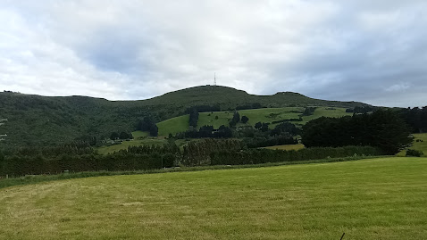
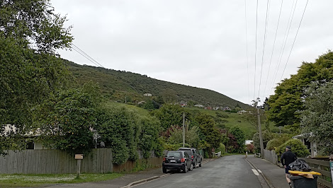
I had been looking at this view 8 months ago and today I started by walking up Emerson Street.  I had walked the lower part of Emerson Street with all the houses in April and today, I was walking the part with no houses. 

 
Like yesterday, once I left the houses behind, I was walking on rural roads with no footpath and surrounded by farmland, although this farmland looks as if it might be subdivided into houses one day. 
 
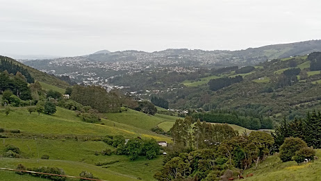
The walk up the hill wasn't difficult and looking back gave me a great view of Concord all the way to Flagstaff and Mt. Cargill, which are the hills in the distance.
Once I reached Blackhead Road, I was able to walk on a wide gravel footpath.  This footpath took me almost to the Tunnel Beach Track.
 
Tunnel Beach is a short walk that takes you down a track to sea carved sandstone cliffs, rock arches and caves. Tunnel Beach gets its name from a hand carved tunnel through the sandstone to the beach which the land owner and local politician, John Cargill had built for his family to have their own private beach in the 1870's.  The beach and walk is very popular and often this car park is full.
 

I didn't have time to go down Tunnel Beach today and instead, carried on walking streets. I was able to get a glimpse down to the sea.  I did not walk all the way to the sea as the road from here becomes narrow with cars traveling at high speed. 

Instead, I turned onto a gravel road as it was a much safer option to walk. It felt a bit strange walking on the gravel road surrounded by farmland, with the city streets only a short distance away. 


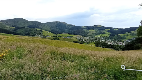
The gravel road didn't take long to walk and I was back onto the sealed road.  This part was much steeper and I was glad to be walking down.  As I walked down the street, I had a great view looking over to Abbotsford, knowing that I have walked every street that I could see.

I also had a great view looking down onto Green Island and Kaikorai Valley with Mt. Cargill in the background. This was a great place to stop and think about how I have walked every street that I could see from here.

And eventually I walked down the hill to join up to Green Island where I had been walking in June.  I was impressed with the great view from here, looking over Green Island and Abbotsford. 

 
There were a few interesting letterboxes today.  The first one is an old gas cylinder mounted on a plinth and the other two were together, one being a large piece of hollowed wood  and the other an old, rusty can with a corrugated iron New Zealand flag behind them.
 

Today's map shows the streets in red that I have walked.  The part I walked today takes in the streets around blackhead and around the gravel roads to Green Island near the top left. 

Distance walked:  5.9 km         Walking time  1 hr 6 mins    

Total distance: 1048.1  km          Total walking  195 hr 04 mins 

Wednesday, December 29, 2021

Day 126 Upper Junction to St Leonards

 If you have been following my blog, you will know that I have completed my challenge to walk every street in Dunedin  - and you may be wondering why I am still walking streets.  There are still a few streets that I didn't walk because they didn't fit my criteria.   You may remember that at the start of my challenge to walk every street in Dunedin, I came up with some 'rules' which included 

  1. Walking on one side of the footpath is enough to say that I have walked the street
  2. Walking on sealed roads only
  3. Private streets/right of ways are not included
  4. Not walking on roads that have high speed limits and no footpath 

There are a few streets remaining that connect some of the areas I have walked and all of these streets do not have footpaths and most are on roads with higher speed limits.  Looking at the map of the streets that I have walked, there are some obvious 'gaps' and I feel these 'gaps' need to be filled.  Today I decided to walk early and fill one those 'gaps'.

Today I walked from Upper Junction to St Leonards which is mostly rural.  I added another three streets to the number of streets that I have walked. 

1700. Strawberry Lane
1701. Upper Junction Road
1702. Blanket Bay Road

I started walking from the corner at Upper Junction and chose to walk early in the morning as there is less traffic and these roads are not busy roads

I started walking the shadow of Mt Cargill and walked along roads that wound their way through rural farmland to the edge of the harbour. 

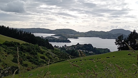
As I walked around the hill, I was rewarded with awesome views of the harbour with Roseneath in the foreground and Port Chalmers on the land jutting out into the harbour.  Quarantine Island and the hills of the peninsula are behind. 

The roads I walked today are narrow, windy and have no footpath.  There were a few cars go past, however they mostly slowed down and gave me room.  At no time did I feel in danger, despite the narrowness of the road.

I really enjoyed my walk this morning as the views from Upper Junction Road are spectacular all the way down the hill.  While I have driven this road a number of times, it is only while walking it, that I was able to really appreciate how great the views are. 

I enjoyed looking out over parts of the city that I have walked.  This is Sawyers Bay and I remember walking those streets a couple of months ago.

I walked past a number of friendly farm animals.  While these sheep looked like they needed to be sheared, they also had a great view of the harbour. 

Eventually I walked all the way down the hill and was on the edge of the harbour.  Here I swapped the bird song for traffic noice but I was also  rewarded with great views.

I had to walk a short part of the highway to Port Chalmers.  Luckily it was still early morning so not much traffic as this was the most dangerous part to walk.

Then I turned back onto the rural roads and enjoyed the next part of my walk.  This road used to be the main road to Port Chalmers, built in the 1860's before the faster and less windy highway was built in 1965.

This road is narrow and windy and it is easy to see why the newer Port Chalmers highway was built.  I saw no traffic on this road while I was walking it today.

 
The final part of my walk was beside the newer highway which has a train line running beside it and I was lucky enough to see a train heading to Port Chalmers.

 
As in other parts of the city, on rural roads, I walked past a number of these pest traps.  These traps are put out by the Halo project to trap stoats, ferrets and rats in an attempt to give our native birds a chance to breed.  The traps are regularly checked by volunteers and all their hard work is paying off as I was serenaded with a lot of bird song during my walk this morning.

 I walked past this once massive tree that has been cut down but as nature shows how resilient it is, the tree has started to regrow.  The photo doesn't show the true size of the stump, but I can assure you that it is massive!
 
I walked past another interesting piece of nature with this overgrown patch of hydrangea bushes.  The flowers are beautiful and show how nature can shine, even when neglected. 

I didn't walk past many letterboxes today, however there was one that I really liked and it is the letterbox for Bellbird Heights - the letterbox is very appropriately in the shape of a bird house.

 
And finally this map shows the streets that I have walked in red.  Today's streets start at Upper Junction and go diagonally down the hill to Sawyers Bay and then around the edge of the harbour to St Leonards at the bottom.


Distance walked:  4.9 km         Walking time  1 hr 14 mins    

Total distance: 1042.2  km          Total walking  194 hr 58 mins 

Saturday, December 18, 2021

Day 125 Recreate first day of street walking

While I had finished walking every street in Dunedin yesterday, I thought it fitting to walk the first streets again.  I started from my home and walked to the very end of Campbells Road.  Campbells Road changes from a sealed street to a gravel road and from here, I had good views of Flagstaff.

 Nearer the end of Campbells Road, I was able to look across to North East Valley, to where I had been walking yesterday. 

And finally I had a fantastic view of the city of Dunedin.  Last time I stood looking at this view, I was contemplating walking every street in the city.  Now, less than a year later, I can say that I have walked every street, and more, that I can see.  

I have enjoyed the challenge.  There has been a lot of walking, 1032 kilometres, and I have walked almost 1700 streets, through mostly sunshine and occasionally rain.   One thing is for certain, Dunedin is a city of hills and there are a lot of steep streets.  Because of the hills and harbour, there are lots of streets with great views and I have discovered many parts of the city that I had never been to before.

At the start of my challenge to walk every street in Dunedin, I came up with some 'rules' which included 

  1. Walking on one side of the footpath is enough to say that I have walked the street.
  2. Walking on sealed roads only
  3. Private streets/right of ways are not included
  4. Not walking on roads that have high speed limits and no footpath 

 I have stuck mostly to these rules and have walked the occasional gravel road.   It's been a good challenge and I am glad that I have completed it.

Tuesday, December 14, 2021

Day 124 Normanby

Today I completed the last few streets in my challenge to walk every street in Dunedin. I walked 8 streets today.

1680. North Road
1681. Ribbonwood Close
1682. Cleghorn Street
1683. Corsall Street
1684. Clava Street
1685. Nisbet Street
1686. Norwood Street
1687. Potters Road
1688. Cotter Road

While walking the streets, yesterday I looked across the harbour to see Mt. Cargill.  Today I walked the streets that would take me closest to Mt. Cargill.  I grew up with this view of Mt. Cargill. 

My walk today took me up the hill and I was able to look down to the streets at the bottom of the hill.  My plan for today's streets is taking me on a large loop and I will be finishing my walk on the street at the bottom of this hill.


As I walked further up the hill, Mt. Cargill (hill on the left with the transmitter) got closer and I was able to see how much further up I had to walk.  The group of trees on the skyline in the middle of the picture is as far up the hill that I needed to walk.
Today I was walking on the northern edge of the city and could look back over farmland.  At the bottom of the field is the Forrester Park sports fields that include a dog park and BMX track.  This used to be an old city dump and was covered over to create recreational facilities for the city many years ago.

As I walked around the side of the hill, I could look back over the northern part of the city.  From here, I was able to see the town belt easily.  The town belt is the 'belt' of trees through the middle of the city.  The town belt was planned in Scotland around 1848 and is one of only three town belts in the world. It is an example of the native bush that would have covered the hills before the settlers arrived and the city was built.

I walked a number of short side streets today and one of those side streets took me around the hill to a view of the harbour and the hills of the peninsula.  I was able to look down to where I was walking yesterday, around the road at the base of the hills.  This view was a nice surprise. 

Then I was back to the main road and onto the top of the hill.  This is as close to Mt. Cargill as I got and from here it is easy to see why the Maori legend tells of  Kapukataumahaka /Mt. Cargill being a warrior lying down.  Mt. Cargill has the transmitter on the top and is the body of the warrior while Buttars Peak to the right is the head with the legs of the warrior to the right of Mt. Cargill.


As I reached the top of the hill, I had one final view of the city before I walked down the hill to the street at the bottom (in the middle of this picture).  I had started walking from this street and walked up the hill around the left before walking down on the right back to where I started walking.

The road down the hill was a lot steeper and narrower than the one that I had walked up.  This road is mainly used by the local farmer but it made a nice loop to walk and had houses near the bottom.

The final view I had was at the bottom of the hill, looking back up to where I had walked earlier.  The houses in the middle of the hill are on streets that I had been on as I walked up the hill.

 
One place of interest that I walked past today is the Upper Junction School war memorial. The large macrocarpa trees were part of the school grounds and there has been a lot of work done recently to tidy the once overgrown site.
There is no school here as it was burnt down in 1945 but the war memorial site is still maintained   The memorial is for seventeen former pupils of the school who were killed during the first world war.

This memorial site is of particular interest to me as one of the memorials is for my fathers uncle who died aged 20 during the first world war.  A beech tree has recently been planted beside each memorial. 

 
At the view of the harbour, I saw how some enterprising locals have made their own seats and bar leaner.  I could see how this would be a great spot on a warm summer evening with a glass or two to drink. 

There were only two interesting letterboxs that I walked past today.  I really liked that it is shaped like the house that it belongs to and I thought the microwave was a good letterbox was a good use for something that was no longer needed. 


Distance walked:  8.4 km         Walking time  1 hr 40 mins    

Total distance: 1032.7  km          Total walking  189 hr 53 mins 

Monday, December 13, 2021

Catch up of streets not counted

As I am finishing my challenge to walk every street in Dunedin, I had a look at the list of streets and I see that I have missed a few off.  Most of these streets didn't get counted as I started and then walked parts of them over different days. Then there are small number of streets that got walked and just didn't get ticked off the list.  Whatever the reason, this is my catch up list of streets. I am adding 11 streets to my total of streets walked.

1689. Burma Road
1690. Dalziel Road
1691. Emerson Street
1692. Hawea Street
1693. Kauri Street
1694. Morris Road
1695. Osborne Terrace
1696. Rata Street
1697. Saint Ronans Road
1698. Eton Drive
1699. Brookside Place

Day 123 Harwood

Today was my longest day of walking as I walked from Company Bay to Harwood, then walked the streets in Harwood.  I walked 14 streets today.

1666. King George Street
1667. Camp Street
1668. Portobello Road
1669. Tily Street
1670. Hanson Street
1671. Weir Road
1672. Harrington Point Road
1673. Harwood Street
1674. Carnock Road
1675. Stepney Avenue
1676. Kokomuka Avenue
1677. Michael Avenue
1678. Ide Street
1679. Tidewater Drive

I started my walk along a wet cycle/walkway at the edge of the harbour.  The weather was overcast with no rain and I knew I had a long way to go today.  I walked around the shared cycle/walkway that runs along the side of Portobello Road and unlike last time when I walked part of the cycle/walkway, I saw only a handful of cyclists and very few walkers/runners.  Today my aim was to walk the rest of the cycle/walkway.

It has taken a number of years for the harbour cycle/walkway to be built and is a real asset to the city.  There has been a lot of work gone into the cycle/walkway with some lovely bridges around some parts of the route.

 
Along the way there are seats placed with great views looking down the harbour towards the city.  A lot of effort has gone into making this shared cycle/walkway appealing for both walkers and cyclists.

There was the odd side street that I needed to walk up and from these streets, I was able to gain a bit of height and look across the harbour towards Mt. Cargill.

But mostly I walked along the side of the harbour along the shared cycle/walkway beside Portobello Road.  I was able to join some of the suburbs up that I had been in walking over the last few days together.

Commonly referred to as Pineapple Rock, this rock with a macrocarpaea tree on top and looks like a pineapple.  The walkway goes around the outside of the rock.  I had been lucky with my walk today as the weather kept improving, the further down the harbour I walked.

With the improving weather, came improving views.  I was able to look across the harbour to Port Chalmers and Mt. Cargill behind it.  Mt Cargill is the hill on the far left. 

Walking beside the harbour was very pleasant as the weather was calm and with very few cyclists, I could wander along at my own pace without having to continuously look around for cyclists.  There was also not a lot of traffic.

 
And then I reached Portobello where I had been walking yesterday. From Portobello, I continued walking around the harbour to Harwood. 

Once past Portobello, the cycle/walkway ended and I continued walking along on the edge of Harrington Point Road.  The edge of this road is wide and there is plenty of room to walk safely.  The views down habour are stunning. 

 
Eventually I walked all the way to Harwood.  There are only a few streets in Harwood with a lot of them having houses on side and the harbour on the other.

An enterprising local has created a seat using the pole.  The seat is a nice place to have great views of the harbour.  On a calm day like today, it is a magical place to sit.
Not all houses in Harwood have harbour views, some look out over rural farmland.  There are a lot of houses with horses in paddocks close by in Harwood. 
But mostly the views in Harwood are of the harbour and Mt Cargill.  This was a good opportunity to see Mt. Cargill from a distance as tomorrow is my final walk and I will be walking the streets as close to Mt. Cargill as I can get.  
I saw this 'mile peg' on the shared cycle/walkway.  This is the last of the old mile pegs remaining on the Portobello Road.  Originally there was a post every mile along the road from Portobello to Vauxhall and each post had the number of miles to Vauxhall engraved on it.  This is the only 'mile peg' left and marks 7 miles to Vauxhall.
If you are wanting to buy a Merry-go-round then I know of where one is on the side of the road.  This Merry-go-round is for sale. Somehow I don't think there is a big market for merry-go-rounds.
 I have seen some unusual signs during my challenge to walk all of the streets.  While I have seen the 'watch out for children' sign, I have not seen one with a cat as well.  
I walked past a number of nicely painted bus shelters.  These bus shelters have been painted by artist John Noakes who lived in Broad Bay.  John Noakes spent  years painting murals on bus shelters around the city.


There were a couple of interesting letterboxes today.  One is shaped like a telephone box and the other is a metal man.  Both are quite large and would hold a lot of mail.

Distance walked:  17.7 km         Walking time  3 hr 06 mins    

Total distance: 1024.3  km          Total walking  191 hr 19 mins 
Otago Harbour Cycleway 30 October 2023

With my sister in town, it seemed a shame to waste a calm, sunny day so the two of us hopped on a bike each to enjoy the recently opened 32k...