If you have been following my blog, you will know that I have completed my challenge to walk every street in Dunedin - and you may be wondering why I am still walking streets. There are still a few streets that I didn't walk because they didn't fit my criteria. You may remember that at the start of my challenge to walk every street in Dunedin, I came up with some 'rules' which included
- Walking on one side of the footpath is enough to say that I have walked the street
- Walking on sealed roads only
- Private streets/right of ways are not included
- Not walking on roads that have high speed limits and no footpath
There are a few streets remaining that connect some of the areas I have walked and all of these streets do not have footpaths and most are on roads with higher speed limits. Looking at the map of the streets that I have walked, there are some obvious 'gaps' and I feel these 'gaps' need to be filled. Today I decided to walk early and fill one those 'gaps'.
Today I walked from Upper Junction to St Leonards which is mostly rural. I added another three streets to the number of streets that I have walked.
1700. Strawberry Lane
1701. Upper Junction Road
1702. Blanket Bay Road
I started walking from the corner at Upper Junction and chose to walk early in the morning as there is less traffic and these roads are not busy roads
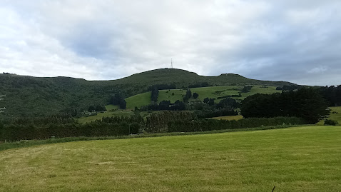
I started walking the shadow of Mt Cargill and walked along roads that wound their way through rural farmland to the edge of the harbour.
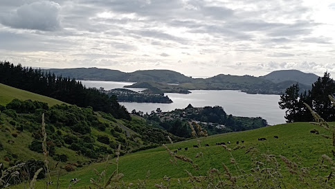
As I walked around the hill, I was rewarded with awesome views of the harbour with Roseneath in the foreground and Port Chalmers on the land jutting out into the harbour. Quarantine Island and the hills of the peninsula are behind.
The roads I walked today are narrow, windy and have no footpath. There were a few cars go past, however they mostly slowed down and gave me room. At no time did I feel in danger, despite the narrowness of the road.
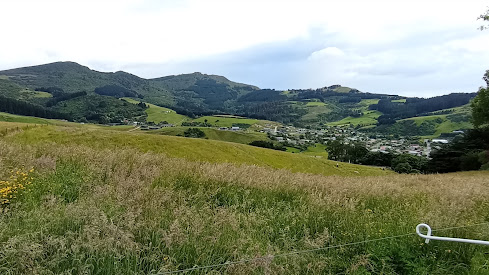
I really enjoyed my walk this morning as the views from Upper Junction Road are spectacular all the way down the hill. While I have driven this road a number of times, it is only while walking it, that I was able to really appreciate how great the views are.
I enjoyed looking out over parts of the city that I have walked. This is Sawyers Bay and I remember walking those streets a couple of months ago.
I walked past a number of friendly farm animals. While these sheep looked like they needed to be sheared, they also had a great view of the harbour.
Eventually I walked all the way down the hill and was on the edge of the harbour. Here I swapped the bird song for traffic noice but I was also rewarded with great views.
I had to walk a short part of the highway to Port Chalmers. Luckily it was still early morning so not much traffic as this was the most dangerous part to walk.
Then I turned back onto the rural roads and enjoyed the next part of my walk. This road used to be the main road to Port Chalmers, built in the 1860's before the faster and less windy highway was built in 1965.
This road is narrow and windy and it is easy to see why the newer Port Chalmers highway was built. I saw no traffic on this road while I was walking it today.
The final part of my walk was beside the newer highway which has a train line running beside it and I was lucky enough to see a train heading to Port Chalmers.
As in other parts of the city, on rural roads, I walked past a number of these pest traps. These traps are put out by the Halo project to trap stoats, ferrets and rats in an attempt to give our native birds a chance to breed. The traps are regularly checked by volunteers and all their hard work is paying off as I was serenaded with a lot of bird song during my walk this morning.
I walked past this once massive tree that has been cut down but as nature shows how resilient it is, the tree has started to regrow. The photo doesn't show the true size of the stump, but I can assure you that it is massive!
I walked past another interesting piece of nature with this overgrown patch of hydrangea bushes. The flowers are beautiful and show how nature can shine, even when neglected.
I didn't walk past many letterboxes today, however there was one that I really liked and it is the letterbox for Bellbird Heights - the letterbox is very appropriately in the shape of a bird house.
And finally this map shows the streets that I have walked in red. Today's streets start at Upper Junction and go diagonally down the hill to Sawyers Bay and then around the edge of the harbour to St Leonards at the bottom.
Distance walked: 4.9 km Walking time 1 hr 14 mins
Total distance: 1042.2 km Total walking 194 hr 58 mins


No comments:
Post a Comment