Today I completed the last few streets in my challenge to walk every street in Dunedin. I walked 8 streets today.
1680. North Road
1681. Ribbonwood Close
1682. Cleghorn Street
1683. Corsall Street
1684. Clava Street
1685. Nisbet Street
1686. Norwood Street
1687. Potters Road
1681. Ribbonwood Close
1682. Cleghorn Street
1683. Corsall Street
1684. Clava Street
1685. Nisbet Street
1686. Norwood Street
1687. Potters Road
1688. Cotter Road
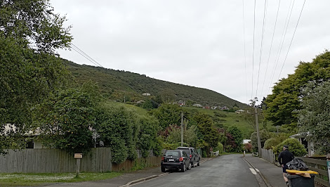
While walking the streets, yesterday I looked across the harbour to see Mt. Cargill. Today I walked the streets that would take me closest to Mt. Cargill. I grew up with this view of Mt. Cargill.


As I walked further up the hill, Mt. Cargill (hill on the left with the transmitter) got closer and I was able to see how much further up I had to walk. The group of trees on the skyline in the middle of the picture is as far up the hill that I needed to walk.


I walked a number of short side streets today and one of those side streets took me around the hill to a view of the harbour and the hills of the peninsula. I was able to look down to where I was walking yesterday, around the road at the base of the hills. This view was a nice surprise.


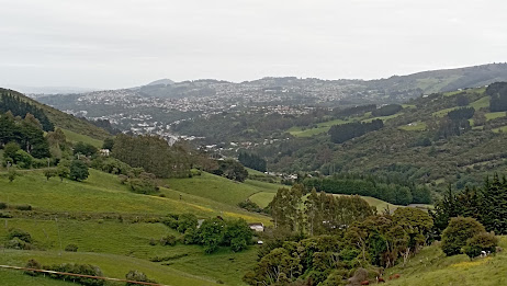
As I reached the top of the hill, I had one final view of the city before I walked down the hill to the street at the bottom (in the middle of this picture). I had started walking from this street and walked up the hill around the left before walking down on the right back to where I started walking.


The final view I had was at the bottom of the hill, looking back up to where I had walked earlier. The houses in the middle of the hill are on streets that I had been on as I walked up the hill.
One place of interest that I walked past today is the Upper Junction School war memorial. The large macrocarpa trees were part of the school grounds and there has been a lot of work done recently to tidy the once overgrown site.

There is no school here as it was burnt down in 1945 but the war memorial site is still maintained The memorial is for seventeen former pupils of the school who were killed during the first world war.

This memorial site is of particular interest to me as one of the memorials is for my fathers uncle who died aged 20 during the first world war. A beech tree has recently been planted beside each memorial.

At the view of the harbour, I saw how some enterprising locals have made their own seats and bar leaner. I could see how this would be a great spot on a warm summer evening with a glass or two to drink.

There were only two interesting letterboxs that I walked past today. I really liked that it is shaped like the house that it belongs to and I thought the microwave was a good letterbox was a good use for something that was no longer needed.


Distance walked: 8.4 km Walking time 1 hr 40 mins
Total distance: 1032.7 km Total walking 189 hr 53 mins


No comments:
Post a Comment