
The day was warm when eight energetic trampers took on the challenge of walking the Complete Northern Skyline which links Flagstaff, Swampy Summit, Mt Cargill and Buttar's Peak over seven tracks from the Bull Ring to the Organ Pipes. Starting with a steep up hill climb up the well graveled track to the first 'summit' of the day, Flagstaff was a good way to get the lungs working and also a taste of things to come. Taking about half an hour to reach Flagstaff, we stopped for a chance to catch our breath and take in one of the views of the city.


At 739m Swampy Summit is our second summit of the trip and is also the highest point on our journey. It offers stunning views of Blueskin Bay, Warrington and up the coast to Karitane and Huriawa Peninsula. Our ultimate destination of Mt. Cargill, which still looked to be quite a distance to go, attracted our attention and after refueling with a drink and snacks, we headed down the Leith Saddle Track which we had walked down two weeks ago on #9/100 trips. This track is steep in places and drops around 300m through tussock before entering native forest and eventually emerging on the side of the Northern Motorway.

We regrouped to safely cross the Northern Motorway and enter the Cloud Forest of Leith Track. The track winds it's way through native bush for 600m to a large outcrop of boulders with a good look out over the Northern Motorway and Swampy Summit. Here was a good lunch spot where we were entertained with jokes from Emilie, who at 8 years was the youngest member of our group.

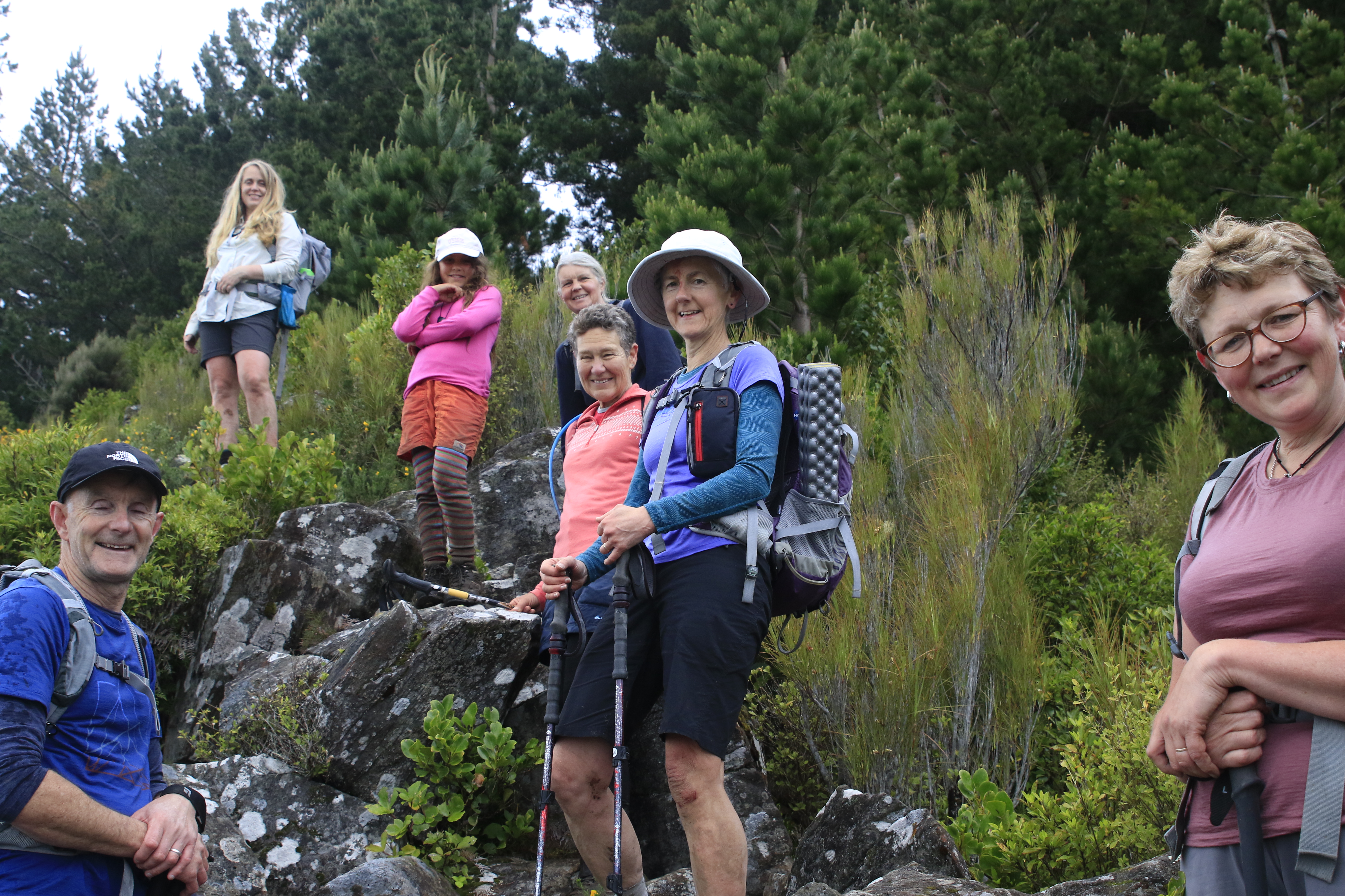
Lunch was over too soon and we headed back into the native bush to follow the track through remnants of a cedar forest and over a small creek continually making our way up hill until we reached the power lines. From the power lines we entered another track, the Escarpment Track and this is the most challenging of all the tracks. The Escarpment Track is a basic track with tree roots, fallen logs and small creek crossings. It is barely maintained with a lot of regrowth obscuring the track and ankle deep mud. The condition of the track made for slow going with most of us having some blood drawn from encounters with bush lawyer and scrapes with branches hidden amongst the ferns that hid the track. After a climbing 150m from the power lines we reached the obstacle of Pigeon Rock which required a scramble and well placed tree to reach great views looking towards Swampy Summit and around to the northern Silver Peaks, Mt Watkin and the Kakanuis being visible in the distance. This was another perfect place to stop, rest and have a drink.

We could see the end was close so down Mt Cargill to the turn off to Buttar's Peak. Ignoring the 'no exit' sign we clambered up the rocky outcrops of Buttar's Peak for another stunning view, this time of the harbour. Buttar's Peak is often overlooked as most people head to the higher Mt. Cargill or the more famous Organ Pipes but the interesting rock formations of Buttar's Peak are well worth taking the time over. We continued over the top of Buttar's Peak, effectively making this our forth summit, to rejoin the Mt Cargill track.


No comments:
Post a Comment