Saturday, August 14, 2021

Day Seventy Seven Green Island

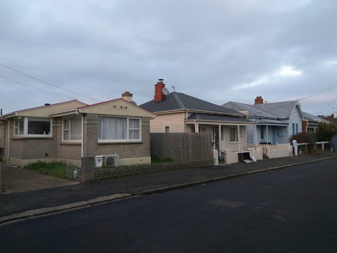
Today I walked the last few remaining streets in Green Island which were a mixture of flat walking and some small hills.  I walked 11 streets today.

962. Westland Street
963. Burgess Street
964. Jensen Street
965. Brooklyn Street
966. Trudi Place
967. Elwyn Crescent
968. Weir Street
969. Allen Road
970. Allen Road South
971. Clariton Avenue
972. Taylor Street
 
I started my walk today by walking alongside the busy off ramp of the Southern Motorway.  Recently there have been three big roundabouts built to help traffic flow exiting and entering the motorway.  
 After the busy off ramp of the motorway I enjoyed a short section of walking beside the Kaikorai Stream.  I have been following this stream off and on for quite a few months as it flows through a number of city suburbs before it reaches the sea.
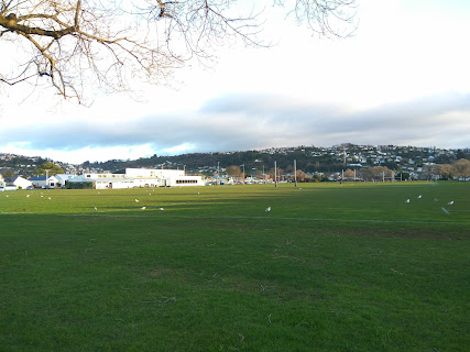
While most of my walking today was reasonably flat, there was a small hilly section that opened out onto a playground.  This gave me the opportunity to see where I was headed in my walk and the streets that I would soon be walking on. 
It was also interesting to see the contrast where the houses (and streets) of the city finish and the farm land begins.  
I continued walking in this area until I eventually came out on the road behind the houses that bordered the farm land and I could look back to where I had been earlier.

As I continued on my walk, the road  changed from tarseal to gravel with houses on one side and farmland on the other.  I was also able to see Saddle Hill which continues to dominate the view looking South.
The gravel road eventually got me back to the tarseal and I finished my walk on the side of this road where I saw two different groups of Pukeko.
 

I really enjoyed seeing pukeko during my walk today.   Pukeko is the New Zealand name for a swamphen and are predominately found in swampy wetland areas although they are very adaptable and live in many areas throughout New Zealand. 
And lastly today, I walked past this wizard hat letter box .  I wonder if the owner is a Harry Potter fan. 

Distance walked:  7.8  km         Walking time  1 hr 24 mins  
 
Total distance: 623.9 km        Total walking  116 hr 29 mins 

Sunday, August 1, 2021

Day Seventy Six Sunnyvale

 I was back finishing walking the streets around Abbotsford and also Sunnyvale.  I walked 23 streets today.

939. Teigmouth Street
940. Totness Street
941. Torquay Street 
942. Exeter Street
943. North Taieri Road
944. McKinlay Road
945. Lambert Street
946. Hyslop Street
947. Freeman Close
948. Abbeyfield Close
949. Will Street
950. Thomson Street
951. Pottinger Street
952. Watson Street
953. Sunnyvale Lane
954. Abbotsford Road
955. Abbotts Hill Road
956. Waldron Crescent
957. Severn Street
958. Tate Crescent
959. Grand Vista Drive
960. Reeves Street
961. Miller Street

The first part of my walk today was to finish streets that I had walked part of yesterday.  Of course these streets all involved walking either up or down a hill.  The good thing about walking hills are the views and, like yesterday, I was able to look over at the streets of Green Island which I have already walked.

 Also like yesterday, Saddle Hill dominated the view.  From this angle it is hard to see why the hill is called Saddle Hill but once I reach the streets of Mosgiel, the shape of the hill will look more like a saddle. 

I was pleased to be able to look down onto the newer part of Abbotsford where I would be walking late in the morning, once I had finished the streets on the hill.  

Another area that I would be walking once I had finished the streets on the hill were the streets of Sunnyvale which behind the sports field. 

As I walked closer to Sunnyvale, I could hear the noise of the traffic on the motorway.  I could also look across the motorway to see streets that I have not walked yet.  

The houses in this area get a good view of the surrounding hills and down onto the streets of Sunnyvale.  I have now walked all the streets in the foreground of this picture.  

I was happy to find four interesting letterboxes today.  Three of them are very solid, metal letterboxes and the forth letterbox has been made interesting by the owners. 


And something else that I spotted that I thought was interesting was both of these gates that are not connected to a fence. Other than holding up the letterbox, I am not sure what the purpose of having a gate that you can walk around.

Distance walked:  12.2  km         Walking time  2 hr 14 mins  
 
Total distance: 616.1 km       Total walking  115 hr 5 mins 

Saturday, July 31, 2021

Day Seventy Five Abbotsford

 It's been a couple of weeks since I was walking the streets and today I walked 22 streets around Abbotsford.

917. Armstrong Lane
918. Boomer Street
919. Crimp Street
920. Kane Street
921. Harrison Street
922. Christie Street
923. Penrich Street
924. Mitchell Street
925. Percy Street
926. Edward Street
927. Mathew Street
928. John Street
929. Lethaby Street
930. Dall Street
931. Binnie Street
932. Runciman Street
933. Paterson Street
934. Shulma Stret
935. Shipka Street
936. Exmouth Street
937. Unsworth Street
938. Neill Street

Not long after starting my walk today, I walked over the bridge that crosses the Kaikorai Stream.  I have walked beside and over this stream before when I walked the streets of Kaikorai Valley and near Frasers Gully.  

The first part of my walk took me around the streets that border the area where the 1979 Abbotsford slip happened.  Today the area has been transformed into sports fields but prior to August 1979 the area was streets and houses.  Over a period of several months cracks were appearing in the ground and burst water pipes were continually being repaired with most residents voluntarily leaving their homes.  In late July 1979 there was heavy rain which increased the size of the cracks substantially and on 8 August, the hillside slipped away, taking 69 homes with it.  Today the area is peaceful with sports fields.


It must have been a very uncertain time for many people living in Abbotsford, including those living on Christie Street as the houses on one side of Christie Street slipped away and the other side was 'safe'.  This photo is of Christie Street with houses on the right and the land on the left now used for sports fields and animal grazing. 

As Abbotsford is a hilly suburb, there were some good views on my walk today and I was able to look down on the streets that I would be walking later on during my walk.  Saddle Hill dominated a lot of the views today.  

I was also able to look over towards Green Island where I had been walking a couple of weeks ago.  It is good to know that I don't have to walk these streets as I have already done so.  

The railway line runs through Abbotsford and I walked along (and over) the railway line for part of my walk today.  A cycle way is being built beside the railway line. 


In Abbotsford today, I walked past a playground with two names.  This playground is called the Matthew Street playground but in the 1970's it was called the Penrich Playground. 


 I was also able to look down on the playground from above while walking the streets on the hill above the playground.

There was piece of public art that I walked past today, this little girl losing her balloons painted on a fence. 

I saw a couple of interesting letterbox today.  This cow letterbox was near animals grazing and while there were no cows nearby, there were sheep on the other side of the road. And the other letterbox is bright and cheerful with daffodils

 
Distance walked:  11.4  km         Walking time  2 hr 6 mins  
 
Total distance: 603.9 km       Total walking  112 hr 51 mins 

Sunday, July 11, 2021

Day Seventy Four South Dunedin

Today was a shorter day of walking as I finished walking the last of the streets in South Dunedin.  I walked 7 streets.

910. Melbourne Street
911. Dick Street
912. Hall Street
913. Oxford Street
914. Atkinson Street
915. Kirkcaldy Street
916. Fawcett Street
 
The streets of South Dunedin have not been the most interesting streets to walk as the area is flat and I feel like I am walking in circles as there are very few landmarks to see where I am.  Each street is similar in look and there are very few views of the surrounding hills.
The houses in South Dunedin are a mixture of old wooden villas and more modern brick houses all built close together making the most use of the flat.  The area can be prone to flooding during heavy rain as the land is not much above sea level and there is no where for the water to go. 
The only interesting thing I saw on my walk today was this buffalo letterbox. I enjoy looking out for interesting letterboxes and have seen quite a few during my walking of the streets.

And finally I thought it was time to share the map of the streets that I have walked on my journey to walk every street in Dunedin this year.  All the streets I have walked are in red and I have walked more than 900 streets out of approximately 1500 streets in Dunedin. 

Distance walked:  4.1  km         Walking time   42 mins  
 
Total distance: 592.5 km       Total walking  110 hr 45 mins 

Saturday, July 10, 2021

Day Seventy Three South Dunedin

The streets of South Dunedin are feeling like they are endless as I walked 20 streets today.

890. Millington Street
891. Bradshaw Street
892. Wesley Street
893. Osmond Street
894. Prendergast Street
895. Cutten Street
896. Bathgate Street
897. Reid Road
898. Largo Avenue
899. Joyce Avenue
900. Macandrew Road
901. Crowder Avenue
902. Fox Street
903. King Edward Street
904. Thomas Street
905. Fingall Street
906. Cashel Street
907. Arney Street
908. Wynyard Street
909. Glasgow Street

The streets of South Dunedin are not only narrow but they criss cross each other on the flat and the only views that the residents of these narrow streets have are of their neighbours. 

One of the narrow streets I walked down today had me a bit confused as it had roadworks on the footpaths down both sides of the street.  The footpath I was walking down was blocked with a fence surrounding a deep hole in the footpath and it had a sign telling me to use the other footpath, however this footpath was being resealed and had a sign telling me to use the the other footpath.  Luckily the narrow streets are not busy and I was able to walk down the middle of the road. 

Another interesting street I walked down today was Prendergast Street where all the houses are small and are of the same design with the only difference being the colour each house is painted. There is no off street parking for any of these houses so I imagine finding parking in this street will be difficult which is probably why cars are parked facing in different directions.

I walked past Bathgate Park sports grounds today, where the sports grounds take up nearly a whole block of South Dunedin.  This sports field has weekend sports and is home to the Southern Rugby Football Club.  It is also one of the only parts of my walk that I was able to see a view of the city hills.


Bordering the long edge of Bathgate Park is the Donaghys rope factory.  The factory has been on this site making rope since 1876.  The rope making part of the building runs 350m along the full length of the Bathgate Park sportsfield.
I noticed only one interesting letterbox on my walk today.This (slightly broken) letterbox is designed to look like a brick house, similar to the house it represents. 
The street art that I walked past today was this large mural on the side of a building representing the native wild life found around Dunedin.

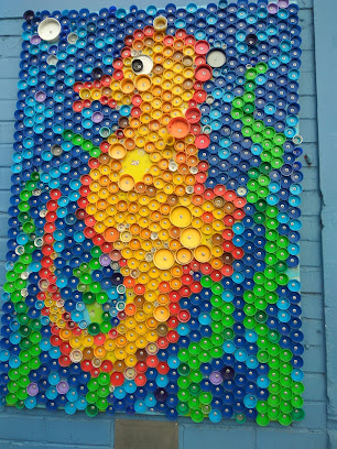
And this picture made from bottle tops which is on the side of another building.  It is very well done with some thought has been put into what coloured bottle tops to use and where to place them.

Distance walked:  9.3  km         Walking time   1 hr 39 mins  
 
Total distance: 588.4 km       Total walking  110 hr 3 mins 

Monday, July 5, 2021

Day Seventy Two South Dunedin

 Today I was back walking the streets of South Dunedin and I walked 15 streets today

875. Hillside Road
876. Law Street
877. Burns Street
878. Neville Street
879. Murrayfield Street
880. Wilkie Road
881. Rankeilor Street
882. Broughton Street
883. Lorne Street
884. Waverley Street
885. Braemar Street
886. McBride Street
887. Brandon Street
888. Sullivan Avenue
889. Carey Avenue

I started my walk this morning with another beautiful sunrise.  The temperature was warmer than yesterday so there was not the frost that I had experienced yesterday morning.  

Today I started walking the streets that took me towards Carisbrook.  The streets here are wider than some that I walked yesterday with trees and grass verges.  In other seasons, the trees would be covered in leaves but in winter, they are bare of leaves

From the corner of South Road and Burns Street, I was able to look over the old Carisbrook site.  Carisbrook was a major sporting venue in Dunedin.  This site was first developed for sports in the 1870's and hosted international cricket in 1883.  Rugby international tournaments were first hosted at Carisbrook in 1908 with the last game being played at Carisbrook in 2011 when the home of Otago Rugby was moved to the new Forsyth Barr Stadium. 

Some of the land where Carisbrook stood has been built on with industrial buildings while much of it remains untouched.  It is sad to think that this land was once the infamous 'house of pain' due to it's reputation as being a difficult venue for visiting rugby teams to play.  

I was pleased to see the historic turnstile gates are still in place at Carisbrook.  These gates have ushered many sports fans into Carisbrook.

I had not realised till now how narrow that gates are.  People must have been smaller when the gates were built or maybe it was a way to ensure that only one person at a time could enter. 

Part of my walking the streets today was down the main shopping area of South Dunedin. The shopping area is an eclectic mix of second hand and small local shops.  The area is an alternative to the main shopping area.

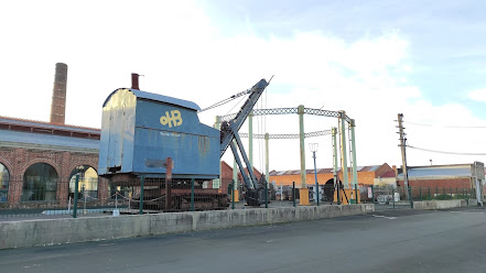
Walking past the Gasworks Museum was very interesting and I only wished that I had been later in the day when the museum is open.  The Dunedin Gasworks Museum is part of the now closed Dunedin Gasworks which was New Zealand’s first and last gasworks, operating from 1863 until 1987. It is one of only three known preserved gasworks museums in the world.

I walked St Patrick's Basilica during my walk this morning.  This site was purchased in 1873 with plans to build a church and school here. A school-chapel was opened in 1878 with building of this Basilica being delayed. It wasn't opened until 1894.  In the early 2000's the Basilica was in a poor state of repair and underwent major renovations and reopened in 2016.

Just down the road from Carisbrook was a wall of graffiti type street art.  The street art makes good use of an otherwise blank wall that runs the length of the street. 


South Dunedin has much street art and below are some more that I walked past today.


Distance walked:  7  km         Walking time   1 hr 16 mins  
 
Total distance: 579.1 km       Total walking  108 hr 24 mins 

Otago Harbour Cycleway 30 October 2023

With my sister in town, it seemed a shame to waste a calm, sunny day so the two of us hopped on a bike each to enjoy the recently opened 32k...