Showing posts with label foot. Show all posts

Sunday, October 24, 2021

Day 103 Mosgiel

Today I started walking the streets on the flat part of Mosgiel and I walked another 15 streets.

1367. Ayr Street
1368. Emlen Place
1369. Hall Street
1370. Mure Street
1371. King Street
1372. Inglis Street
1373. McDonald Street
1374. Shaw Street
1375. Dutton Place
1376. Steven Place
1377. Ashton Street
1378. Burns Street
1379. Duke Street
1380. Bruce Street
1381. Queen Street

I started my walk at the railway line.  Yesterday I walked the streets on the right of the railway line and today, I was walking streets on the left of the railway line.  

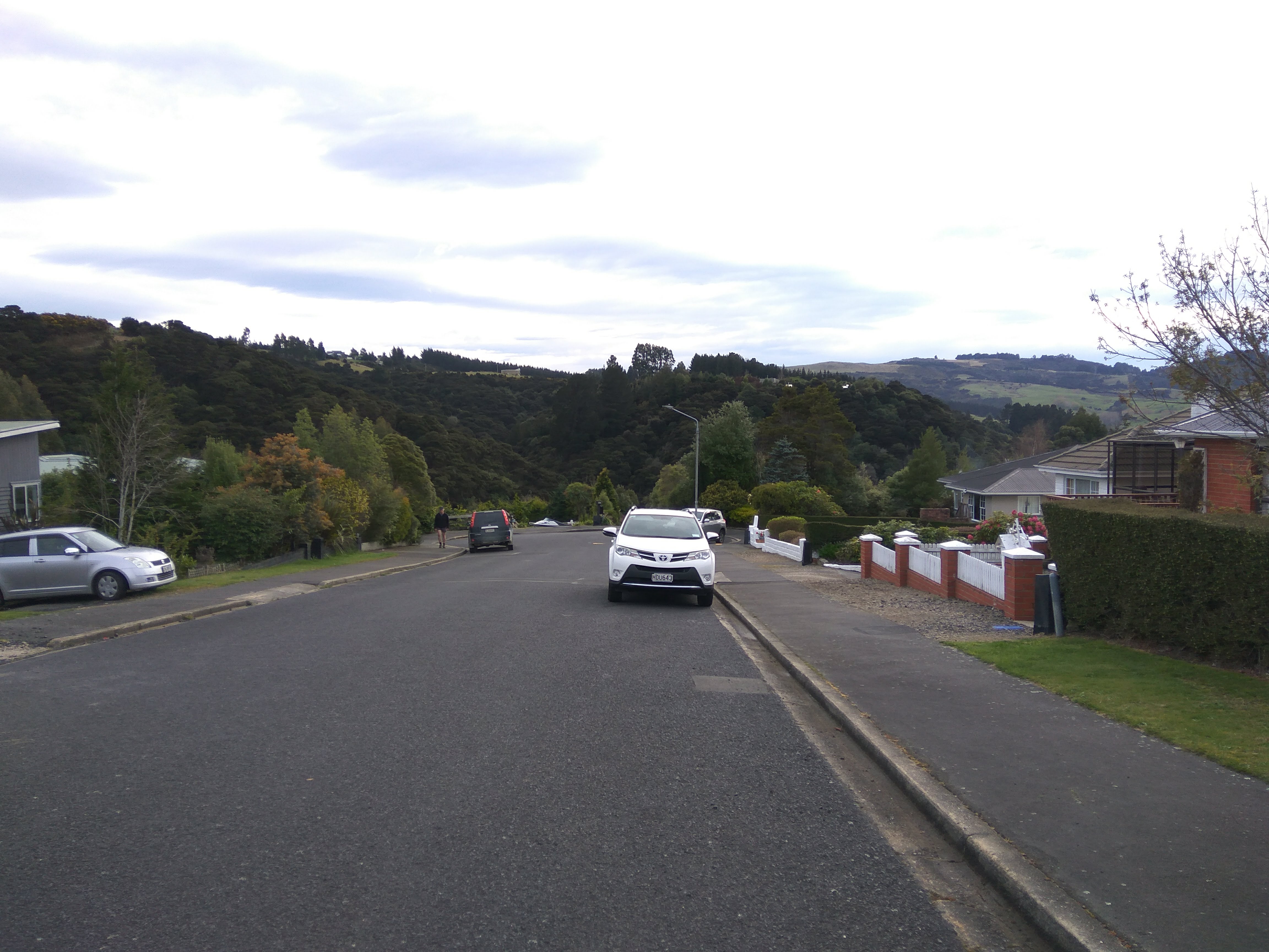
And once past the railway line, the streets were long, straight and flat.   Mosgiel is named after Mossgiel Farm in Ayrshire,Scotland which was the farm of the poet Robert Burns whose nephew Thomas Burns was a co-founder of the region in 1848.

While walking these streets, I was able to look over to Saddle Hill where I could easily see the reason for the name.  Saddle Hill is one of only two places in Otago to have been named by Captain James Cook during his 1769 voyage of discovery.  According to Maori legend the hill is the remains of a tanawha.  

The view of Saddle Hill is the only view I saw today and because the streets in this part of Mosgiel are set out in a grid, I needed to keep track of which streets I had walked so I didn't walk them twice.

 
Some of the streets end at a farm fence.  I imagine that over time, there will be new houses built in this area but at the moment, it is a lovely peaceful looking place. 

It was nice to see the farm paddocks which broke up the monotony of walking the long, straight streets of Mosgiel.  In this part of Mosgiel, there are some very royal streets with names such as King Street, Queen Street and Duke Street.

 
I walked past this plaque which commemorates the site of the home built for Arthur Burns in 1850.  Arthur Burns was the son of Thomas Burns who was one of the co-founders of the region.  Arthur Burns founded the Mosgiel Woolen Mills and was a member of the New Zealand House of Representatives

 
One interesting thing I walked past today was this 'Beautiful Street' competition sign from 1992.  I have only seen a couple of these signs during my walk.  Most of the poles that these signs were attached to have been replaced over the years. 

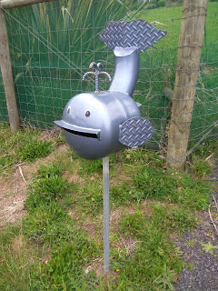
While walking the streets of Mosgiel, I walked past these two fun advertising 'statues'.  The tin man is made from exhaust parts and the other tyre bear was outside a tyre shop.

Below is the map of Mosgiel and the streets we have walked are in red.  Today we walked the grid of streets on the left while the red streets at the bottom of the map are where I was walking yesterday.
 
Distance walked:  10.3 km         Walking time  1 hr 50 mins   
 
Total distance: 851  km          Total walking  159 hr 20 mins 

Saturday, October 16, 2021

Day Ninety Eight Allanton, Momona & Outram

Today I decided to walk the streets of another three suburbs on the outskirts of the city.  I walked 29 streets today.

1297. Peel Street
1298. Ralston Street
1299. Grey Street
1300. Bardsey Street
1301. Precelly Street
1302. Ramsey Street
1303. Snowdon Street
1304. Caernarvon Street
1305. Hay Street
1306. Douglas Street
1307. Stack Street
1308. Castleton Street
1309. Ward Street
1310. Trigg Street
1311. Trent Street
1312. Holyhead Street
1313. Mountfort Street
1314. Franks Place
1315. Bidston Street
1316. Orme Street
1317. Railway Lane
1318. Bell Street
1319. Beaumaris Street
1320. Formby Street
1321. Rodeo Place
1322. Three Kings Court
1323. Lynas Street
1324. Skerries Street
1325. Hoylake Street

I started walking the streets in Allanton today which is a small township at the turnoff to the Dunedin Airport from State Highway One. I was surprised at the number of small hills that I walked up and down in Allanton

 
I have driven past Allanton many times but I had never walked it's streets before today and I found it be a pretty township with lots of green trees and shrubs. 
While there are quite a few houses in Allanton, there are paddocks alongside most houses which seem to have a few sheep or other farm animals. 
After walking the streets in Allanton, I moved onto the streets of Momona.  Momona is a small township on the edge of the Dunedin Airport and built on airport land.  There are three streets in Momona and they are all named after RNZAF airmen who received the Victoria Cross

The streets of Outram are wide, straight and flat with the hill of Maungatua behind it.  The name Maungatua is Maori and means 'Hill of the Spirits'.  

There is a lot of flat farmland surrounding Outram and the township is growing with new streets and new houses being built.  Today I walked a number of these new streets.
 
The streets of Outram run in a grid and I found that I needed to keep track of which streets that I had walked or I would miss completing some of them.  With the township being flat about the only hill I could see was Maungatua which dominated the view South.   

As Outram is close to the Taieri River, along one side runs the floodbank which protects the township when the river floods. Built around 1986, access to the floodbank is from the ends of some of the streets.
While there is no vehicle access on the floodbank, there is a walking track that is a popular walk, taking in farmland on one side and houses on the other. 

I walked past some interesting letterboxes today.  My favourite of the day is the Minion which is as large as a child. 


I saw quite few different animals during my walk today.  Apart from disturbing lots of dogs, I saw horses, sheep, a goat, pigs and two alpacas.


Distance walked:  14.5 km         Walking time  2 hr 47 mins   
 
Total distance: 810.8 km          Total walking  152 hr 07 mins 

Sunday, October 3, 2021

Day Ninety Six Waldronville

Since I had finished walking the streets of Waikouaiti yesterday,  I headed south to walk the streets of Waldronville.  I walked 13 streets today.

1273. Craddock Place
1274. Friendship Drive
1275. Viscount Road
1276. Vulcan Road
1277. Lancaster Lane
1278. Delta Drive
1279. Valiant Road
1280. Vampire Road
1281. Dakota Place
1282. Canberra Place
1283. Wavy Knowes Drive
1284. Brighton Road Waldronville Section
1285. Kilmanock Close

Waldronville is close to where I was walking a few weeks ago when I walked the streets of Green Island.  The streets of Waldronville all run off on the left of the main road through the suburb. Waldronville is close to the sea and I could hear the waves during my walk of the streets today.

The streets of Waldronville are not the most interesting streets to walk as they are flat and laid out in a grid.  This meant that I needed to walk a lot of the streets twice in order to ensure I didn't miss any sections.

There are some walkways through to the beach behind the suburb.  This gives the residents easy access to the beach and good exercise areas for dog walkers and mountain bikers. 

The last street I walked was Wavy Knowes Drive which is on a small hill overlooking the Island Park Golf Course and Kaikorai Lagoon.
 
Most of the streets of Waldronville were built in the 1950's and are named after World War 2 fighter aircraft.  This is shown in a playground located off Delta Drive where a replica of a plane has been combined into the playground equipment

 
I walked past some interesting letter boxes today.  I am guessing the snorkeling and whale letterboxes are because Waldronville is close to the sea and the cow because some of the houses have a rural outlook.

The other interesting thing I noticed about the letterboxes are that all the letterboxes in Lancaster Lane all have the same letterboxes.  This street is a new subdivision that has been built on the old Waldronville School site.

One of the bus stops that I walked past today was painted with World War 2 fighter plane scenes which reflects the street names. 

 And below is a map of the streets of Waldronville that I walked today.  The streets that I walked are highlighted in red.

 
Distance walked:  7.9 km         Walking time  1 hr 29 mins   
 
Total distance: 789.2 km          Total walking  147 hr 56 mins 

Tuesday, September 14, 2021

Catch up of streets not counted

If you have been following this blog on my challenge to walk every street in Dunedin, you will know that I have walked over 1100 streets.  Now that I am over 2/3 through my challenge I went over the list of remaining streets to check that I have not missed counting any streets.  As a result I am able to count another 18 streets

1114. Great King Street
1115. Alexander Street
1116. Alton Avenue
1117. Bellevue Place
1118. Beverley Place
1119. Bombay Street
1120. Corrie Street
1121. Dundas Street
1122. Eglin Road
1123. Harrow Street
1124. Jellicoe Crescent
1125. Liverpool Street
1126. Lookout Point overbridge
1127. Mellor Street
1128. Monro Street
1129. Raglan Street
1130. Samuel Street
1131. Thesis Street

I have walked all of these streets but I missed counting most of them as I walked the streets over two days or in some cases over a number of days, either way I didn't realise that I hadn't counted them at all.  There are some streets that changed names partway along the street and I didn't count them as separate streets and there is also the odd street that I just didn't count at all.  Whatever the reason that I missed counting them, I did walk them so am adding them to my total. 

There remains around 400 streets still to walk. 

Sunday, September 12, 2021

Day Eighty Seven Fairfield

Lockdown in New Zealand has been eased with a move to Alert Level 2 which means that I can travel further to exercise so today I went back to Fairfield to finish the streets that I had started walking three weeks ago. Today I walked 20 streets

1094. Hartley Street
1095. Park Lane
1096. St James Place
1097. Cockburn Street
1098. Fry Street
1099. Martin Road
1100. Fairplay Street
1101. Centennial Road
1102. Freyberg Road
1103. Coach Road
1104. Saddleview Place
1105. Sickels Street
1106. Robert Street
1107. Walton Park Avenue
1108. Hogan Place
1109. Estuary Crescent
1110. Blanc Avenue
1111. Edith Street
1112. Alfred Place
1113. Main Road

After walking the steep streets of North East Valley and Opoho over the last couple of weeks, the streets of Fairfield were a complete contrast as Fairfield is mainly flat.  There is not the same views in Fairfield, however the area is surrounded by some small hills with farmland and trees.


Part of my walk today, took me along the old road that was once the main road out of Dunedin before the Southern Motorway was built.  I have slowly been walking my way towards Saddle Hill. 
 
And this is the Southern Motorway which is now the main route out of the city.  I was out walking early in the morning before there was much traffic on the motorway.  During the week, this motorway can be very busy.
 
Built in 1904 this house was the former Coach and Horses Hotel and has been extensively renovated. While it is now a private home, it features many of the original fittings from it's former days as a hotel. 
On my walk today, I walked past the Fulton Hogan yard where there is this old mechanical loader/shovel.  Obviously not in use anymore, it is much smaller than modern machinery.  
Some of the street art that I walked past today was the wall of this building painted with some local wildlife and their habitat
And this bus shelter painted with art from children at the local school.  I am really enjoying seeing all the painted bus stops around the city. 
I walked past a number of interesting letterboxes today.  The most unusual is the old water pump one, the most fun is the yellow smiley one.  The small barrel is probably my favourite letterbox of the day.


Distance walked:  10.7  km         Walking time  1 hr 55 mins  
 
Total distance: 700.5 km        Total walking  131 hr 16 mins 

Otago Harbour Cycleway 30 October 2023

With my sister in town, it seemed a shame to waste a calm, sunny day so the two of us hopped on a bike each to enjoy the recently opened 32k...