Showing posts with label Saddle Hill. Show all posts

Friday, March 17, 2023

#37 of 100 trips for 100 years - Saddle Hill 11 March 2023


Today's trip to Saddle Hill/Makamaka was special for a number of reasons.  One being that it is a prominent landmark seen from many parts of Dunedin, another that it is privately owned land with permission needed and finally, that there have been over 60 club trips to Saddle Hill in the past 100 years.  Being another beautiful, sunny Dunedin day meant that 23 people gathered at the club rooms with high hopes of spectacular views from Saddle Hill/Makamaka.  After the short drive to Saddle Hill/Makamaka we met up with the land owner whose grandfather had lead a club day trip to the area nearly 30 years ago and he was to be our ‘guide’ for the walk. In order to make it more of a 'round' trip, we walked back down Saddle Hill Road for a short distance and turned off to walk through a farm paddock where a bag of mushrooms and a few four leaf clovers were collected before the real business of climbing up the hill began.

After crossing the paddock, we went through a gate into the cool of a native bush reserve. From the gate the track zig zagged up the hill under the shade of the mature fushia trees to the chorus of native birds. The gradient wasn’t overly steep making it easy to chat while walking.Once at the top of the reserve, we went through another gate into a farm paddock where we were rewarded where the views really opened out from Black Head Beach down to the Catlins.
We spent some time here drinking in the fantastic views and were hesitant to leave this wonderful spot but the top was calling. The track lead us around the base of the top of the hill where we had more spectacular views, this time looking towards the city and Mosgiel from an angle not often seen. The streets of Fairfield and Green Island with the dividing motorway were laid out in front of us.
The final push saw us clamber over a rocky section to reach the trig at the top of Saddle Hill/Makamaka. This was the perfect place to sit for a snack and admire the views over the Taieri Plains that were stretched endlessly in front of us. We could see the hills that we had climbed last weekend – trip #35 Mt Charles and trip #36 Mt Watkin and also where we were headed on tomorrow’s day trip into the Silver Peaks for 7 summits.
After the compulsory team photo at the top, we were reluctant to leave such a magical place but time was getting on and we started the final downhill section which took us along an old farm track that zig zaged down to the landowners house and back to the cars. Despite being a shorter day of 4.5 km it was a memorable trip with lots of stopping time for amazing views in all directions.

Tuesday, January 11, 2022

Day 129 Halfway Bush to Mosgiel

Today I walked the streets that joined up Halfway Bush to Mosgiel meaning that I have now walked from Harwood to East Taieri and every street in between.  The street I walked today is a paper road meaning that it is unformed and is a track through farmland.  I walked part of Friends Hill Road in October and today I walked the unformed part of it today.  

I started at the top of the hill in Halfway Bush and walked down to Mosgiel at the bottom of the hill.  Friends Hill Road started as a gravel road through farmland.

Then it became more of a track.  It looks as though it is used regularly by walkers, dog walkers, cyclists and also a few horses. 

Mosgiel became closer the further down the hill I walked.  It was a good chance for me to see how big Mosgiel is and very rewarding to know that I have walked every street in Mosgiel. 

I was also rewarded with a good view of Saddle Hill. I have seen Saddle Hill from many angles during my challenge to walk every street in Dunedin .

At the end of the unformed part of the road is a locked gate meaning that the track is open to the public but only for walking/cycling and not for vehicles.  This is the first time that I had walked this road before and I enjoyed the walk.

From the locked gate, Friends Hill Road becomes a gravel road again and I continued walking along the gravel road till I reached the sealed roads of Mosgiel.  

I was impressed with the roses planted on the side of the road.  There is a large display of them and the colours are beautiful.  Someone has put a lot of effort into growing them here.

And finally I walked to the bottom of the hill and Gladstone Road where I had walked in October.


Distance walked:  3.7 km         Walking time  45 mins    

Total distance: 1061.6  km          Total walking  198 hr 34 mins 

Saturday, January 1, 2022

Day 128 Halfway Bush to Kaikorai Valley

 I walked the streets of Halfway Bush and Kaikorai Valley in March and looking at the map, there is a definite 'gap' that joins the two suburbs via Brockville.  Today I walked 8 streets.

1707. Halfway Bush Road
1708. Chalmerston Road
1709. Three Mile Hill Road
1710. Brinsdon Road
1711. McMeakin Road
1712. Mount Grand Road
1713. Reservoir Road
1714. Boundary Road
 
 I started walking today at the end of Halfway Bush Road which overlooks Mosgiel and the Taieri Plains.  One day, I plan to walk down this hill  to Mosgiel via the gravel road. 
I only walked the sealed roads today and, again, the roads took me through rural land with houses surrounded by paddocks.  The roads are quiet with hardly any traffic and it is peaceful to walk with plenty of bird song to keep me company.
There was one point where I walked along one of the main roads from the city to Mosgiel.  Three Mile Hill Road can be busy and the traffic is traveling very fast so I was glad there was a good sized verge on the side of the road. 

The nice thing about today's walk is being in a more rural area with lots of bush and open space as the amount of birds and hearing their birdsong is great. At times I was also rewarded with glimpses of the city and the harbour.

 
The road today, took me around the edge of Brockville and the top of Frasers Gully which is a recreational reserve that includes walking tracks through native bush and playing fields. 


I stopped to have a look at the water from the Mount Grand water treatment plant.  This is where Dunedin's drinking water is pumped to from Deep Stream.  Stopping here also gave me the opportunity to see Mt Cargill with the reservoir in front. 

 
The next part of the street involved walking along this lovely tree tunnel.  The photo doesn't show how dark it really is.  The trees are huge and form a lovely tunnel. 

Once I had walked through the tree tunnel, I was walking down the hill to Kaikorai Valley  From here, the views started to open up with Saddle Hill and the southern suburbs in full view. 

Parts of the road that I walked down were steep and mostly I was walking past farmland.  There were a few cars on this part of the road and most slowed when they saw me walking. 

The further down the hill I walked, the view changed and I was able to see where I had been walking yesterday.  Yesterday I walked the streets that took me past the houses near the middle of this picture, along the top of the hill and down past the houses on the right .

 
Before I knew it, I was at the bottom of the hill and Kaikorai Valley was spreading out with the large buildings of the industrial area dominating this part of the valley.


I spent some time at the tree tunnel to marvel at the size of the trees.  They are huge and their trunks are massive. 

One thing I noticed on my walk of the streets was a lot of rock walls.  Most houses and a lot of paddocks had rock walls.  These walls are usually built using the stones that are removed when building the foundations for houses or by farmers clearing their paddocks. Going by the number of rock walls and how substantial most of them are, I am thinking that the land must have been very rocky.
 
This is another example of the size of the rock walls.  A lot of work has gone into making these rock walls and as you can imagine, there must be a lot of rocks. 
 
 I saw this friendly alpaca on my walk today.  It was very curious and watched me walk past. 
The map today shows the streets that I have walked in red.  The streets that I walked today run from the top left, across to the middle before skirting around Brockville and down past Mount Grand, all the way to Kaikorai Valley at the middle bottom. 
Distance walked:  9.8 km         Walking time  1 hr 45 mins    

Total distance: 1057.9  km          Total walking  197 hr 49 mins 

Sunday, November 7, 2021

Day 111 Kinmont Park

The sun was shining and the temperatures were very warm as I walked the streets in Kinmont Park today where I walked 16 streets.

1497. Riccarton Road East
1498. Cuddie Close
1499. Elizabeth Avenue
1500. Orchard Gove
1501. Jaffray Drive
1502. Fairmile Drive
1503. Braeside
1504. Clyde Street
1505. Leith Street
1506. Gebbie Street
1507. Kinmont Crescent
1508. Quarry Road
1509. Woodland Avenue
1510. Boundary Road
1511. Dee Street
1512. Tweed Street

The weather was shaping up to be quite hot so I was out walking early in the morning to beat the heat.  I walked the few streets in East Taieri before walking the streets in Kinmont Park.
It was in East Taieri that I had one of my last views of Saddle Hill before moving onto other areas of Dunedin that I haven't walked. 

Kinmont Park is on a hill that overlooks part of Mosgiel and it was here, that I was finally able to see over Mosgiel where I have been walking for the last 10 days. After the flat streets of Mosgiel, it was great to be walking on the hills again.

 
 As I walked around the streets in Kinmont Park, I was rewarded with a view in another direction, looking towards East Taieri and Maungatua.

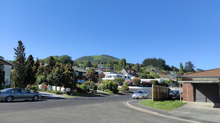
And then I was at the bottom of the hill, looking back up to where I had been walking.  Kinmont Park is on the lower slopes of Saddle Hill and I was able to see the rounded back of Saddle Hill at the top.  

My next destination was to the streets below the Mosgiel sign.  Each letter  of the Mosgiel sign is 3m tall and was put up by the local Rotary club in1987.  The sign is visible by the traffic as it travels past on State Highway 1.

Before reaching the Mosgiel sign, I walked the bridge over State Highway 1.  This is the main road that travels the length of the country and, at times, can be very busy.  Early on a Sunday morning is not one of those busy times.

From the bridge over the motorway I was able to see all the streets that I had walked in Kinmont Park. 

Once over the bridge, I walked a street that bordered an area where I had walked a few days ago where there is a subdivision with new houses being built.
 
Then all I had to do was cross the bridge again and walk up the hill,taking a street that was on the edge of the suburb with houses on one side and peaceful green fields with sheep on the other. 

An interesting part  of my walk today was along the street at the base of the hill that the Mosgiel sign is on.  Sometimes called Mollywood after the famous Hollywood sign, the sign has been here for 35 years and is lit up at night.

I walked past two letterboxes of interest today.  I really liked the tall house letterbox and I thought the number 7 was great too.
Distance walked:  12.2 km         Walking time  2 hr 12 mins   
 
Total distance: 923.6  km          Total walking  172 hr 13 mins 

Saturday, November 6, 2021

Day 110 Mosgiel

My plan today was that if I have a longer walk, I would be able  to finish walking the streets of Mosgiel.  I walked 27 streets today.

1470. High Street
1471. Green Street
1472. Victoria Street
1473. Wickliffe Street
1474. Tudor Lane
1475. Kent Place
1476. Windsor Place
1477. Haggart Alexander Drive
1478. Balmoral Avenue
1479. Owhiro Avenue
1480. Glenimire Close
1481. Tuwhare Lane
1482. Beech Street
1483. Cedar Crescent
1484. Oak Place
1485. Elmwood Drive
1486. Ash Place
1487 Cornish Lane
1488. Doon Street
1489. Spey Street
1490. Dunbar Place
1491. Gretna Place
1492. Arran Street
1493. Lomond Place
1494. Kelso Place
1495. Glenbrook Drive
1496. Glenleigh Place

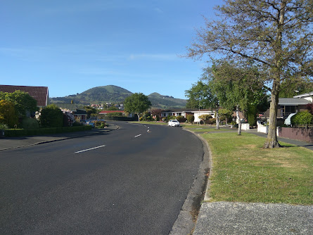
I have become used to seeing Saddle Hill from this angle and today is the last day of walking streets that I will Saddle Hill from this angle as my goal for the day is to finish walking the streets of Mosgiel. 

I walked a mixture of streets of long, straight streets and shorter, curved streets.  The long, straight streets were wide and tended to have older houses

While the shorter, curved streets had newer houses and tended to have more trees and grass verges. 

 
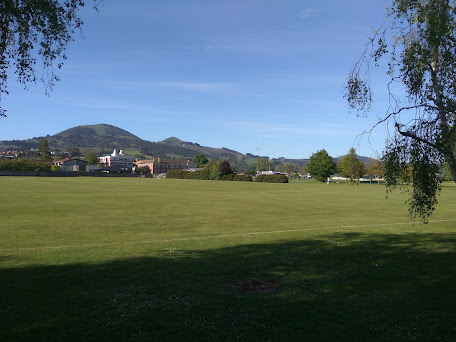
Most of the streets I walked today had a view of Saddle Hill.  I have enjoyed seeing Saddle Hill, occasionally it has been covered in cloud although mostly, like today, I have had an excellent view of it.

 
Some of the newer subdivisions have a view of the Chain Hills and have lots of landscaping on the surrounding streets which makes them very enjoyable streets to walk though.

I walked past a number of playgrounds and sports fields today.  Mosgiel has a lot of playgrounds and sports fields and it has been great when I have come across these open, green spaces as it has given me the opportunity to see something other than streets and houses.  

Today I walked past Taieri College.  Taieri College started in 1871 when it was known as Mosgiel District High School and by 1882, there were over 170 students at the high school. In 2004, the high school merged with Mosgiel Intermediate to become Taieri College and now has over 1200 students. This year is the schools 150th anniversary.

 
I walked past some interesting letterboxes today.  I really liked the one painted with New Zealand's native birds and I thought the one with the 'person' leaning on the letterbox was clever.

 And finally, after 10 days and 93.5km of walking, I have completed walking the streets of Mosgiel.

 Distance walked:  13.2 km         Walking time  2 hr 16 mins  

Total distance: 911.4  km          Total walking  170 hr 01 mins 

Otago Harbour Cycleway 30 October 2023

With my sister in town, it seemed a shame to waste a calm, sunny day so the two of us hopped on a bike each to enjoy the recently opened 32k...