Showing posts with label houses. Show all posts

Sunday, October 17, 2021

Day Ninety Nine Wingatui

Having finished walking the streets in the suburbs on the outskirts of the city yesterday, I started walking the streets of Mosgiel.  I walked 9 streets today.

1326. Paterson Road
1327. Haggart Street
1328. Crossan Street
1329. Magazine Road
1330. Friends Hill Road
1331. Puddle Alley
1332. Henderson Street
1333. White Hart Lane
1334. Soper Road

Mosgiel is a satellite town  of Dunedin with a population of over 14,000 people within the Dunedin City Boundary.  Mosgiel was founded in the early 1850's on the flat land of the Taieri Plains and while most of the town is flat, the eastern boundary runs along the low hills dividing Mosgiel from the rest of the city and this is where I started my walking today.  

 
Mosgiel is a growing town with a lot of new homes being built on the fringes.  Only a few years ago, most of this area was farmland.
The houses that have been built on the slightly elevated land of the hills have a view looking over the Taieri Plans and towards Three Mile Hill which is one of the main roads over the hill into Dunedin's hill suburbs.
Once off the slight hill, I was walking the long, straight streets on the edge of Mosgiel.  Because the streets are long and straight, I did not walk many streets although I did walk a reasonable distance today.

 
The road I walked along today runs beside the railway line.  This railway line travels the length of the South Island and I have crossed the railway line a number of times during my challenge to walk every street in Dunedin.

I walked past the Wingatui Railway Station on my walk today.  This station was opened in 1875 with this particular stating being built in 1914.  The station was closed in 1983 with both the station and signal box being preserved.  The inside of the signal box still has all the levers once used to manually change the track points.

But mostly the streets that I walked today were long and straight with only a few shorter side streets.

And to show that I did manage to walk some shorter streets, this is looking down Henderson Street from the railway embankment where there is a walking track beside the train track.  I walked one way along the footpath beside the road and then back along the embankment.

And at the end of the short streets was open farmland, which I am sure will not remain as farmland for long with all the new houses being built.  This will mean that in a few years, there will probably be new streets for me to walk. 

 
On the railway line embankment is this cleverly planted and maintained hedge spelling out the name of the suburb.  A popular myth for the name was when William Stevenson, an early settler in the area,  shot a Tui in the wing. Liking the sound of “Wing-a-tui”, William Stevenson named his property Wingatui in the mid 1850’s or the name could be the English spelling of the area which has the Maori name Whiringatua  meaning the place of plaiting of straps
These hens became excited as I walked past their home today, coming out onto the road to greet me and see if I had any food for them.

Distance walked:  7.8 km         Walking time  1 hr 26 mins   
 
Total distance: 818.6 km          Total walking  153 hr 33 mins 

Friday, August 20, 2021

Day Seventy Nine Pine Hill

New Zealand is in Lockdown  Alert Level 4 which is our highest level of restrictions due to an outbreak of Covid 19 in the community. It means that I am only allowed to exercise locally.  I have not walked the streets close to home as I had thought if NZ was to go into Lockdown, then I would be able to continue my walking the streets of Dunedin.  Today I walked 3 streets

983. Pine Hill Road
984. Maxwellton Street
985. Patmos Avenue

I started my walk by walking up the hill towards Mt Cargill from my home.  It only takes about 10 minutes walking to reach farmland and the views of the city really start to open up. It was a good feeling looking at this view knowing that I have walked every street that I could see. 

As I walked around the hill  I was rewarded with a view of Pine Hill which is where I live.  I still need to walk these streets but with Lockdown, these will be the next streets that I will be walking. 

 As I started walking down the hill to Leith Valley I crossed over a bridge that goes over the Northern Motorway.  This is State Highway One and is the main road to get into the city from the North.  Normally this is a very busy road but as we are in Lockdown and the only travel allowed is for essential services (e.g. food and medicine) there was very little traffic. 

On my walk I caught a glimpse of the magnificent house built by Dunedin's first bishop.  This house is huge and was built in the 1880's by the the first Bishop of Dunedin who lived here for 50 years and raised a family of five children.
At the entrance to the property once owned by the first Bishop is the gatehouse which is, itself, a beautiful home.  The gatehouse is much smaller that the main house.

Spring is definitely in the air and it was wonderful to walk past these trees covered in beautiful blossom.  I have walked past these trees before back in April when they were losing their leaves.  

 
And finally I walked back up the hill towards home by walking up Pine Hill Road, and over the bridge over George Street which is the main street of Dunedin.  As it is Lockdown, the streets are very quiet with no traffic today. 

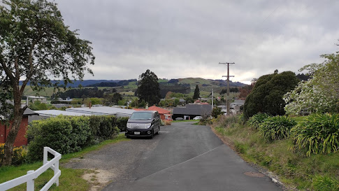
It might seem a strange photo but this fence is a new fence, only a few weeks old,  that replaced a very old fence that ran up the side of the road.  This is a much nicer and safer fence.  

 
Looking over the side of the fence part, I could see that road has been built up with most of the road not actually on the ground but suspended on a bridge. 

On my walk today I walked past a number of these traps which are part of the Halo Project.  The Halo Project maintains a number of predator traps to protect the native wildlife.  There are a variety of traps for possum, stoats and rats around the fringes of the city that are regularly checked by volunteers

To show that half my walk was past farmland on the edge of the city, here are some of the farm animals that I walked past today.


I walked past this lovely stone fence built from the stones that the farmer cleared from his paddocks.  This is a very old style way of making a fence but this fence is only a few years old.

I walked past these two letterboxes.  One is painted with a kereru (NZ wood pigeon) and the other is shaped like a man going walkabout.

Lastly is this painted telephone cabinet that I walked past today. 


Distance walked:  10.4  km         Walking time  1 hr 55 mins  
 
Total distance: 641.8 km        Total walking  119 hr 42 mins 

Saturday, July 10, 2021

Day Seventy Three South Dunedin

The streets of South Dunedin are feeling like they are endless as I walked 20 streets today.

890. Millington Street
891. Bradshaw Street
892. Wesley Street
893. Osmond Street
894. Prendergast Street
895. Cutten Street
896. Bathgate Street
897. Reid Road
898. Largo Avenue
899. Joyce Avenue
900. Macandrew Road
901. Crowder Avenue
902. Fox Street
903. King Edward Street
904. Thomas Street
905. Fingall Street
906. Cashel Street
907. Arney Street
908. Wynyard Street
909. Glasgow Street

The streets of South Dunedin are not only narrow but they criss cross each other on the flat and the only views that the residents of these narrow streets have are of their neighbours. 

One of the narrow streets I walked down today had me a bit confused as it had roadworks on the footpaths down both sides of the street.  The footpath I was walking down was blocked with a fence surrounding a deep hole in the footpath and it had a sign telling me to use the other footpath, however this footpath was being resealed and had a sign telling me to use the the other footpath.  Luckily the narrow streets are not busy and I was able to walk down the middle of the road. 

Another interesting street I walked down today was Prendergast Street where all the houses are small and are of the same design with the only difference being the colour each house is painted. There is no off street parking for any of these houses so I imagine finding parking in this street will be difficult which is probably why cars are parked facing in different directions.

I walked past Bathgate Park sports grounds today, where the sports grounds take up nearly a whole block of South Dunedin.  This sports field has weekend sports and is home to the Southern Rugby Football Club.  It is also one of the only parts of my walk that I was able to see a view of the city hills.


Bordering the long edge of Bathgate Park is the Donaghys rope factory.  The factory has been on this site making rope since 1876.  The rope making part of the building runs 350m along the full length of the Bathgate Park sportsfield.
I noticed only one interesting letterbox on my walk today.This (slightly broken) letterbox is designed to look like a brick house, similar to the house it represents. 
The street art that I walked past today was this large mural on the side of a building representing the native wild life found around Dunedin.

And this picture made from bottle tops which is on the side of another building.  It is very well done with some thought has been put into what coloured bottle tops to use and where to place them.

Distance walked:  9.3  km         Walking time   1 hr 39 mins  
 
Total distance: 588.4 km       Total walking  110 hr 3 mins 

Monday, January 18, 2021

Day Twelve St Kilda

 I'm walking on the flat streets of South Dunedin and as most of the streets are in a grid pattern, I am walking horizontal streets then vertical streets to ensure that I walk every street and some of these streets are quite long.  Today I walked 8 streets

123. Grove Street
124. Tedder Street
125. Eskvale Street
126. Annex Street
127. Begg Street
128. New Street
129. Market Street
130. Prince Albert Road 

 Walking streets on the flat means there are not many places to get views of the city, except some streets that look towards the hills.  This view is looking towards the hills of St Clair. 


It was quite fast walking today and one of the things I noticed today was how close the houses are to each other.  Being on the flat, South Dunedin was one of the first parts of Dunedin where houses were built and as a result a lot of the houses are wooden villas interspersed with more modern  townhouses.  I was quite intrigued by an old stone house built in 1879 that I passed today.  

An interesting thing I noticed on my walk today is this footpath that is concrete on one side of the street and the usual asphalt on the other.  Concrete footpath's are not common in Dunedin and this is the first street that I have walked that is concrete. 

Today I also walked past the St Kilda Fire Station which was built in 1965.  

Distance walked: 5.1km     Walking time 1 hr  00 mins    

Total distance: 95.5km       Total walking  18 hr 01 mins

Thursday, January 14, 2021

Day Nine Tainui

 It was a long, hot walk on the streets today.  I walked 12 streets today.

81. Gresham Street
82. Chisholm Place
83. Spottiswoode Street
84. Bayfield Road
85. Elliot Street
86. Arawa Street
87. Tainui Road
88. Dundonald Street
89. Kamura Street
90. Aotea Street
91. Norman Street
92. Tahuna Road

I also walked part of a number of other streets but can't count them until they are completed.  First thing today I walked part of Tahuna Road till it met up with Tomahawk Road.


Then I had to retrace my steps before heading down a walkway to get to Gresham Street and Chisholm Place.  Today's streets were a mixture of hills and flat and the views are changing, looking more over South Dunedin which is good to see where I am heading next. 


Today on my walk I found  this view, looking over St Clair towards Corstorphine from the end of Kamura Street.  I took this opportunity for a rest while admiring the view.

 It is becoming important to keep track of which streets I have walked part of so that I don't miss any parts of them out and sometimes this means walking some parts of streets twice (or three times!) The final part of my walk was completing Tahuna Road, and again, retracing my steps to get back to my starting place.  

Today I noticed a few things while walking.  The first is this old tram car, how great would it be to have in your back yard?!

I passed two more beautifully painted telephone cabinets.  It is great to see these necessary pieces of infrastructure being turned into art for the community. 


Distance walked: 10.9km     Walking time 2 hr  2 mins    

Total distance: 68.4km       Total walking  13 hr 04 mins


Otago Harbour Cycleway 30 October 2023

With my sister in town, it seemed a shame to waste a calm, sunny day so the two of us hopped on a bike each to enjoy the recently opened 32k...