Showing posts with label view. Show all posts

Wednesday, December 8, 2021

Day 120 Ocean View

With Ocean View having only a few streets, I thought it would be a good place to walk in the evening.  I walked 7 streets.

1627. Edna Street
1628. Kayforce Road
1629. Bennett Road
1630. Hare Road
1631. Creamery Road
1632. John Street
1633. Brighton Road
 
I had missed walking the streets in Ocean View when I walked Brighton a couple of days ago as it seemed like a good area to finish walking one evening and tonight was a good night to complete the streets.  I started walking on the flat, not far from the Ocean View domain and beach.
The first street I walked took me up a hill where I was rewarded with a view looking down towards the beach and some of the streets that I was walking tonight.
Ocean View is a lovely seaside township that has the sea on one side and farmland on the other. I walked streets that took me to the edge of the township. 
There is a main street through Ocean View which runs along the flat with a few houses between it and the beach.  There are a few side streets which take you up into the hills. 
There are a number of nicely painted bus stops in Ocean View.  Most of them have scenes relating to the sea or beach and the wildlife that that can be found in the area. 


There were some interesting letterboxes - one was made from an actual surf board and the other was made from wood in the shape of a surf board.  Both very appropriate for being near the beach.
 
I really liked this letterbox and guess that it belongs to a family who like motorbikes
And this is the map of the streets that I have walked in Brighton and Ocean View. 

Distance walked:  4.9 km         Walking time   56 mins    

Total distance: 991.8  km          Total walking  185 hr 22 mins 

Saturday, September 18, 2021

Day Eighty Eight Ravensbourne

I took advantage of the evenings starting to get lighter by getting another walk in.  Tonight I walked 13 streets.

1132. Neptune Street
1133. Magnet Street
1134. Taupo Street
1135. Ellesmere Street
1136. Gerrys Road
1137. Mark Street
1138. Rimu Street
1139. Waireki Street
1140. Ocean View Road
1141. Lindsay Avenue
1142. Tekapo Street
1143. Parry Street East
1144. Kowhai Street

I started my walk from near the stadium and walked along the shared walking/cycleway that runs along the side of the harbour.  The cycleway is popular with cyclists, runners and walkers, however tonight I saw very few people. 
 There are excellent views of the Otago harbour and peninsula all along the walk/cycleway.  I enjoyed looking across the harbour to see streets that I have walked.  I still have streets to walk further down the peninsula but I have walked everything that I could see from here. 
 
The cycleway/walkway runs along between the harbour and the railway line for a couple of kilometres before crossing the railway line at Ravensbourne.  From here it was all uphill for me.

 
Once I started walking up the hill, it didn't take long before the views across the harbour started opening up. 

The streets became steeper and narrow the further up the hill I walked.  The residents of these streets get great views of the harbour and hills of the peninsula.

Near the top of the hill the streets followed the contour of the land and flattened out which gave me the chance to see the views looking across the harbour to harbour cone and the Soldiers Monument.

After reaching the streets at the top of the hill, I then walked back down to the hill and was rewarded with more views, this time looking towards the city.

I timed my walk well as I neared the bottom of the hill, the sun was setting and the lights of the city were coming on.  Despite the hills, it had been a good walk to a part of Dunedin that I had not seen much of before.

I walked past this large kuri (dog).  Placed here in 2008, this kuri looks out over the Otago harbour and is a cultural guardian looking after the people of Dunedin and the surrounding environment.

I liked this unique stainless steel seat conveniently placed with a view of the harbour.  It was a good place to rest and catch my breath before continuing up the hill.
 During my walk today I saw both black sheep and white sheep.  The black sheep were inquisitive and had cute faces while the white sheep moved away when I got closer to them.


There were a few interesting letterboxes on my walk today.  I thought the railway signal one was unique and the blue postbox is also very good.


Distance walked:  10.4  km         Walking time  1 hr 58 mins  
 
Total distance: 710.9 km        Total walking  133 hr 14 mins 

Saturday, August 21, 2021

Day Eighty Liberton

I enjoyed my walk in the sunshine around the streets close to home today.  I walked 20 streets

986. Raleigh Street
987. Hillary Street 
988. Dover Street
989. Lowe Street
990. Tasman Street
991. Tensing Street
992. Egmont Street
993. Allenby Avenue
994. Blundell Street
995. Hislop Street
996. Wilkinson Street
997. Truby King Crescent
998. Pryde Street
999. Croydon Street
1000. Barclay Street
1001. Buccleugh Street
1002. Glencairn Street
1003. Gladstone Road
1004. Forrester Avenue
1005. Newhaven Street
 
 It was a frosty start to the morning and I walked gingerly around the streets that were still in the shade.The first group of streets I walked around are all named after mountains and climbers.  Hillary Street and Tensing Street being the most obvious along with Lowe Street for climbing Mount Everest. Tasman and Egmont are New Zealand mountains and Dover is a mountain in Antarctica.
Many of the streets in Liberton have great views.  Some of the streets have good views of Flagstaff and look towards where I was walking yesterday.
Streets on the other side of the hill have great views looking towards the city.  After stopping to admire the view, I walked down the hill to then walk back up to where I started.
The further down the hill I walked, the views changed to looking towards Opoho and North East Valley.  The road also became very narrow as it grew steeper the nearer I got to the bottom.

The residents of these houses have very steep sections/gardens and very little parking but the views they get are outstanding. These are streets that I have not walked yet.

Of course what goes down must also go up and some of the up was quite steep but as I walked up the hill, I was reward with more great views.   This is looking towards Opoho and are streets that I have not walked yet.

The higher I walked up the hill, the views changed and I was able see over to the Dunedin Botanical Gardens with a glimpse of the harbour and Waverley beyond.

And as I neared the crest of the hill, the view changed back to Flagstaff.  The weather is beautiful and the views have been fantastic today. 

I stopped to have a look at the Dalmore Reserve which has been turned into a community vegetable garden.  The garden is a little overgrown after the winter but it does have great views of the city.
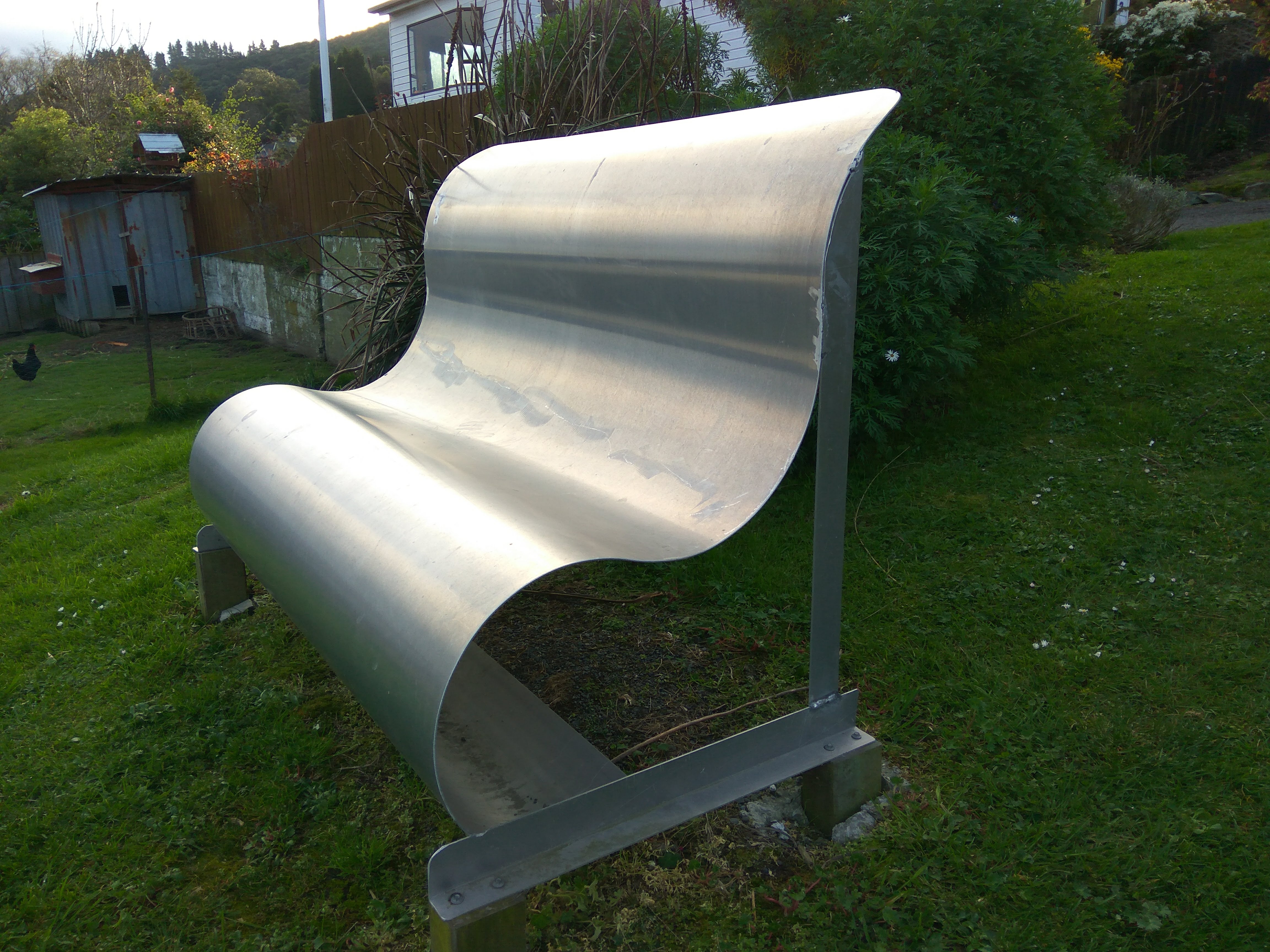
One of the more sad things that I have walked past during my challenge of walking every street in Dunedin is this wooden seat which has a fantastic view of the city.  The seat is dedicated to baby Mae. 
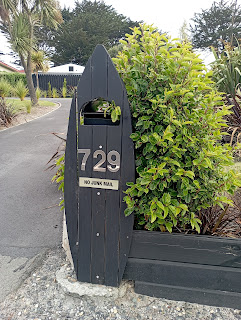
Today I walked past three interesting letterboxes.  One is an ordinary letterbox that is painted like a house while another has used a large piece of interesting wood to cleverly create a letterbox and the third letterbox has been decorated with mosaic tiles.


The ultimate in recycling is this used chain to make the house number on the fence.

The Pine Hill bus stop has been beautifully painted with scenes of the early Pine Hill School. The scenes are taken from old photographs of the school and have been faithfully replicated in the bus stop.


Distance walked:  11.2  km         Walking time  2 hr 10 mins  
 
Total distance: 653.0 km        Total walking  121 hr 52 mins 

Saturday, June 26, 2021

Day Sixty Eight South Dunedin

With threatening rain clouds,  I decided it was time to walk some of the streets on the flat of South Dunedin.  Today I walked 8 streets.

836. Turakina Street
837. Portsmouth Drive
838. Teviot Street
839. Otaki Street
840. Timaru Street
841. Colston Street
842. Andersons Bay Road
843. Midland Street
 
Part of my walk today took me along Andersons Bay Road which follows the shoreline of the harbour mouth before the land was reclaimed in the 1940's.  All the streets I walked today are on reclaimed land. This is a view looking along Andersons Bay Road, where the shoreline would have been prior to 1940.

I have skirted around parts of the harbour during my walks over recent months and today I walked along Portsmouth Drive which gives one of the best views of the city skyline and harbour.  On a calm day, it is a beautiful place to enjoy the view of Mt Cargill.

And looking the other way towards Waverley which is one of the first suburbs that I walked when I started this journey.  I walked this area back in January and it is good to know that I have walked all the streets that I can see from here.

I was quite excited to see this fur seal sunbathing on the edge of the harbour.  The seal doesn't look at all perturbed to be lying so close to a busy road, and it didn't mind getting it's photo taken. 
 
I walked along Portsmouth Drive which  was opened in 1978 after all the surrounding land was reclaimed.  Prior to the land being reclaimed, it was a causeway that ran along the edge of the harbour from 1912 and was used as access to the southern part of the city in the early days.  From the 1940's to the 1970's the land around here was reclaimed from  dredging the harbour.  The land is quite low lying and it is easy to see that there is no where for the water to go after heavy rain.


At the end of Portsmouth Drive, just before heading down the edge of the harbour is this large 3D map of the peninsula.  It is a great place to stop and see the topography of the peninsula and where the roads and walking tracks are. 

I found it to also be a good place to see how far I need to walk to get to the end of the peninsula.  This sign was also good for letting me know the distance I still need to walk. It looks like I have a 28km walk ahead of me to get to the end of the harbour.

Today I walked past two buildings with art on them.  This one is of a a couple of Tui and the forest.

The other is this penguin and the litter we leave in our wildlife's habitat.


Distance walked:  7.6  km         Walking time   1 hr 20 mins  
 
Total distance: 546 km       Total walking  102 hr 22 mins 

Otago Harbour Cycleway 30 October 2023

With my sister in town, it seemed a shame to waste a calm, sunny day so the two of us hopped on a bike each to enjoy the recently opened 32k...