Saturday, June 26, 2021

Day Sixty Eight South Dunedin

With threatening rain clouds,  I decided it was time to walk some of the streets on the flat of South Dunedin.  Today I walked 8 streets.

836. Turakina Street
837. Portsmouth Drive
838. Teviot Street
839. Otaki Street
840. Timaru Street
841. Colston Street
842. Andersons Bay Road
843. Midland Street
 
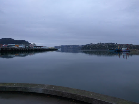
Part of my walk today took me along Andersons Bay Road which follows the shoreline of the harbour mouth before the land was reclaimed in the 1940's.  All the streets I walked today are on reclaimed land. This is a view looking along Andersons Bay Road, where the shoreline would have been prior to 1940.

I have skirted around parts of the harbour during my walks over recent months and today I walked along Portsmouth Drive which gives one of the best views of the city skyline and harbour.  On a calm day, it is a beautiful place to enjoy the view of Mt Cargill.

And looking the other way towards Waverley which is one of the first suburbs that I walked when I started this journey.  I walked this area back in January and it is good to know that I have walked all the streets that I can see from here.

I was quite excited to see this fur seal sunbathing on the edge of the harbour.  The seal doesn't look at all perturbed to be lying so close to a busy road, and it didn't mind getting it's photo taken. 
 
I walked along Portsmouth Drive which  was opened in 1978 after all the surrounding land was reclaimed.  Prior to the land being reclaimed, it was a causeway that ran along the edge of the harbour from 1912 and was used as access to the southern part of the city in the early days.  From the 1940's to the 1970's the land around here was reclaimed from  dredging the harbour.  The land is quite low lying and it is easy to see that there is no where for the water to go after heavy rain.


At the end of Portsmouth Drive, just before heading down the edge of the harbour is this large 3D map of the peninsula.  It is a great place to stop and see the topography of the peninsula and where the roads and walking tracks are. 

I found it to also be a good place to see how far I need to walk to get to the end of the peninsula.  This sign was also good for letting me know the distance I still need to walk. It looks like I have a 28km walk ahead of me to get to the end of the harbour.

Today I walked past two buildings with art on them.  This one is of a a couple of Tui and the forest.

The other is this penguin and the litter we leave in our wildlife's habitat.


Distance walked:  7.6  km         Walking time   1 hr 20 mins  
 
Total distance: 546 km       Total walking  102 hr 22 mins 

Saturday, June 19, 2021

Day Sixty Seven Wharf

 Today I completed the streets behind the railway station, around the wharf where I had been walking a couple of days ago.  I walked 5 streets.

830. Ward Street
831. Ward Street Overbridge
832. Halsey Street
833. Bauchop Street
834. Sturdee Street
835. Wickliffe Street

From the wharf area, there are good views of the city skyline with Flagstaff behind the city and the ridge leading to Mount Cargill.  

The area around the wharf is flat and industrial businesses and warehouses.  The part that I walked today was nearer the wharf where the large ships dock.  I walked past the logging port with all the logs stacked up like tooth picks.  

And I walked past the Ward Street Power Substation.  This was the second substation built in Dunedin in 1938 and the historic building has been preserved as an example of art deco industrial architecture.  The substation was replaced in 2010 with  modern, larger capacity equipment making the building obsolete.


While the substation no longer houses the power equipment, it has been preserved with a series of interpretive panels inside, describing the history and workings.  As the building remains inside the live, high voltage grounds of the substation, it is cannot be opened to the public. 

Today I walked past two very nice pieces of public art.  On the building wall opposite the inter-city bus depot is the this large scale map of Dunedin.  

And just along the road is this equally impressive mural with a girl over the harbour reaching out to the sea gulls and kereru.


Distance walked:  4.5  km         Walking time   48 mins  
 
Total distance: 538.4 km       Total walking  101 hr 02 mins 


Monday, June 7, 2021

Day Sixty Six Green Island

 I decided to finish walking the streets of Green Island today and I walked 20 streets.

810. Scotland Terrace
811. Devonport Street
812. Tomkins Street
813. Quarry Road
814. Corbett Street
815. District Road
816. Church Street
817. Derby Street
818. Edinburgh Street
819. Rennie Street
820. Muir Street
821. Loudon Street
822. Kirkland Street
823. Geddes Street
824. Howden Street
825. Benfell Street
826. Shand Street
827. Jenkins Street
828. Harraway Road
829. Carnforth Street

Green Island is an unusual name for the suburb that I am walking today as it is not an island.  Green Island gets it's name from a nearby offshore island, Green Island/Okaihe.  Even more unusual is that the suburb Green Island is not near the sea and you cannot see the offshore island from the suburb of Green Island. 

Green Island has some steep streets and I started my walk today by walking up Scotland Street.  The good thing about hills is that you get some good views and I was rewarded with a good view of Saddle Hill. 

The residents of the houses in the first few streets that I walked have some very good views looking towards Saddle Hill and Abbotsford.  I have not walked the Abbotsford streets yet so it was a good chance for me to stop and see where I still have to walk.
I walked past the Green Island cemetery today which has a lovely outlook onto rural farm land.  I heard a lot of birdsong during this part of my walk.


 District Road was an interesting street to walk along as not only did I walk past a cemetery, but as I neared the end, the street turned from built up with houses to farmland and the views looking towards the hills opposite and Abbotsford really opened up. 
Once back down the hill and onto the flat, I walked the streets surrounding the Green Island shopping area and then down Harraway Road which runs down the side of the Harraway Mill which has been on its current site since 1867.
Harraway Road is a short street with a small one lane bridge over the Kaikorai Stream.  I had already walked over the Kaikorai Stream when I walked Kaikorai Valley. 
 
 The last street I walked today was Carnford Street which borders the Green Island Rugby Club fields.  This is where 69 houses slipped down the hill during the 1979 Abbotsford landslide.  Below is a photo of what the area is like today and the photo below was taken not long after the 1979 slip.


One of the more interesting things I walked past today was this old plow.  It was something that I would not have thought I'd see on the side of a road in a city suburb.
 
I saw a few farm animals on my walk today, including horses and sheep.  Running around the horse paddock was a pukeko but it was too far away for me to get a photo. 
I walked past the Green Island School which is one of Dunedin's older schools, opening in 1953. It's original site is where the cemetery is and  the school moved to this current site in 1862.


During my walk I walked past these two bus stops that are painted to represent rugby and tennis.  The tennis bus stop was outside the Green Island tennis club but the rugby bus stop was in the shopping area.
 

And finally, it's been a while since I shared the map of the streets that I have walked.  All the streets in red are the streets that I have walked over the last six months.

Distance walked:  11  km         Walking time   2 hrs 24 mins  
 
Total distance: 533.9 km       Total walking  100 hr 14 mins 


Sunday, June 6, 2021

Day Sixty Five Wharf

 I took the opportunity of a quiet Sunday morning to walk the streets around the wharf which is usually a busy industrial area of Dunedin during the week.  I walked 19 streets today.

791. Wharf Street
792. Kitchener Street
793. French Street
794. Roberts Street
795. Buller Street
796. White Street
797. Birch Street
798. Fryatt Street
799. Fish Street
800. Tewsley Street
801. Cresswell Street
802. Devon Street
803. Jutland Street
804. Akaroa Street
805. Thomas Burns Street
806. Mason Street 
807. Ward Street Extension
808. Fairley Street
809. Willis Street
 
 The area around the Wharf is reclaimed land so it is flat and is where most of the industrial businesses are.  It is also where some of the ships into the harbour arrive and as a result is where the Customs House was built. Now most of the shipping comes into Port Chalmers and the Customs House has been turned into a restaurant/cafe.
I walked along the Customs House Quay during my walk which is a wonderful area on a calm day to see the harbour from.  Over the years there have been plans to develop this area further but nothing has ever been done.
 
The views of the harbour from the Customs House Quay are beautiful.  It can often have a cold wind but today it was calm with no wind and a lovely place to be. 

This is also an area that is a popular cycle route.  The area around the harbour has a well developed cycle pathway that is very popular during the weekday commute and also in the weekends. 
The wharf area has opportunities to enjoy views of the harbour.  While today was overcast and had been raining earlier in the morning, the harbour was very calm.  I could see around the harbour and wharf area with Mount Cargill in the distance. 
 
The wharf area is quiet on the weekends with wide streets making it easy for trucks to travel to the warehouses and during the week the streets are full of parked cars from people who work in the CBD looking for free all day parking. 

I had thought that there would not be much to see during my walk around the streets of the industrial part of the Dunedin but there were a number of interesting old buildings.  These two buildings were built in 1872-1885 not long after the land they stand on was reclaimed. 


I also walked over the overbridge which connects the wharf area to the rest of the city and the overbridge was built in 1976.  It crosses the railway yard and Cumberland Street. The railway yard is not as big as it once was but it is still impressive to walk over and look down on the railway lines . 
The overbridge also crosses Cumberland Street which is also State Highway One.  Cumberland Street is the main road going south through the city but early on a Sunday there is very little traffic. 
The overbridge is also a good place to be able to see the area that I was walking the streets around today.
Today I walked past an interesting sculpture called Toroa which was placed here in 1989 and represents the wings of the Royal Albatross, of which the only only breeding colony of the albatross on the mainland can be seen from the site of the sculpture. Toroa is the Maori for albatross.
The other monument that I walked past today is the Royal Navy's tribute the Otago sailors that died on the HMS Neptune which ran into a minefield and sank in the Mediterranean in 1945. 


And lastly, I walked past some good murals on buildings in the streets around the wharf area.


Distance walked:  10.8  km         Walking time   2 hrs  
 
Total distance: 522.9 km       Total walking  97 hr 50 mins 


Saturday, June 5, 2021

Day Sixty Four Green Island

 Today was a lovely warm winters day, perfect to be out walking the streets again and I walked 10 streets today.

781. Irmo Street
782. Bideford Street
783. Orange Street
784. Price Street
785. Owen Street
786. Kaler Street
787. Koremata Street
788. Winifred Street
789. Prosser Street
790. Shanks Street
 
 I started my walk on the side of the Southern Motorway which is a good place for an early morning view looking towards Saddle Hill and Green Island, which is where my walk was taking me today. 

As I walked down the hill towards Green Island, I skirted around the edge of Concord where I had been walking a few weeks ago.  It is quite satisfying knowing that I have already walked all the streets on the hill. It is also interesting to have paddocks with sheep and cows in the city, on the edge of the motorway.

Once I reached the bottom of the hill, I was walking along Main South Road and up all the side streets.  The traffic noise is quite noticeable down in the valley. I was able to look back up the hill to where I had started my walk.

I walked some very short streets with only a few houses and others that are longer and steeper.  Koremata  Street is one of the longer streets and has a good view looking towards farmland on the hill opposite and Flagstaff in the distance.  I had been walking the streets at the base of Flagstaff only a few days ago.

Owen Street was one of the steeper streets and it had a short street off it that finished because the hill was too steep for it to carry on and there is a gap between Kaler Street and Shanks Street, at the bottom which is good for me as I got to count them as two separate streets.

One of the more unusual things I saw today on my walk was Spongebob Squarepants up a tree.  I don't know how Spongebob got to the top of the tree but he is looking very happy. 


I walked past a couple of interesting letterbox on my walk. One is this speedy looking bee and the other is an old milk urn.

And finally there is this great library.  I have passed quite a few Lilliput Library's during my walking every street but this is the first large size one I have come across.  There were quite a few books in the library.


Distance walked:  8  km         Walking time   1 hr 35 mins     
 
Total distance: 512.1 km       Total walking  95 hr 50 mins


Otago Harbour Cycleway 30 October 2023

With my sister in town, it seemed a shame to waste a calm, sunny day so the two of us hopped on a bike each to enjoy the recently opened 32k...