Showing posts with label wharf. Show all posts

Sunday, November 21, 2021

Day 116 Port Chalmers & Careys Bay

Today was a longer walk as I combined finishing the streets in Port Chalmers with walking the streets in Careys Bay.  I walked 22 streets today

1561. Bernicia Street
1562. Bellevue Place
1563. Fox Street
1564. Meridan Street
1565. Harrington Street
1566. Laing Street
1567. Burns Street
1568. Daly Street
1569. Mount Street
1570. Church Street
1571. Ajax Road
1572. Borlases Street
1573. Blueskin Road
1574. Kohi Place
1575. William Street
1576. Coombe Hay Terrace
1577. Harbour Terrace
1578. Cemetery Road
1579. Willmott Street
1580. Slant Street
1581. Henry Street
1582. Macandrew Road
 
My walk today took me over the top of the hill at Port Chalmers, although I did have to walk up and down the hill a couple of times as I walked each street completely.  
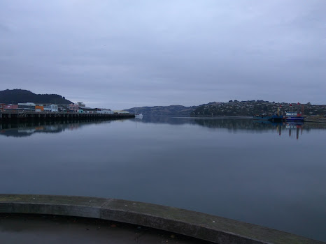
The houses on the streets that I was walking today were positioned on the hill so that they looked either towards the harbour or towards Mt Cargill.  Today the harbour was calm with great reflections of harbour cone. 
Mt. Cargill has dominated the view in many parts of the city that I have walked although I haven't seen it from this angle before.  Mt. Cargill has the transmitter on it with Buttars Peak beside it and Mt Holmes further along.
 
Port Otago is obvious from most streets in Port Chalmers.  I have been able to see the crane gantries and ships or hear the noises from the port during my walk of the streets.

Having seen the Iona Church from most parts of Port Chalmers, this is as close as I got to walking past it.  Built from Port Chalmers Blue Stone and Oamaru Stone, Iona Church was built in 1872 and is still used for services today.

After walking past Iona Church, I continued walking up the hill behind Port Chalmers.  This was a great place to be able to see the streets that I have been walking.  It is always a good feeling looking back and knowing that I have walked every street that I can see.

As I walked further up the hill, I crossed the railway line.  I have been around this railway line many times during my challenge to walk every street.  From here I had beautiful views looking down the harbour towards the city and closer are the houses of Roseneath.

Eventually I walked all the way to the Robert Scott Memorial Lookout.  The views from the look out are fantastic and I was able to see most of Port Chalmers, both Goat and Quarantine Island in the middle of the harbour and harbour cone on the peninsula behind. 

I was also able to look down onto the port with two container ships.  It was fascinating to watch the gantries and straddle carriers moving about, lifting and loading containers.  From this height everything looks small, however I remember how big and high the rows of containers were when I was walking down near them.

 
Built in 1913, the Scott Memorial commemorates the ill-fated Scott expedition that left Port Chalmers for Antarctica on 19 November 1910

Also at the site of the Scott Memorial is this large iron anchor from an unknown sailing ship that often got caught in local fisher nets, it was hauled ashore in 1978.

From the lookout, I took a track past the Port Chalmers cemetery to Careys Bay which is the next bay around from Port Chalmers.  The streets of Careys Bay are steep and the houses are nestled amongst native bush.

Most of the houses in Careys Bay have a view of the marina and habour.  Today the habour was calm with no wind and it was a beautiful place to be walking. 

 
Careys Bay is also close to Port Otago.  It was easy to see from this angle how much the port dominates the area with the containers stacked high.

Once down from walking the streets on the hill, it was nice to be beside the sea and watch the boats bobbing on the harbour while I walked back along the road around the bottom of the hill.

 
One of the lovely old buildings I walked past today is the Chick's Hotel beside Port Otago.  Built in 1876, Chicks operated as a hotel and more recently a music venue until it closed in 2016. 

The Careys Bay Hotel was another historic hotel that I walked past today.  Built in 1874 from Port Chalmers Blue Stone, the hotel has been continuously serving alcohol and today is a popular seafood restaurant particularly during weekends.
Another historic building that I walked past was the old Port Chalmers School.  There has been a school at Port Chalmers since 1856 on various sites.  This school building has been turned into a home.
 
I walked past the memorial to where the local Ngāi Tahu sold the Otago block to the New Zealand Company in 1844.

I have often driven past this large tree that has grown beside the road.  The footpath goes around the tree and it is obviously a notable tree but there was no plaque or sign to say why. 
 
The bus stop at Port Chalmers is painted to match the suburb with a boat, the harbour and Mt. Cargill as the main features. 

I walked past three interesting letterboxes today.  The house shaped letterbox was similar in shape to the house that it belonged to and the castle letterbox looked nothing like the house that it belonged to.  I thought the anchor letterbox was very appropriate for the home it belonged to - near the sea.


And finally, below is the map of the streets that I have walked in Port Chalmers and Careys Bay as well as Sawyers Bay and Roseneath. 
 
 Distance walked:  10.9 km         Walking time  2 hr 3 mins    

Total distance: 960.5  km          Total walking  179 hr 11 mins 

Friday, November 19, 2021

Day 114 Port Chalmers

As I walked the streets of Port Chalmers, I was able to watch as a large container ship being loaded in Port Chalmers tonight. I walked 10 streets tonight.

1539. Currie Street
1540. Scotia Street
1541. Aurora Terrace
1542. Kaio Lane
1543. Island Terrace
1544. Campbell Buchanan Lane
1545. Constitution Street
1546. Grey Street
1547. Magnetic Street
1548. Mary Street

During the first part of my walk I was able to look over to the historic Iona Church on the hill opposite. The Iona Church was opened in 1872 and is made from Port Chalmers Blue Stone and Oamaru Stone.

As I walked to the top of the hill overlooking Port Chalmers, I was rewarded with a great view of Goat Island and Quarantine Island.  Quarantine Island is the bigger island in the harbour.  Now a reserve and open to the public, the island was a quarantine station from 1863 to 1924.  When ships arrived into the harbour with infectious diseases, they stopped at the island to quarantine their passengers for a few weeks until they were no longer infectious.  In the 60 years the island was used, there were 9000 people quarantined and 70 deaths.  There is a small cemetery on the island.

Once at the top of the hill, there is a look out over the port where I was able to watch a container ship being loaded.  It was fascinating to watch the gantry cranes loading the containers into the ships and the straddle carriers moving around the port collecting containers for the gantries to load into the ships. 

From the lookout, I was able to see how small the township of Port Chalmers looks beside the huge container ship.  I could easily see the Iona Church and how the buildings cluster around the Port. 

The lookout also gave me a great view looking towards the harbour mouth.  This would be a great spot to be to see the ships arriving into the port. 

Further around the hill, I walked to the end of another street that gave me a great view of the other side of the port and I watched a forklift empty a wagon.  It was also a great spot to see how close the two islands are in the harbour with only a small opening for ships to travel down to Dunedin City. 

From the streets on top of the hill, I was able to look over other streets that I still need to walk as well as the street around the bottom of the hill that I walked yesterday. 

And then I was walking streets looking towards Mt Cargill in the distance.  I am enjoying walking in Port Chalmers as the views keep changing as I walk around the hill.

 
At the Port Chalmers lookout is the time ball that I saw while walking around the road the bottom of the hill yesterday.  The time ball is which has stood on this spot since 1867 with the ball dropping at 1pm each day so ships officers could set their  chronometers used in navigation.

 
During my walk tonight, I walked past the Hotere Garden Oputae.  Ralph Hotere was a Maori artist whose studio was on the point near the time ball, overlooking Port Otago.  When the port was expanded, part of the land was removed and in 2005 this garden was established in Ralph Hotere's memory.  There are a number of his sculptures in the garden.

 
I was surprised to find during my walk a number of conveniently placed seats that overlook parts of the port or harbour.  These are great places to stop and admire the view. 

 
Distance walked:  4.1 km         Walking time  49 mins   
 
Total distance: 942.3  km          Total walking  175 hr 46 mins 

Saturday, June 19, 2021

Day Sixty Seven Wharf

 Today I completed the streets behind the railway station, around the wharf where I had been walking a couple of days ago.  I walked 5 streets.

830. Ward Street
831. Ward Street Overbridge
832. Halsey Street
833. Bauchop Street
834. Sturdee Street
835. Wickliffe Street

From the wharf area, there are good views of the city skyline with Flagstaff behind the city and the ridge leading to Mount Cargill.  

The area around the wharf is flat and industrial businesses and warehouses.  The part that I walked today was nearer the wharf where the large ships dock.  I walked past the logging port with all the logs stacked up like tooth picks.  

And I walked past the Ward Street Power Substation.  This was the second substation built in Dunedin in 1938 and the historic building has been preserved as an example of art deco industrial architecture.  The substation was replaced in 2010 with  modern, larger capacity equipment making the building obsolete.


While the substation no longer houses the power equipment, it has been preserved with a series of interpretive panels inside, describing the history and workings.  As the building remains inside the live, high voltage grounds of the substation, it is cannot be opened to the public. 

Today I walked past two very nice pieces of public art.  On the building wall opposite the inter-city bus depot is the this large scale map of Dunedin.  

And just along the road is this equally impressive mural with a girl over the harbour reaching out to the sea gulls and kereru.


Distance walked:  4.5  km         Walking time   48 mins  
 
Total distance: 538.4 km       Total walking  101 hr 02 mins 


Sunday, June 6, 2021

Day Sixty Five Wharf

 I took the opportunity of a quiet Sunday morning to walk the streets around the wharf which is usually a busy industrial area of Dunedin during the week.  I walked 19 streets today.

791. Wharf Street
792. Kitchener Street
793. French Street
794. Roberts Street
795. Buller Street
796. White Street
797. Birch Street
798. Fryatt Street
799. Fish Street
800. Tewsley Street
801. Cresswell Street
802. Devon Street
803. Jutland Street
804. Akaroa Street
805. Thomas Burns Street
806. Mason Street 
807. Ward Street Extension
808. Fairley Street
809. Willis Street
 
 The area around the Wharf is reclaimed land so it is flat and is where most of the industrial businesses are.  It is also where some of the ships into the harbour arrive and as a result is where the Customs House was built. Now most of the shipping comes into Port Chalmers and the Customs House has been turned into a restaurant/cafe.
I walked along the Customs House Quay during my walk which is a wonderful area on a calm day to see the harbour from.  Over the years there have been plans to develop this area further but nothing has ever been done.
 
The views of the harbour from the Customs House Quay are beautiful.  It can often have a cold wind but today it was calm with no wind and a lovely place to be. 

This is also an area that is a popular cycle route.  The area around the harbour has a well developed cycle pathway that is very popular during the weekday commute and also in the weekends. 
The wharf area has opportunities to enjoy views of the harbour.  While today was overcast and had been raining earlier in the morning, the harbour was very calm.  I could see around the harbour and wharf area with Mount Cargill in the distance. 
 
The wharf area is quiet on the weekends with wide streets making it easy for trucks to travel to the warehouses and during the week the streets are full of parked cars from people who work in the CBD looking for free all day parking. 

I had thought that there would not be much to see during my walk around the streets of the industrial part of the Dunedin but there were a number of interesting old buildings.  These two buildings were built in 1872-1885 not long after the land they stand on was reclaimed. 


I also walked over the overbridge which connects the wharf area to the rest of the city and the overbridge was built in 1976.  It crosses the railway yard and Cumberland Street. The railway yard is not as big as it once was but it is still impressive to walk over and look down on the railway lines . 
The overbridge also crosses Cumberland Street which is also State Highway One.  Cumberland Street is the main road going south through the city but early on a Sunday there is very little traffic. 
The overbridge is also a good place to be able to see the area that I was walking the streets around today.
Today I walked past an interesting sculpture called Toroa which was placed here in 1989 and represents the wings of the Royal Albatross, of which the only only breeding colony of the albatross on the mainland can be seen from the site of the sculpture. Toroa is the Maori for albatross.
The other monument that I walked past today is the Royal Navy's tribute the Otago sailors that died on the HMS Neptune which ran into a minefield and sank in the Mediterranean in 1945. 


And lastly, I walked past some good murals on buildings in the streets around the wharf area.


Distance walked:  10.8  km         Walking time   2 hrs  
 
Total distance: 522.9 km       Total walking  97 hr 50 mins 


Otago Harbour Cycleway 30 October 2023

With my sister in town, it seemed a shame to waste a calm, sunny day so the two of us hopped on a bike each to enjoy the recently opened 32k...