Wednesday, January 11, 2023

#22 of 100 trips for 100 years - Kaikorai to Whare Flat and return 8 January 2023

In an attempt to find out what it was like for members of the OTC one hundred years ago we decided to walk from Cableways in Kaikorai Valley to Whare Flat and return.  This route would have been one that those early club members did often as Cableways is the end of the cable car line and this would have been their starting place to access tramping areas.  Expecting this trip to be a longer day with no water enroute and a warm, sunny day we didn't expect a large crowd so were pleasantly surprised to have 7 people meet at Cableways.  The first part of the trip was a 300m climb up Taieri Road and along Whare Flat Road.  Being mostly on the sealed footpath, we were able to chat with others during the climb up the hill which seemed to take no time.  Before I knew it, we were at the forestry gates in under an hour.
The early OTC members followed tracks through what is now forestry but would have been native bush down to Whare Flat and that was our intention today.  After entering the forest from the locked gate we took the first right off Laing Road onto a mountain bike trail that took us on an easy 1.9km wander through the pine forest to the Bull Ring.  From the Bull Ring we again took the first right onto  another mountain bike trail which was heading down the hill in the general direction that we wanted to go.  Because the trails are for mountain bikes they were easy to follow and whenever we reached a junction we kept taking the trail that continued to take us down hill until we reached one of the main forestry roads which we followed to Whare Flat.
Once at the locked gate of the forestry roads at Whare Flat we opted to follow the gravel road and over the ford where one of our OTMC drowned during the club marathon 15 years ago.  We stopped for a couple of minutes to remember Trevor before carrying onto the Whare Flat School which was a regular stopping place for 'a brew up' by the early club members 100 years ago.  The school was opened in 1868 and once hosted up to 42 children from all over the Taieri before closing in 1948.  While looking a little overgrown the school building still stands behind it's school gates looking to be in reasonably good condition for having been unused for almost 75 years.
We continued down the Whare Flat Road to the Silver Stream car park which is where there was some discussion about lunch but upon deciding it was a little early we continued through the ford and over the bridge before heading straight up to the Tunnels Track.  The Tunnels Track is a nice meander beside the water race.  Built in the 1870's the water race provided much of the water for a reservoir in Kaikorai Valley for the growing city of Dunedin until the 1960's when it was deemed there were too many problems with subsidence and the weir was no longer maintained.  We passed one of the two tunnels on the water race where one of our team who was happy to get his feet wet, jumped in with a head torch to see how far the tunnel went.  Not being able to see the end it wasn't long before he was back out into the sunshine.

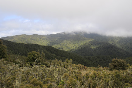
As the water race follows the contour of the hill it is easy walking until the pine plantation is reached then it is a short scramble up out of the bush.  It was here that we elected to have lunch in the shade of the trees.  After lunch we were back onto the forestry roads heading up the hill to Flagstaff.  This time we opted to take Longridge Road which we nicknamed 'the long easy' because it was a constant easy gradient winding it's way up the hill.  We were rewarded for our efforts half way up the hill where the pine trees had been harvested and we had great views of Whare Flat, Taieri Plains and Saddle Hill. 

By now the temperature was rising and it was hot work up the hill on 'the long easy' which felt like it just kept going - and it did for 5km until we reached a junction and could take Laing Road back to the forestry gates where we had entered the forest this morning.  Thankfully Laing Road mostly follows the contour so we were granted a rest from the uphill.  Once at the locked forestry gate we retraced our steps down Whare Flat Road and onto Taieri Road where we were surprised to find an armchair on the footpath. Not wanting to waste an opportunity, one of our team was quick to take a rest before walking further down Taieri Road where we took a compulsory stop at the ice cream shop.  Once replenished with an ice cream it was a fast final 1km to the cars.  

A great effort of 7 hours 45 minutes for the round trip of 30km.  We were left to wonder about those early OTC members who would walk what we had just done just to get to the start of the tramping area and then  go onto to do their tramping trip often returning by candle light.  Our conclusion was that they must have been very fit!

Tuesday, January 10, 2023

#20 of 100 trips - Campbells Road/Bethunes Gully/Watts Road 7 January 2023 (by Jade Pettinger)

After our first attempt at this trip in December last year was postponed due to inclement weather, we had our fingers and toes crossed that the 7th of January would be kinder to us. Heading into the first week of 2023 we had fantastic weather - days on end filled with blue skies and warm temperatures, until… the day before the trip, thunderstorms rumbled across the city, pelting us with heavy rain and once again we thought the trip would be rained off. Waking up on the 7th we anxiously peered out the window and were pleasantly surprised to see the weather had cleared, the trip was on! 

This was a special trip for us as it was in our ‘backyard’, the meeting point was a 2 minute walk down the road at the intersection of Campbells and Pine Hill Road. We meandered down the road and, despite being 20 minutes early, were delighted to see people were already starting to arrive. By the time the trip was ready to depart at 11am, a staggering 22 people had gathered, perhaps an OTMC record for a day trip in early January?


It was a speedy trip up the hill to the end of the paved part of Campbells Road, with groups happily chatting away and catching up on what everyone has been up to over the break. Layers were soon being stripped off as the weather was warmer than expected after yesterday's downpour. One local must have been amazed to see such a tribe walking up the ‘dead end’ road and stopped to find out what we were up to.

With warnings of a bull that was supposedly roaming the paddocks we intended to cross ringing in our ears, we bravely opened the gate and entered the paddock anyway. While this section of the track appeared to be traversing a farmers paddock, we were actually on a Paper Road. These are unformed roads, often on what appears to be private property, however are recognised as legal roads and members of the public have the right to access these without having to gain permission from landowners. We followed the Paper Road (an extension of the formed Campbells Road) through the paddocks, on high alert for any possible sightings of a rogue bull, although to our relief the only livestock we found evidence of were sheep

After dodging the muddy bogs of the paddock we arrived at the bush which marked the beginning of the Mount Cargill Scenic Reserve. This section of track was certainly more interesting, however the slippery mud made for slow going. A few of us took a tumble, although thankfully the only wounds were to people's dignities. Being a section of bush that is not commonly visited, we were able to appreciate the true beauty of New Zealand bush. It was so vibrant and lush with rays of sunlight peeking through the thick bush, highlighting the endless shades of green which makes the NZ bush so magical.

Before long we arrived at the junction of the Bethunes Gully - Mount Cargill track and with our tummies starting to rumble for lunch, we set off at a brisk pace down the well-maintained track towards Bethunes Gully. The scenery soon started to change as we made our way through the pine forest and eventually to the open fields of Bethunes Gully. Lunch was quickly consumed, the obligatory team photo taken and packs were back on for the final ascent back up to Pine Hill.
The weather was really starting to heat up as we headed along North Road, happily chatting away in small groups. A quick pit stop was made to rehydrate before the slog up Watts Road. The section walking up the road was steeper than expected, and the speedy pace we had maintained for the rest of the trip was soon replaced as we plodded up the hill. We gained height quickly and by the time we reached the end of the tarseal we had quite a good view down into North East Valley and across to Ōpoho.
The end of the tarseal marked the beginning of another Paper Road, straight up the paddock to join up with Abbeyhill Road in Pine Hill. After negotiating our way up a scrambly bank and over a couple of fences, we were met by some power poles which indicated we were not far from our destination. Sticking to the fence line, it was a straightforward climb up the hill, although thankfully the gradient was not as steep as it had been on the road. We stopped to admire a set of old rugby posts, dreaming of days gone by when games would have been played perched on the side of the hill.
Before we knew it, we were clambering over the stile and onto Abbeyhill Road. A quick head count and it was soon confirmed that all 22 of us had made it safely back up the hill. While the majority of the group made its way back down the hill to the starting point, we said our goodbyes at the end of our street and headed home for a well-deserved cold drink.

Trip #20 ticked off the 100 Trips list, and what a fantastic trip in our backyard it was. The OTC used Campbells Road to access Bethunes Gully in the 1930’s, and it was great to put our own spin on this to create a loop trip in an area not usually frequented by the club but certainly well worth the visit. In total we were away for about 3 ½ hours (including lunch) and walked about 8km. 

Written by Jade Pettinger

Friday, January 6, 2023

Black Gully to Evansdale 4 January 2022 (was #3 of 100 trips)


Following Careys Creek from Black Gully to Evansdale was trip #3 of 100 trips in October 2022 and as I had missed the trip (we were on weekend trip #2 of 100 trips) Three of us decided it was time to walk this track that I'd not completed before.  Starting at Double Hill the track initially winds its way through a tunnel of flowering manuka before dropping a knee jarring 100m downhill to Black Gully. The descent is made slightly easier with a number of steps cut into the bank making for a fast descent over a reasonably short distance.  We made the small detour to Black Gully Dam which was built in 1912 along with 17 km of pipeline to give water to the Seacliff Mental Hospital.  The flow to the hospital was gravity fed and not always successful due to the distance and terrain the pipe traversed.  After a fire at the Seacliff Hospital in 1942 with the loss of 37 lives, it was decided that a more reliable form of water supply was needed.

From the dam the track follows the old pipeline, crossing the stream often.  It is easy to see how difficult the terrain  made it to install and maintain the pipeline around 100 years ago.  There are numerous places that the pipeline is broken and these made the walk along the track more interesting.
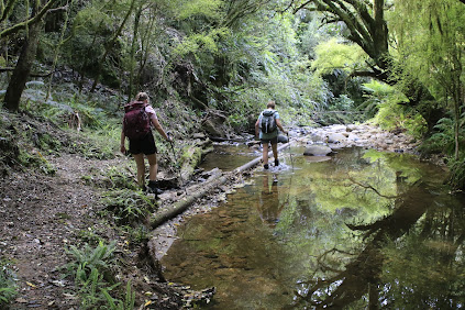
The first part of the track is very pleasant walking between the moss and ferns beside Careys Creek.  The creek winds its way around slippery rocks and through numerous deep pools that look perfect for a dip in the clear water.  At this time of the year, the Careys Creek track is good for mushroom enthusiasts with a large variety of fungi to see. Not knowing the names of the mushrooms we saw, all I can say is that we saw  small perfectly round marble sized red fungi, large red and white spotted ones, grey frilly ones, large cream coloured ones and round white doughnut shaped ones.  We passed a number of fallen logs spouting whole cities of fungi.

As the track continues down the valley, the track moves from native bush to open grassy meadows and back into the bush with numerous stream crossings interspersed with the odd patch of pine forest.  After the lush greens of the native bush and bright sunshine of the grassy meadows the pine forest is dark and ominous.  It was good to pass through the pine forest quickly and back into the sunshine again.

From about half way the track drops into the creek and continues along the creek bed, crossing from one side to the other.  Keeping dry feet became impossible and it was refreshing as the water filled our boots and helped to cool us down. The track would climb out of the creek bed for a short distance then drop back in again.
 
There were patches of mud to negotiate, however the numerous creek crossings were good to wash the mud off.  In places the pipeline would disappear while in other parts we needed to continually step over it.  The pipeline often sat on top of the rocky ground like a snake, closely following the creek bed while other times it was raised above the ground.    All the time we continued to follow it down the valley.

Once we reached where the Honeycomb track joined the Careys Creek track the going became easier with less creek crossings and less mud.  We stopped for lunch beside the creek.  While enjoying the coolnes of sitting near the creek on a hot day we saw a couple of freshwater lobsters moving about in the clear water.  It is surprising how small the cracks and holes the lobster can disappear into under the water. Feeling replenished from lunch we continued down the track, in and out of the water for another hour until we reached Evansdale.  All up the trip was around 10km and took 4 hours (including stops). 

Sunday, December 18, 2022

#19 of 100 trips - Gardens / Upper Junction / Blanket Bay / return to Dunedin Gardens 17 December 2022

Five intrepid trampers met at the Gardens corner to recreate one of the early tramping trips of the Otago Tramping Club which involved a lot of road walking which, for the early trampers, would have been on narrow, winding gravel roads but for us was on mostly narrow, winding sealed roads and a wide, flat, smooth cycleway.   We were quietly confident that the sea fog would lift by the time we had reached Upper Junction so that we would be able to see the views, little did we realise how wrong we were.  Meeting at the Gardens corner we set off walking up North Road towards Upper Junction.
The first two and a half kilometers has only a mild gradient and the time went quickly as we walked and chatted our way up North East Valley.  Once we reached Normanby the gradient increased and the sea fog seemed to come lower down the hill so that it felt like it wouldn't be long before we walked into it.  It was a nice surprise to meet my father out for his morning walk and we stopped for a brief chat before continuing on.  Only a short distance on the footpath ran out and we were walking along the edge of the road. 
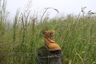
One of the reasons for the early start to the walk was to avoid the traffic on this part of the road and for the most part it worked with only spasmodic traffic. The higher we climbed the thicker the fog became and by keeping well to the side of the road, we didn't disrupt any traffic.  One of the good things about road walking is that the slower pace means that you get time to see things that you'd normally miss when driving past which is exactly what we did - chatting to passing cyclists, listening to the birds, spying bugs in the long grass, watching the sheep and cows (who were watching us), admiring the flowers and our most unusual find was one new, unused boot. 
The higher we climbed the thicker the fog/mist became so that when we reached the highest point at Upper Junction, disappointingly there was no view.  Instead of admiring the view of North East Valley and the city that was hidden to us, we took a small detour to visit the war memorial on the site of the former Upper Junction School that was destroyed by fire in 1945.  There are 17 beech trees planted beside plaques in remembrance of former pupils who were killed during the first world war. This is a particularly poignant war memorial for me as my fathers uncle has a plaque and beech tree planted in his memory here.  John Williams was 17 when he signed up, lying about his age so that he would be accepted into the army and killed at the Somme, aged just 19 years.  It seemed very fitting with the muted light from the  mist swirling around the hundred year old giant macrocarpa trees creating an ethereal atmosphere during our visit of this site.
What goes up must then come down and that is exactly what we did, heading 300 metres down hill on Upper Junction Road, all the way to sea level.  It seemed almost impossible but the mist seemed to grow thicker and we were barely able to see each other at times.  The striking views were non-existent so had to keep an ear open for cars to avoid being hit on the narrow, winding road.
As we dropped lower the mist slowly started to thin until we dropped below it and finally got our first views of the surrounding farmland and down to the harbour. We stopped on a sweeping bend where we could get well off the road for a morning tea break.  Replenishing ourselves with a drink and snack while admiring all that we could see.  With the hills on the opposite side of the harbour and most of the city being shrouded in fog, we were only able to see down to Blanket Bay and Roseneath. 
Knowing that most of the hill was behind us, we continued down the hill where we eventually met up with the main road to Port Chalmers, State Highway 88.  We admired the yet to be completed new cycleway/walkway including the blue surface from a distance. Despite the cycleway looks like it is completed, there are large fences stopping access  so we continued walking along St Leonards Drive.
A lunch stop was called at St Leonards Park where Mandy found a swing to sit while the rest of us opted for the picnic table.  Lindsay arrived with his dog and a box of cherries which he shared while we watched a large ship sail past on it's way to the inner harbour.  By now we were over halfway through our walk and were about to start on the 'easy' part of our walk, along the flat cycle/walkway which runs beside the railway line.  This proved to be more difficult than first thought as the 8km of flat, hard surface made for tired legs and feet.  The fog was lifting with the views of the harbour opening out and we were able to distract each other by seeing who could spot the most interesting sight.  Some of the interesting things we saw were kayakers getting tooted at by the harbour tug for being in the main shipping channel, swimmers jumping off the harbour channel markers, a speedboat jumping the tug boats wake, a grey spoonbill, a few sad, rotting boats, some exercise equipment, lots of walkers and only a handful of cyclists but no trains. 
Once we reached the stadium we turned off the cycle/walkway and continued past the University, skirted around a cricket match in progress and wandered through the student housing until we reached the Water of Leith. We followed the Water of Leith through the Gardens and back to the main gates where we had started 5.5 hours and 21km earlier.

Tuesday, December 13, 2022

#18 of 100 trips for 100 years - Burns Track / Mountain Road (Track) / Rongomai / Evansdale Glen 11 December 2022

With heavy rain the night before and then waking up to low cloud this morning, it wasn't surprising that only three hardy souls turned up for what can only be described as a trip of many parts.  The results of last night's rain was obvious right from the start as the Pipeline Track, where we had walked on a dry surface only a month earlier during trip #9/100, was now slippery with a thin layer of mud.  After only 20 minutes walking on the Pipeline Track we reached the start of the Burns Track and from here the real work began. 

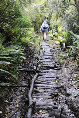
The Burns Track has always had a reputation of being muddy and while I'd not been on it for a number of years, I was pleasantly surprised to find that while there was plenty of mud to contend with, it wasn't difficult to avoid most of it.  The track has been well maintained with a number of channels dug to help drain the water and the vegetation has been cut back reasonably recently with one substantial section of 'board/branch walk'.  We made good progress and reached the Burns Saddle in around 40 minutes.  

It was on this section that we startled a couple of small pigs relaxing on the track.  The pigs were very quick to dive into the scrub as soon as they became aware of our presence.  The track follows the contour around and crosses the Burns Creek before climbing up a short but steep section to the junction of Rustlers Ridge where a morning tea stop was called and we got to have a short break (we had crossed here about a month ago on trip #9/100).

Continuing on the Burns Track, we headed towards Swampy Ridge with the track starting to deteriorate with larger and deeper patches of mud but mostly we were able to skirt around the edges of it.  On this section we had another encounter with wild life, this time we surprised a family of goats which took off in all directions and for some time we could hear them crashing through the undergrowth trying to regroup and move away from us at the same time.  We passed the steel stile to no where and continued onto Swampy Ridge where we turned towards Sleepy Hollow and the Silver Peaks. This is where we really encountered the mud, making anything we had already been through on the Burns Track seem insignificant.  It felt like the mud went on and on with some hilarity along the way, seeing who could avoid the worst of the mud and who would go in the deepest. 

 Everything must end eventually and so too did the mud. As we got nearer to Hightop, it was with relief when we entered the golden tussock.  This was a really enjoyable part of the track to walk along as it reminded me a lot of what the Silver Peaks looked like 25+ years ago when the all the tops were covered in this tussock and we were able to wander at will down any of the ridges. A bonus was that we were past the mud and were able to walk along without having to be careful of every step taken. 

We made a small detour off the track and up to Hightop where we stopped for an early lunch at 11.30am in the sun. We nestled amongst the golden tussock looking towards the tops of the Silver Peaks and reminisced about some of the trips we'd been on over the years into the Silver Peaks and some of the people that had been on those trips.  It was during lunch that Rob discovered he had left his cup at home and his tea was too hot to drink straight from the thermos.  Feeling sorry for him having carried his hot tea all this way and still with quite a distance to go,  I donated my lunch box to him to use as a cup and Rob was able to enjoy his hot tea.  
Feeling replenished we shouldered our bags and continued on our journey.  Finding our way down from Hightop involved a small amount of bush bashing as the track is overgrown and difficult to follow in places but all to soon we found ourselves on Mountain Road. This next part of the trip was the section that I was least looking forward to as it involved about 6km of walking along Mountain Road.  I must confess that it wasn't as monotonous as it has been in the past due to the fact that all the pine trees have been harvested which meant we weren't walking in a tunnel of trees but instead had good views and were able to amuse ourselves by picking out distant landmarks as we walked. 
After about an hour of road walking we reached the Rongomai track which starts off on a gentle slope then descends steeply down a defined ridge.  Thankfully there were a few well placed trees to hold onto but mostly it was a careful descent making sure to stick to the track as there was no room for error with extremely steep sides.  At one stage we heard a snuffly snort almost under our feet and not wanting to see what made the noise we quickened our pace and eventually we had dropped 300m to emerge at Careys Creek.  The final stretch of track involved a 3.5km walk along the grassy bank of Careys Creek winding in and out of the bush. This part was what we affectionately named the 'boot cleaner' section as the long grass wiped all the mud off our boots and we emerged from the track looking a lot cleaner than we might have otherwise been.  All in all a fun day out where we walked 19.2km in a little over 6 hours.  

Monday, December 12, 2022

#16 of 100 trips for 100 years - Tunnel Beach 8 December 2022 (by Jade Pettinger)


This day trip was in place of a club Thursday night talk and is part of the 100 trips because the third weekend of the Otago Tramping Club in 1923 included two trips from the St Clair tram terminus to Blackhead via Cargill’s Castle. Similar trips appeared sporadically through the trip programme up until 1983, but urbanisation and more private owners of the land now make the original trip impossible and hence this trip was added to the 100 trip list.  

Being a windy evening and with the threat of rain, it was very heartening to see 19 people turn up at 6pm for the 1km wander 150m down the hill to Tunnel Beach. It was a reasonably fast walk down with a short stop for a team photo.

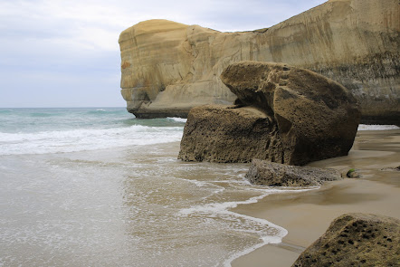
 The magnificent sculptured sandstone cliffs and arches provide a stunning backdrop for the turbulent waves that slam into the cliffs.  It's an impressive place to be to see how ferociously the waves are thrust into any small crevices in the rock, creating a larger crack which eventually breaks off from the main cliff.  There was plenty of evidence of the power of the water with large slabs of sandstone littering the base of the cliffs and  billowing plumes of water crashing into the rugged cliff face.

Turning our attention away from the surging sea we descended the 72 steps down the hand carved tunnel that gives Tunnel Beach it's name.  The tunnel was commissioned by a local politician, John Cargill  in the 1870's for his family to access their own secluded beach near the family home of Cargills Castle.  The tunnel is sloped and steep but easy to navigate and at the bottom we were rewarded by being able to see up close some of the large sandstone boulders that had fallen from the surrounding craggy cliffs. The boulders are a variety of  shapes and sizes with most being easy to clamber up onto. 

The tide was on it's way out so more sand was slowly being exposed and if you were quick, you were able to run around a small headland to a sheltered cave without getting wet.  A few people were not quite as quick as they should have been and ended up with wet feet. The cave is also a favourite overnight retreat for sea lions and some of our group were lucky to see one come surfing into the safety of the cave. 
All too soon it was time to retrace our steps back up through the tunnel and then continue following the track up the hill.  The climb up the hill was much slower than the descent but we all made good time, with only the occasional short rest and arrived at the cars about 1 hour after leaving.  
Written by Jade Pettinger

Otago Harbour Cycleway 30 October 2023

With my sister in town, it seemed a shame to waste a calm, sunny day so the two of us hopped on a bike each to enjoy the recently opened 32k...