Tuesday, February 7, 2023

#30 of 100 trips for 100 years - Cloud Forest Of Leith - Escarpment Track - Three Peaks Track 4 February 2023


When the thermometer hits more than 30°C the most sensible thing to do would be a swim at the beach, instead we opted for a walk - up a hill from Sullivans Dam up to Mt Cargill / Kapukataumahaka via the Cloud Forest and Escarpment Tracks and return via the Three Peaks Track. We had already been over the Cloud Forest and  Escarpment Tracks in November during the Trip #13 Complete Skyline and I was interested to see if our dry summer had any effect on how much mud we would encounter on the Escarpment Track.

Maybe it was the heat or maybe it was the reputation of the notoriously muddy Escarpment Track but whatever the reason, there ended up being only two of us brave enough to face both the heat and the Escarpment Track.  We started our adventure by walking around Sullivans Dam with the surrounding hills reflected in it's dark and tranquil waters. We stopped for a few minutes at the outlet of the dam where we had, had lunch on trip #15 Leith Saddle-Morrison Burn-Sullivans Dam  to enjoy the calm and peace of the place before following the track into the relative cool of the bush and continued around the side of the dam to the start of the Cloud Forest of Leith Track.

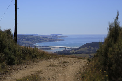
The Cloud Forest of Leith track has become overgrown in places with ferns covering the board walk making it difficult to see where to put your feet, although mostly this part of the track is relatively straightforward and easy to negotiate.  Despite being in the shade of the native bush the temperature was rising and the sweat was starting to flow with the constant uphill gradient. Emerging from the bush, into the full sun at the power lines we were rewarded with great views towards Waitati and Warrington and around to Mihiwaka and Mt Kettle. 

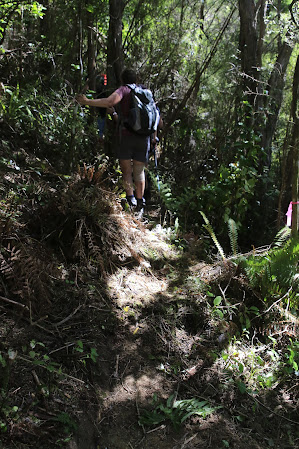
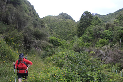
After a short drink stop we crossed the open ground under the power lines before heading back into the bush and onto the Escarpment Track.  The condition of the track hasn't improved much since our last visit in November.  The undergrowth of ferns is quite thick along the track, making it difficult to see your feet along with the track and the ever present obstacles of tree roots, fallen trees and mud. Thankfully with all the dry weather recently there was only minimal mud and what mud there is, is firm and porridge like so we clambered up Pigeon Rock with relatively clean boots.   As always Pigeon Rock is a perfect place to stop for a drink and snack while taking in the uninterrupted views of Swampy Summit and around to the northern Silver Peaks, Mt Watkin, Blueskin Bay and the Kakanuis in the distance. 

The next part of the track involves finding your way through the pine plantation which is not as easy as it once was.  The pine trees are now a few years old and being taller than a person means that you need to keep a close eye on the markers to ensure you continue in the right direction.  It feels a little like walking in circles but by sticking to the makers we were rewarded with arriving on the Mt Cargill road with no wrong turns. 

By now the sun was high in the sky and the temperature was pushing into the 30°C's and we had a kilometre or so of road walking ahead of us but on the plus side - we had done all the uphill and there was only downhill ahead of us now.  Not wanting to be longer than necessary in the full force of the sun we turned right and walked down the road 15 minutes to the Three Peaks track.  The first part of Three Peaks track is a lovely section with the trees interlocking branches overhead creating an open green tunnel to walk through. Eventually we reached the end of the tunnel and emerging back into the sun, on another four wheel drive road which we followed back to the power lines. 
Now we had completed a large loop and were on the final home stretch so we stopped for a short drink stop and then back into the shade of the bush.  Going down through the ferny undergrowth is no easier than going up, still can't see our feet but at least we had gravity on our side.  Before we knew it we had reached Sullivans Dam and then it was a short walk around the outside of the dam to complete another loop and we were back at the car, happy to finish a very hot 10.5 km walk in 3.5 hours. 

Friday, February 3, 2023

#28 of 100 trips for 100 years - Silver Peaks River Track 29 January 2023

The Silver Peaks is the OTMC's most visited tramping area and the addition of the River Track linking tracks from the Waikouaiti River up the side ridges to the back bone of the Silver Peaks, Rocky Ridge (trip 5/100 trips) has really opened the area for a larger range of tramping trips.  Today's trip is special because Arthur led us on a guided tour of the River Track to Philip J Cox Memorial Hut, explaining the philosophy and issues of the work he has done on the River Track, and the improvements that continue to be made for all trampers benefit.  It was testimony of how important the Silver Peaks and the River Track are to the OTMC that eighteen people turned up for this special trip.
The day was hot and sunny so it was with some relief that we imediately headed into the shade of the bush and down the Goldminers Direct Track to the Waikouaiti River.  As the name suggests the Goldminers Direct Track takes you directly down the ridge to the river and is very steep in places.  Arthur has done a large amount of work replacing some of the steeper sections with zig zags which make for easier travel although care still needs to be taken on some sections of the track. We reached the river at the bottom in a little over half an hour where we were treated to the first of Arthur's explanations and stories as to the building of the part of this section of track.  Arthur explained the significance of the track signs and what we could expect over the next section of track.

I had been over the River Track a number of years ago when the track had only had rudimentary markings and was just a vague route through the bush, and I was keen to see the changes that had been made. The River Track winds it's way through the mature manuka bush with many sections of extensive benching meaning the track had been dug into the bank while in other parts, the track has been built up to avoid boggy areas making for a more level and smoother track to walk on.
During the walk we learnt that Arthur has spent many hours working on the track approximately (a conservative) 400 days over the past 10 years, with some help from others but mostly on his own. Some sections have required a large amount of building up with rocks dug out of earlier sections and all of this track has been hand built and funded by Arthur.  The amount of work that has gone into the River Track is phenomenal and it was a privilege to walk the track with Arthur as our guide. 
A morning tea stop was called in the shade at the Hunters Track junction and once we had rested we continued following Arthur down the River Track, crossing a couple of small side creeks including Cats Teeth Creek.  All the time we were given a running commentary of how each part of the track had been constructed and the obstacles that had to be overcome.  Once we reached the end of the benched  River Track, we continued on through the bush, following Arthur's makers.  This unformed part of the track was a privileged to walk as it gave us a good appreciation of the amount of work that was still required to complete the track. 
The temperature continued to rise throughout the morning and the steep sides of the valley seemed to radiate that heat inwards. One good thing in our favor was that we stayed in the shade of the bush all the way.  Just before the track begins to climb up towards Philip J Cox Memorial Hut, it drops to cross a significant side creek with some lovely large rocks that have created some nice pools.  Here some of the group took the opportunity to throw cold water over their head while others submerged completely for a refreshing dip. 
From the creek, the real work began for us as we climbed our way up around 300m to the Philip J Cox Memorial Hut. Without the benched track, the pace slowed and we were forced to climb over tree tree roots, sidle around slippery slopes and scramble up steep banks which made the going much slower.  We passed through a lovely section of tall tree ferns and another of twisted Fuchsia  trunks with the high leaves keeping the sun from reaching the ground beneath.  Still the track continued to wind it's way up hill through the manuka nnd sweltering under the oppressive heat we finally reached the Philip J Cox Memorial Hut in the blazing sun. Most of the group headed to the edge of the bush to sit in the shade for lunch.  Once lunch was out of the way it was time for a small ceremony to thank Arthur, on behalf of all those who have used the River Track, followed by cake.
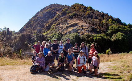
Once we had all had a look around the Philip J Cox Memorial Hut, the compulsory team photo was taken before we shouldered our bags to begin the descent down Yellow Spur to the Waikouaiti River.
The track down Yellow Spur mostly follows the ridge downhill and is steep in places, dropping 300m with a rope conveniently placed in the more difficult places.  One section at the bottom involves climbing down a large muddy rock wall with most people finding the easiest way was to abseil down backwards holding onto another conveniently placed rope.   Once over this hurdle it was a pleasure to douse water over our heads and soak our feet in the cold water of the Waikouaiti River.
From the river, the final section of track heads straight back up the hill via The Tunnels Track to the cars.  This is a particularly steep track that climbs around 250m up to through the pine plantation to almost the same height as the Phillip J Cox Memorial Hut which we had left only a short time ago.  The tall pine trees helped to keep us in the shade and while the gradient was unrelenting the wide track made for reasonably easy walking. 
Despite the heat and steepness of the Tunnels Track, it was only 30 minutes from the river to the road and into the blazing sun.  The general consensus from everyone on the trip was that Arthur has done a phenomenal amount of work on the River Track and we are in awe of his dedication to seeing it completed. Saying thank you Arthur, just doesn't seem enough when you see the amount of work and consider how much time and energy Arthur has put into the River Track, providing a valuable alternative access into  the Silver Peaks. 

Sunday, January 29, 2023

#27 of 100 trips for 100 years - Blackhead to Brighton via Green Island Beach 28 January 2023


Despite heavy rain further north, the day in Dunedin was warm and sunny with only a light breeze which was a good sign for a walk along Green Island Beach.  We arrived at Blackhead to a full carpark and waves crashing onto the sand making it easy to see why this is a popular surfing beach.  The cliffs of Blackhead are basalt columns similar to those we had seen at the Organ Pipes last weekend and the Pyramids two weekends ago.  The Blackhead headland of basalt columns juts out into the sea and there are some interesting rock formations that can accessed by scrambling around the base at very low tide.

Today, though, our mission was to walk along the beach from Blackhead to Brighton and with one and a half hours to low tide there was plenty of beach for the 9 of us to walk along.  The walk of 7km each way was very pleasant in the sun and with a tail wind on the journey to Brighton making for an enjoyable walk where  we saw a sea lion and only a handful of people walking their dogs.  The dogs looked to be having a lot of fun chasing balls and sticks in the water. We passed the Waldronville estuary without even noticing as there was no water flowing down the estuary. 
The further we walked down the beach the more sand was exposed by the retreating tide and there was plenty of opportunity to walk with different people which made the 1.5 hour walk to Brighton pass quickly.  
Once we reached the end of the beach, we found a large rock to sit and replenish the energy with a drink and some snacks in the sun while we contemplated the walk back.  We were all a bit jealous of Laurence and his cinnamon scroll but he wasn't keen to share so we contented ourselves with our own horde of lollies.
The second part of our journey was the return to Blackhead, however this time we had the wind in our faces.  This made for some lovely patterns in the blowing sand and with the tide out we looked to have a massive beach all to ourselves.  The bulk of Blackhead kept beckoning us on and before we knew it, we had passed the Waldronville estuary again and were back in amongst the dog walkers again. 
Once at Blackhead, it was a final scramble over the rocks and up to the cars.  The beautiful weather meant this had been an enjoyable 14km beach walk with great company. 

Tuesday, January 24, 2023

#26 of 100 trips for 100 years - Burns Track /Mountain Road (Track) / Rongomai / Evansdale Glen 22 January 2023


For one reason or another this trip is a repeat of #18 in December with the biggest difference being that the December trip had only three of us, this time the group was much larger with 10 people.  With memories of the mud still in my mind, we began with a walk of a kilometre or two along the Pipeline Track to the Burns Track turn off.  I was pleasantly surprised with how dry this part of track was and had high hopes that other parts of the track would be in a similar condition.  The start of the climb up the Burns Track is always steep and flattens out before a short steep climb to the Rustlers Ridge track junction which is where a compulsory morning tea stop was called. While most of us settled for water there was the one or two who broke out the thermos for a cup of tea.
From the junction we followed the contour around to Swampy Ridge.  The going was reasonably good with only the occasional muddy patch to contend with.  Being at the back was good because I could see where others had gone and could avoid the worst of it.  This is a pleasant part of the Burns Track as the bush thins with more open patches.  Once at Swampy Ridge we turned towards Hightop and this was the section where the mud had been at it's worst during our last time along here in December.  How different things can be a month later as the track is much drier and most of the mud had a thick porridge consistency rather than the ankle deep, wet, sloppy mud from last time making it much easier to avoid the majority of it. 
As we approached Hightop the bush opens out to golden tussock and with all the climbing and mud behind us we were able to relax and enjoy our surroundings more.  I have always enjoyed the tussock tops of the Silver Peaks and while most of the peaks are now covered in scrub, there are still some open tussock tops which are a pleasure to stroll through.  We made the small detour to the top of Hightop where we found a place to sit in the sun amongst the tussock for lunch.  
We had purposely chosen a place that faced West and we were rewarded with panoramic views of the Silver Peaks. In December the tops of the Silver Peaks had been obscured by cloud where as today we could easily see from Pulpit Rock all the way through to The Gap and beyond.  This was the route along Rocky Ridge that we had taken during trip #5 The Three Ridges in November.  One of the things I am enjoying as we complete the 100 trips is seeing how all the tracks and previous trips connect as we walk our through the them.  We could also see Hikarora/Mt Watkin near Waikouaiti which is where trip #36 will be going in March.
All too soon lunch was over and we were back on our feet and retracing our steps to the Hightop track where we were able to look down to our next part of our trip, walking along Mountain Road.  From this vantage point it is easy to see all the tree felling that has happened in the area and the contrast of the harvested pine plantation versus the lush green of the native manuka forest of the Silver Peaks Reserve. 
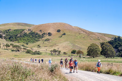
Finding our way down from Hightop involved some bush bashing as the track is indistinct in places but thanks to some good navigation with Antony in the lead, it wasn't long before we were back on track and rejoining the Green Ridge track which lead us to Mountain Road.  Here we stopped briefly for a team photo before starting the hot 6km walk along Mountain Road to the Rongamai track. 

The roadwalk is always monotonous and felt never ending however with good company the conversations were varied and the distance seemed to fall behind us with very little effort.  It is good with the pine trees gone to be able to see more of our surroundings and also to wonder about the trips the early club members did in the area, often running to Evansdale to catch the last train back to Dunedin. After an hour of road walking we reached the Rongamai track which starts as an old 4WD track before narrowing into a walking track and eventually onto a narrow ridge that then drops steeply to Carey's Creek.Itis here that care needs to be taken to avoid a fast descent, and with lots of trees to hang onto we were soon at the bottom without any mishaps.
The final stretch is a about 3km alongside Carey's Creek where last month had been a sea of lupins and today was more long grass and blackberries.  It is a pleasant walk beside the crystal clear creek and we were able to look behind at the ridge that the Rongamai track comes down.
Eventually we reached Evansdale Glen with the final hurdle being a shallow creek crossing which helped to wash the worst of the mud off our boots.  This had been a trip that covered 19.2km over a variety of terrain in around six and a half hours. 

Monday, January 23, 2023

#25 of 100 trips for 100 years - Bethunes Gully to Mt Cargill and Organ Pipes 21 January 2023

Kapukataumahaka/Mt Cargill has featured in over 150 OTMC trips with the first recorded club trip dating from 1924 so it seemed appropriated to have this as one of the 100 trips.  Despite the relative short distance traveled there is still a significant height gain of around 400m from Bethunes Gully to the top of Kapukataumahaka/Mt Cargill.  Maybe it is the prominence of Mt Cargill on the city skyline, maybe it was the warm, sunny day or maybe people felt like they needed a walk but whatever the reason, a good turnout of 12 people arrived at Bethunes Gully for the start of this shorter 100 trips day walk. 

The wide, gravel track starts from the carpark and follows Lindsay Creek for a short distance before crossing a bridge over the creek.  The track then begins to wind it's way up hill though pine plantation where there are a number of mountain bike trails through the pine trees, however we stuck to the main walking trail and continued past where David Bethune had built a brick kiln and sawmill in the 1870's.  There is very little to see today apart from a stand of large macrocarpa trees.  After leaving the pine plantation and moving into the native bush, we briefly stopped at the first view point of Kapukataumahaka/Mt Cargill.

From here the track continues to wind up through the native bush towards the top of Kapukataumahaka/Mt Cargill.  The track is wide enough for two people to walk side by side and everyone seemed to naturally break into groups of two or three chatting as we climbed higher.  Time and distance seemed to pass very quickly and we reached the junction to the organ pipes where we took the pathway that continued up to the top of Kapukataumahaka/Mt Cargill and the transmitter.  The views of the city, harbour and Blueskin Bay are always spectacular from the top. 
Surprisingly we saw very few people and just about everyone we did see was walking a dog.  This was also a good spot for a break and we took the time to replenish ourselves with a drink and a snack while taking in the city views. Often it can be windy on top of Kapukataumahaka/Mt Cargill but today was reasonably calm with only a slight breeze. 

The next part of our walk saw us returned down all the steps to the Organ Pipe track junction where we followed the track for only a short distance before turning off to climb Buttars Peak.  The city views from Buttars Peak are even more spectacular than those from top of Kapukataumahaka/Mt Cargill.  The rock formations on Buttars Peak are excellent examples of columnar jointed basalt and are easy to scramble over making it well worth a visit.  We had been here a few months earlier on trip #13 The complete Skyline Track.

 We crossed over the top of Buttars Peak and rejoined the Organ Pipes track for a short stroll across the ridge to the Organ Pipes where we took another break to enjoy the views and marvel at the 'pipes'.  No doubt the organ pipes would have been more spectacular during those early club trips, the columnar basalt tors are still an impressive sight. 
This was officially our turn around point and we retraced our steps back along the track to the Kapukataumahaka/Mt Cargill junction and down the main track back to Bethunes Gully.  The downward journey gave us a chance to mix and chat again, this time with different people to what we had walked up the hill with.  All up we walked around 10km in 4 hours. 

Tuesday, January 17, 2023

#24 of 100 trips for 100 years - Victory Beach and Pyramids 15 January 2023 (by Jade Pettinger)

17 of us assembled at the Clubrooms on Sunday morning, all of us keen to make the most of another beautiful summer day and explore Victory Beach. We quickly sorted ourselves into cars and headed down the harbour towards Portobello, admiring the stunning views our city has to offer. Before long we had arrived at our destination! Piling out of the cars we applied sunblock, donned sunhats and tied shoelaces ready to go.
It was just over a kilometre from the carpark to the pyramids, traversing some paddocks on a 4wd track. The track was flat and in a straight line and would have made for a dull walk if it were not for the delightful company. Arriving at the pyramids, it was time for a team photo before heading off to explore the cave at the bottom of the small pyramid. The cave was interesting as we could see clear examples of columnar basalt, the same type of rock as the Organ Pipes.
After consulting with our leader Alan, it was decided that we would take the scenic way to the beach. The loop around the reserve is a bit of a self-guided tour, with numbered markers along the way which tell you some information about the area. We enjoyed learning some facts and observing the work that has been done by the Yellow Eyed Penguin Trust to create a safe habitat for these endangered wildlife. A highlight was seeing some trees that Jade had helped plant at school in 2004, nearly 20 years ago!
After close to an hour of exploring the reserve underneath the beating hot sun, we arrived at the edge of the sand dunes. Making our way down to Victory Beach, we were delighted to see we had the beach to ourselves (minus a few sea lions). The beach was absolutely stunning - crystal clear water that sparkled in the sun and a wide expanse of white sand as far as the eye could see. Some of us took the opportunity to shed our shoes and feel the cool water swirling over our toes, providing some much needed refreshment.
We began our trek to the south end of the beach, keeping our distance from the sea lions dotted around the shoreline sunbathing. One sea lion was a bit curious and came over to see what we were up to, forcing us to make a hasty retreat before he settled down again and we could continue on our mission.
Near the south end of the beach we spotted the remains of the SS Victory, which ran aground in 1861, en route from Port Chalmers to Melbourne. Fortunately no lives were lost due to the proximity of the beach, however as the ship was embedded in 6-7 feet of sand it was unable to be salvaged and thus became the namesake of Victory Beach.
Rounding the end of the beach we reached Papanui Inlet and were pleased to find a sheltered spot out of the wind for lunch. Just as we were settling in, an inquisitive sea lion was spotted playing in the calm waters of the inlet before popping up to have a look at us. Upon deciding we weren’t a threat, the sea lion plopped back in the water and continued his play time - not a bad idea on such a hot day!
Lunch was quickly consumed before we packed up and made our way alongside the inlet, keeping a careful eye on the playful sea lion in case he decided to make another appearance. All was well and we plugged our way through ankle deep sand, admiring the expansive views of Papanui Inlet, Mt. Charles, Harbour Cone and even all the way across the city to Mt. Cargill.
We soon arrived at a farm track, relieved to be trading in the soft sand and the relentless sun for firm ground and some shade provided by the trees. The track was dotted with sheep huddling under any shade they could find. Arriving at the road, we geared ourselves up for the final kilometre or so along the dusty gravel road back to the cars. 

by Jade Pettinger

Otago Harbour Cycleway 30 October 2023

With my sister in town, it seemed a shame to waste a calm, sunny day so the two of us hopped on a bike each to enjoy the recently opened 32k...