Tuesday, November 16, 2021

Day 113 Port Chalmers

Today I started walking the streets in Port Chalmers where I walked 7 streets

1532. George Street
1533. Beach Street
1534. Peninsula Beach Road
1535. Victory Place
1536. Wickliffe Terrace
1537. Albertson Avenue
1538. Blundell Avenue

Port Chalmers is the main port of Dunedin and has a lot of history which I was able to see through some of the historic buildings that I walked past today.  It is in Port Chalmers in 1844 that  the local Ngai Tahu tribe sold the Otago Block to the New Zealand Company. 
 
A few years later in  1875, Port Otago was started and in 1882 the first frozen meat shipped from New Zealand to the Northern Hemisphere left from here.  Today the port is still very much a major part of the township and is evident by the main street ending at the Port Otago yards with the container cranes dominating the view. 
 
Very close to the town hall is where the first sailing ship, the John Wickliffe landed and the first settlers disembarked in 1848.  This building was built in 1888 and was not just the town hall but also home to the Fire Brigade, the Police Station (including the Sergeant’s residence and cells), Court Rooms, Customs Office and Government Shipping Office. There was also a morgue that occupied a backroom downstairs.  Today the bottom floor houses a public library and the top floor is available for functions.
 
Across the road from the town hall is the old Post Office built in 1877.  The building now houses the maritime museum. Collections at the museum cover commercial fishing, shipping, Antarctic exploration and social history.

During my walk, I crossed the Port Chalmers railway line which is the first railway line built in Otago in 1873.  The railway line goes through a tunnel to finish at the port.  This railway line is well used for taking containers and logs to and from the port to the city.  

The port is a busy place with containers and logs.  Today I didn't see any ships being unloaded but I was able to see the time ball on the hill overlooking the port which has stood on the hill since 1867 with the ball dropping at 1pm each day so ships officers could set their  chronometers used in navigation.  The time ball was used up until 1931. 

 
I walked around, past the port to Back Beach.  Back Beach is at the 'back' of Port Chalmers and isn't much of a beach.  It is more of a place to launch boats and has a number of boat sheds.
The view from Back Beach is beautiful looking across to Goat Island, Quarantine Island and the hills of the peninsula behind.  It is from here the water taxi leaves to make the journey across the harbour to Portobello. 

From Back Beach, the road winds it's way around the bottom of Port Chalmers, close to the water of the harbour.  This is a narrow, gravel road that is a popular walk for locals. 

This road is a good place to be able to see in both directions down the harbour. It also shows how narrow parts of the harbour are and why Port Chalmers is the preferred port for large ships. This pictures shows how close Port Chalmers is to Goat Island and then a small gap to Quarantine Island. The road I am walking runs around the base of Port Chalmers, close to the water.

I was able to look across to the hills of the peninsula and Harbour Cone which is the pointy hill on the right.  The houses below Harbour Cone are part of Portobello and are streets that I have not walked yet.

And then I was able to look down the harbour towards the city.  The habour really opens out the further you travel down to the city where it narrows again. 

As I rounded the corner and walked back towards the township of Port Chalmers, I was able to look across to Sawyers Bay where I had been walking yesterday.  I have walked all the streets that I could see. 

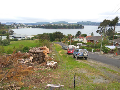
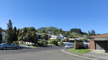
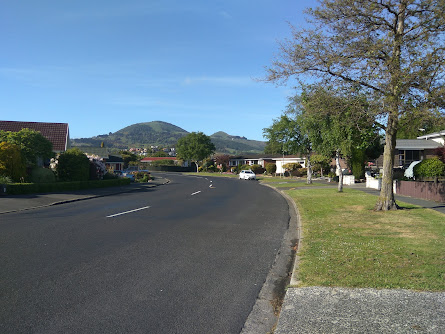
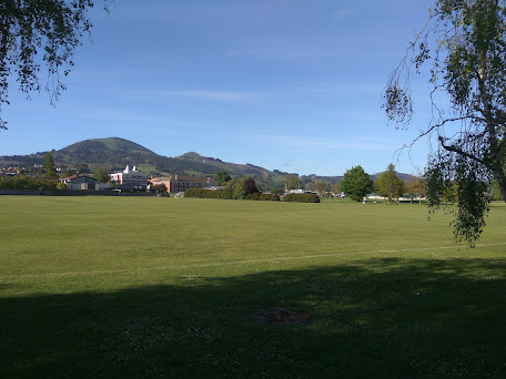
Then I was back into the streets with houses and I was able to look across to streets that I have not walked yet.  This is the area that I will be walking over the next few walks as I near the end of my challenge to walk every street in Dunedin.

One area I walked past was this spot where the steam ship 'Pride of the Yarra' sank in July 1863.  Thirteen people drowned here, including the first rector of the new Dunedin High School (now Otago Boys High School), Reverend Thomas Campbell, his wife and and five children who had just completed a 3 month journey from London.

On my walk around from Back Beach, I followed the Writers Walk which is a trail of 11 concrete plinths each bearing poetry written by a member of the Writers Group. 

I walked past two pieces of art today.  The first is huge and  is on the side of a Port Otago warehouse and is of a boat on the back of a whale which I thought was great.  I am not sure what the second piece of art is but it is interesting none the less.


This map shows the streets in Port Chalmers that I have walked are highlighted in red

Distance walked:  5.5 km         Walking time  59 mins   
 
Total distance: 938.2  km          Total walking  174 hr 57 mins 

Friday, November 12, 2021

Day 112 Sawyers Bay

My intention tonight was to walk most of Sawyers Bay and as it was such a nice night for walking, I kept walking until I had walked all of the streets in Sawyers Bay.  I walked 19 streets.

1513. Brick Hill Road
1514. Bells Road
1515. Stevenson Avenue
1516. Hall Road
1517. Springdon Avenue
1518. Delphic Street
1519. Kaira Street
1520. Fairview Terrace
1521. Tewsley Street
1522. Hugh Street
1523. Glendermid Close
1524. Mill Street
1525. Blackman Avenue
1526. Reservoir Road
1527. Constant Street
1528. Station Road
1529. Rohais Place
1530. Duke Street
1531. Freyberg Avenue

I started my walk by walking up Brick Hill Road.  This part of the street had slipped away after heavy rain in July 2018.  The road was closed for a number of months for extensive repairs. 

I enjoyed the rural views as I walked up the hill towards the houses at the top.  At one stage I watched a sheep in the paddock chase a rabbit for a short distance.

I was rewarded for my effort of walking up the hill, with some great views looking towards Port Chalmers where I will be walking next. 

These houses have some great views and I can imagine the residents would have been very happy when the large trees were cut down in front of their homes.  It has certainly opened the view up.

Sawyers Bay has hills on three sides which gives it a nice rural view.  There is a walking track that heads up the hill to the Organ Pipes and Mt Cargill. 

 Sawyers Bay is a nice mix of rural farmland and houses.  Sawyers Bay has a variety of views from farmland, harbour and hills.  It is a very pretty suburb.

I walked past this private cemetery in amongst the houses of Sawyers Bay.  The head stone is for the McDermid family.  Originally from Glasgow, Hugh McDermid and his wife settled in Sawyers Bay in 1849 and set up a sawmill.  Hugh went on to help set up the Port Chalmers School and Port Chalmers Presbyterian Church. 

I saw only one interesting letterbox during my walk today and it was extremely well done.  I really liked this tractor letterbox. 

 The map below shows Sawyers Bay and where I have walked is highlighted in red.
 
 
Distance walked:  9.1 km         Walking time  1 hr 45 mins   
 
Total distance: 932.7  km          Total walking  173 hr 58 mins 

Sunday, November 7, 2021

Day 111 Kinmont Park

The sun was shining and the temperatures were very warm as I walked the streets in Kinmont Park today where I walked 16 streets.

1497. Riccarton Road East
1498. Cuddie Close
1499. Elizabeth Avenue
1500. Orchard Gove
1501. Jaffray Drive
1502. Fairmile Drive
1503. Braeside
1504. Clyde Street
1505. Leith Street
1506. Gebbie Street
1507. Kinmont Crescent
1508. Quarry Road
1509. Woodland Avenue
1510. Boundary Road
1511. Dee Street
1512. Tweed Street

The weather was shaping up to be quite hot so I was out walking early in the morning to beat the heat.  I walked the few streets in East Taieri before walking the streets in Kinmont Park.
It was in East Taieri that I had one of my last views of Saddle Hill before moving onto other areas of Dunedin that I haven't walked. 

Kinmont Park is on a hill that overlooks part of Mosgiel and it was here, that I was finally able to see over Mosgiel where I have been walking for the last 10 days. After the flat streets of Mosgiel, it was great to be walking on the hills again.

 
 As I walked around the streets in Kinmont Park, I was rewarded with a view in another direction, looking towards East Taieri and Maungatua.

And then I was at the bottom of the hill, looking back up to where I had been walking.  Kinmont Park is on the lower slopes of Saddle Hill and I was able to see the rounded back of Saddle Hill at the top.  

My next destination was to the streets below the Mosgiel sign.  Each letter  of the Mosgiel sign is 3m tall and was put up by the local Rotary club in1987.  The sign is visible by the traffic as it travels past on State Highway 1.

Before reaching the Mosgiel sign, I walked the bridge over State Highway 1.  This is the main road that travels the length of the country and, at times, can be very busy.  Early on a Sunday morning is not one of those busy times.

From the bridge over the motorway I was able to see all the streets that I had walked in Kinmont Park. 

Once over the bridge, I walked a street that bordered an area where I had walked a few days ago where there is a subdivision with new houses being built.
 
Then all I had to do was cross the bridge again and walk up the hill,taking a street that was on the edge of the suburb with houses on one side and peaceful green fields with sheep on the other. 

An interesting part  of my walk today was along the street at the base of the hill that the Mosgiel sign is on.  Sometimes called Mollywood after the famous Hollywood sign, the sign has been here for 35 years and is lit up at night.

I walked past two letterboxes of interest today.  I really liked the tall house letterbox and I thought the number 7 was great too.
Distance walked:  12.2 km         Walking time  2 hr 12 mins   
 
Total distance: 923.6  km          Total walking  172 hr 13 mins 

Saturday, November 6, 2021

Day 110 Mosgiel

My plan today was that if I have a longer walk, I would be able  to finish walking the streets of Mosgiel.  I walked 27 streets today.

1470. High Street
1471. Green Street
1472. Victoria Street
1473. Wickliffe Street
1474. Tudor Lane
1475. Kent Place
1476. Windsor Place
1477. Haggart Alexander Drive
1478. Balmoral Avenue
1479. Owhiro Avenue
1480. Glenimire Close
1481. Tuwhare Lane
1482. Beech Street
1483. Cedar Crescent
1484. Oak Place
1485. Elmwood Drive
1486. Ash Place
1487 Cornish Lane
1488. Doon Street
1489. Spey Street
1490. Dunbar Place
1491. Gretna Place
1492. Arran Street
1493. Lomond Place
1494. Kelso Place
1495. Glenbrook Drive
1496. Glenleigh Place

I have become used to seeing Saddle Hill from this angle and today is the last day of walking streets that I will Saddle Hill from this angle as my goal for the day is to finish walking the streets of Mosgiel. 

I walked a mixture of streets of long, straight streets and shorter, curved streets.  The long, straight streets were wide and tended to have older houses

While the shorter, curved streets had newer houses and tended to have more trees and grass verges. 

 
Most of the streets I walked today had a view of Saddle Hill.  I have enjoyed seeing Saddle Hill, occasionally it has been covered in cloud although mostly, like today, I have had an excellent view of it.

 
Some of the newer subdivisions have a view of the Chain Hills and have lots of landscaping on the surrounding streets which makes them very enjoyable streets to walk though.

I walked past a number of playgrounds and sports fields today.  Mosgiel has a lot of playgrounds and sports fields and it has been great when I have come across these open, green spaces as it has given me the opportunity to see something other than streets and houses.  

Today I walked past Taieri College.  Taieri College started in 1871 when it was known as Mosgiel District High School and by 1882, there were over 170 students at the high school. In 2004, the high school merged with Mosgiel Intermediate to become Taieri College and now has over 1200 students. This year is the schools 150th anniversary.

 
I walked past some interesting letterboxes today.  I really liked the one painted with New Zealand's native birds and I thought the one with the 'person' leaning on the letterbox was clever.

 And finally, after 10 days and 93.5km of walking, I have completed walking the streets of Mosgiel.

 Distance walked:  13.2 km         Walking time  2 hr 16 mins  

Total distance: 911.4  km          Total walking  170 hr 01 mins 

Otago Harbour Cycleway 30 October 2023

With my sister in town, it seemed a shame to waste a calm, sunny day so the two of us hopped on a bike each to enjoy the recently opened 32k...