Wednesday, February 22, 2023

#33 of 100 trips for 100 years - Rosella Ridge - River Track - Gold Miners Direct 19 February 2023


It promised to be another hot day but that didn't deter the 14 people who were keen for an up close look at Rosella Ridge in the Silver Peaks.  The pace was set early after leaving the cars and we made very good time along Green Ridge.  It helps that the track is so dry and in good condition which meant that we were able to walk and chat easily.  Each break in the trees was an opportunity for those of us (only two) for a short stop to reminisce about last weekend's Silver Peaks Half Marathon (#31/100 trips) that had seen us walking over this same track but in the opposite direction.  Everyone was feeling very warm by the time we reached Green Hut Site and were happy for a drink stop.

Feeling good after the break, it was straight uphill behind Green Hut Site to bushline where we were rewarded with views looking towards one of the high points in the Silver Peaks, Pulpit Rock.  The track climbs 160m from Green Hut Site to the turn off to Rosella Ridge.  The water gouged track is easy to follow up through the low growing scrub and it was during this part that we really started to notice the humidity. 

Some of the team opted to tackle the extra 100m climb to the top of Pulpit Rock while others of us (who had been there for lunch last weekend) chose to wait at the Rosella Ridge turnoff.  It was a nice half hour wait for the Pulpit Rock group to return and then the next section was down Rosella Ridge.  Rosella Ridge is an informal name which appeared in the 1980’s from a couple of club members who spotted a Rosella while walking on this ridge.  At the time it was erroneously referred to as ‘Parakeet Ridge’ until the late 1980's when it was changed to the more appropriate name of Rosella Ridge. Rosella Ridge is a long, defined ridge that has a number of 'bumps' with the track going up and over each bump.  The track is well maintained through the shoulder high scrub which offers some shade from the noon day sun. We reached the end 'bump' affectionately known by the informal name of 'Little Pulpit Rock' for a final rest and where we were able to look across to The Cat's Teeth on Rocky Ridge (trip #5/100trips). From this vantage point we were also able to take in 360 degree views of the Silver Peaks. 
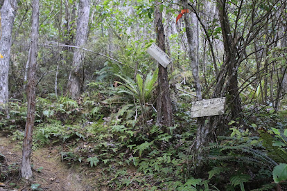
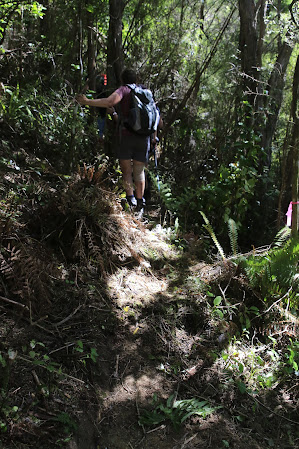
Being a little early for lunch, we continued walking and entered the mature manuka and kanuka bush as it dropped gently at first 450m down to the Waikouaiti River where we would join the River Track.  The track down through the native bush is very pleasant with ferns and mossy undergrowth along a steeply sided ridge.  A piwakawaka/fantail followed us along the trail, enjoying the feast of microscopic bugs that we stirred up as we passed through.  Partway down the ridge we stopped for a lunch break, spread out along the track in the shade.  Once lunch was over, we were back on the track, passing a number of tracks that branch off down the sides of Rosella Ridge
By following Rosella Ridge all the way down to the Waikouaiti River we eventually met up with the River Track (#28/100 trips), We had last been on this track only a couple of weeks ago, however this time we were doing the track in reverse and it was surprising to see how much climbing the track does alongside the Waikouaiti River. 
We were feeling grateful to be in the bush as the heat and humidity was high.  It was also a relief to be beside the river as we were able to stop at the small side creeks and refill our nearly empty water bottles.  The cold water from the side creeks was refreshing and some of the group took the opportunity to dunk their hats in the cold water.  After  an hour walking along the River Track we reached the Goldminers Direct Track which is a steep 30 minute climb up a number of zig zags and steps to Mountain Road and the cars in 7 hours and 15km.

#32 of 100 trips for 100 years - OTMC Picnic Long Beach 12 February 2023

This one isn't really a tramping trip but it is a numbered trip so qualifies for a trip report.  Traditionally a club picnic was on the day after the OTMC marathon and was a good way for those involved to relax and recuperate.  In recovery mode from walking  the Silver Peaks half marathon yesterday, I was looking forward to a day in the sun at the beach.  The walk along the beach was relaxing and we stopped for a brief look at the rock climbers before making our way to the end of the beach near the caves.  There was a sea lion who had taken up residence in the shade so we kept our distance and set up chairs and picnic blankets near the dunes.

The weather was perfect for the beach with sunshine and no wind so the 14 of us were able to sit and happily chat before some of the group headed into the water for a swim while others enjoyed a paddle or explored the caves.

We watched the antics of another sea lion further down the beach lounging in the shallows before making it's way into the deeper waves.  Around mid afternoon people started packing up their picnic and headed back to the cars which left only a few of us to enjoy one last swim/paddle before walking back along the almost deserted beach.

Wednesday, February 15, 2023

#31 of 100 trips for 100 years - OTMC Silver Peaks Half Marathon 11 February 2023

Through the 1970's-2000's the OTMC Marathon has held legendary status for those wanting to test their fitness over the 60+km course through the Silver Peaks.  Nowadays part of the original course is not so easy to access as it goes through pine plantation and at nearly 40km long the half marathon is still a considerable challenge.  It was heartening to have eight people arrive for the 6am start of the Pineapple Track for what was sure to be a long and tiring day. 

The Pineapple Track climbs a steep 480m to the top of Flagstaff starting with native bush and eventually onto the tussock tops.  Starting in the dark through the bush and coming out into the tussock gave us a chance for a short stop to take in the sunrise and the beautiful coloured sky promising a warm day ahead. 
We didn't have time to linger for too long because we still had a long way to go.  Up the hill we went enjoying the sunrise and the wonderful cloud formations as we continued on to the top of Flagstaff.  It was here that we  stopped for a breather and drink at the top by the plane table.  A fitting place to stop with the plane table highlighting features on the city skyline, and was installed in 1973 by the OTMC after it's 50th anniversary and here we were, about to celebrate the 100th anniversary. 
By now the sun was up and with the first uphill section completed we were able to relax a little and regain our breath as we started downhill to the Bull Ring.  We regrouped at the Bull Ring before tackling the 6km road walk of Whare Flat Road  to Silver Stream which saw us drop 400m in height, effectively losing all the height we had gained. 
The road walk wasn't as bad as I had feared with the time passing quickly as we all took the opportunity to chat on this downhill section.  Being still early there was very little traffic on the gravel road and we were able to stop at the ford where one of our OTMC members, Trevor Mason, drowned while completing the OTMC marathon 15 years ago.  Unlike 15 years ago when the weather was atrocious and the river was rushing over the ford, today there was no water and we were able to cross with dry feet. A complete contrast to 15 years ago. 
Once at the bottom of the hill we climbed over the stile and walked alongside Silver Stream through the bush to the weir.  We crossed the weir before taking the track towards the Powder Hill turn off which is where the fun really began as the climb of 480m up Powder Hill is particularly steep and gnarly until the ridge is gained and the gradient eases off slightly.  Even though the upper part of the ridge is not as steep as lower down it continues to climb and fall as the track goes over a number of false summits before reaching the junction with Long Ridge. All the height we had gained climbing up Flagstaff, then losing as we headed downhill to Silver Stream, was gained again on Powder Ridge.  Stopping for another breather in the shade of the bush at the junction of Long Ridge we contemplated that we were half way through our journey and thankfully most of the climbing was behind us. The walk along Long Ridge is very pleasant as it follows the contour and is open grassy tops giving plenty of opportunity to take in the expansive views of the Silver Peaks and particularly our destination for lunch, Pulpit Rock.
The final push to Pulpit Rock involves a 120m climb which took us to a great place to sit and admire the views while having a well deserved lunch.  Despite there still being quite a distance to go, psychologically reaching Pulpit Rock was a big milestone in our journey as we could see our next obstacle, Swampy Summit which was the highest point of the half marathon and then not far behind, in the distance is Flagstaff and the end of our journey.  Knowing we still had a few hours of walking ahead of us, lunch was eaten reasonably quickly and we were off again. 
We dropped 120m down the ridge to Green Hut Site where we grabbed a few minutes for a drink and although feeling a little weary by now our spirits were high.  Green Hut Site is the site of the club's first hut built in 1933, 10 years after the club had started.  After a short break, we were off again, through the bush along Green Ridge.  At least this part of the track follows the contour so we were able to stretch our legs and make good time along the track.  Often the Green Ridge track can be muddy but with all the good weather of summer the track is very dry and hard underfoot. 
A stop at the turnoff to Swampy Summit was compulsory as we met up with our support person Jade who had walked in to meet us with a supply of water and lollies.  Gratefully we helped to relieve her of most of the weight in her pack as the water was greedily shared amongst us and the lollies were quickly devoured.  The next section of the journey involved another 300m climb up to Swampy Summit. Previous trips along this part of the track had involved ankle deep mud but again with a dry summer the track was dry with only the occasional muddy section that was easily avoided.  This made for reasonably quick walking until the terrain steepens as we approached the top of Swampy Summit.
 Taking shelter behind a building to avoid the wind, we regrouped for a final drink and snack stop.  It was a good feeling to know that most/all of the climbing was behind us and there only remained a few more kilometres between us and the finish.  Shouldering our bags for one last time we trudged along the gravel road along the top of Swampy before taking the Swampy Summit track to Flagstaff.  Deceptively there are  a couple of small ups and downs on the track which taxed tired legs.  Finally we reached the Flagstaff turn off and it was all down hill for the last few kilometres, dropping 400m to where we had started 11 hours and nearly 40km (with 1600m of climbing) earlier.

Tuesday, February 7, 2023

#30 of 100 trips for 100 years - Cloud Forest Of Leith - Escarpment Track - Three Peaks Track 4 February 2023


When the thermometer hits more than 30°C the most sensible thing to do would be a swim at the beach, instead we opted for a walk - up a hill from Sullivans Dam up to Mt Cargill / Kapukataumahaka via the Cloud Forest and Escarpment Tracks and return via the Three Peaks Track. We had already been over the Cloud Forest and  Escarpment Tracks in November during the Trip #13 Complete Skyline and I was interested to see if our dry summer had any effect on how much mud we would encounter on the Escarpment Track.

Maybe it was the heat or maybe it was the reputation of the notoriously muddy Escarpment Track but whatever the reason, there ended up being only two of us brave enough to face both the heat and the Escarpment Track.  We started our adventure by walking around Sullivans Dam with the surrounding hills reflected in it's dark and tranquil waters. We stopped for a few minutes at the outlet of the dam where we had, had lunch on trip #15 Leith Saddle-Morrison Burn-Sullivans Dam  to enjoy the calm and peace of the place before following the track into the relative cool of the bush and continued around the side of the dam to the start of the Cloud Forest of Leith Track.

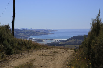
The Cloud Forest of Leith track has become overgrown in places with ferns covering the board walk making it difficult to see where to put your feet, although mostly this part of the track is relatively straightforward and easy to negotiate.  Despite being in the shade of the native bush the temperature was rising and the sweat was starting to flow with the constant uphill gradient. Emerging from the bush, into the full sun at the power lines we were rewarded with great views towards Waitati and Warrington and around to Mihiwaka and Mt Kettle. 

After a short drink stop we crossed the open ground under the power lines before heading back into the bush and onto the Escarpment Track.  The condition of the track hasn't improved much since our last visit in November.  The undergrowth of ferns is quite thick along the track, making it difficult to see your feet along with the track and the ever present obstacles of tree roots, fallen trees and mud. Thankfully with all the dry weather recently there was only minimal mud and what mud there is, is firm and porridge like so we clambered up Pigeon Rock with relatively clean boots.   As always Pigeon Rock is a perfect place to stop for a drink and snack while taking in the uninterrupted views of Swampy Summit and around to the northern Silver Peaks, Mt Watkin, Blueskin Bay and the Kakanuis in the distance. 

The next part of the track involves finding your way through the pine plantation which is not as easy as it once was.  The pine trees are now a few years old and being taller than a person means that you need to keep a close eye on the markers to ensure you continue in the right direction.  It feels a little like walking in circles but by sticking to the makers we were rewarded with arriving on the Mt Cargill road with no wrong turns. 

By now the sun was high in the sky and the temperature was pushing into the 30°C's and we had a kilometre or so of road walking ahead of us but on the plus side - we had done all the uphill and there was only downhill ahead of us now.  Not wanting to be longer than necessary in the full force of the sun we turned right and walked down the road 15 minutes to the Three Peaks track.  The first part of Three Peaks track is a lovely section with the trees interlocking branches overhead creating an open green tunnel to walk through. Eventually we reached the end of the tunnel and emerging back into the sun, on another four wheel drive road which we followed back to the power lines. 
Now we had completed a large loop and were on the final home stretch so we stopped for a short drink stop and then back into the shade of the bush.  Going down through the ferny undergrowth is no easier than going up, still can't see our feet but at least we had gravity on our side.  Before we knew it we had reached Sullivans Dam and then it was a short walk around the outside of the dam to complete another loop and we were back at the car, happy to finish a very hot 10.5 km walk in 3.5 hours. 

Friday, February 3, 2023

#28 of 100 trips for 100 years - Silver Peaks River Track 29 January 2023

The Silver Peaks is the OTMC's most visited tramping area and the addition of the River Track linking tracks from the Waikouaiti River up the side ridges to the back bone of the Silver Peaks, Rocky Ridge (trip 5/100 trips) has really opened the area for a larger range of tramping trips.  Today's trip is special because Arthur led us on a guided tour of the River Track to Philip J Cox Memorial Hut, explaining the philosophy and issues of the work he has done on the River Track, and the improvements that continue to be made for all trampers benefit.  It was testimony of how important the Silver Peaks and the River Track are to the OTMC that eighteen people turned up for this special trip.
The day was hot and sunny so it was with some relief that we imediately headed into the shade of the bush and down the Goldminers Direct Track to the Waikouaiti River.  As the name suggests the Goldminers Direct Track takes you directly down the ridge to the river and is very steep in places.  Arthur has done a large amount of work replacing some of the steeper sections with zig zags which make for easier travel although care still needs to be taken on some sections of the track. We reached the river at the bottom in a little over half an hour where we were treated to the first of Arthur's explanations and stories as to the building of the part of this section of track.  Arthur explained the significance of the track signs and what we could expect over the next section of track.

I had been over the River Track a number of years ago when the track had only had rudimentary markings and was just a vague route through the bush, and I was keen to see the changes that had been made. The River Track winds it's way through the mature manuka bush with many sections of extensive benching meaning the track had been dug into the bank while in other parts, the track has been built up to avoid boggy areas making for a more level and smoother track to walk on.
During the walk we learnt that Arthur has spent many hours working on the track approximately (a conservative) 400 days over the past 10 years, with some help from others but mostly on his own. Some sections have required a large amount of building up with rocks dug out of earlier sections and all of this track has been hand built and funded by Arthur.  The amount of work that has gone into the River Track is phenomenal and it was a privilege to walk the track with Arthur as our guide. 
A morning tea stop was called in the shade at the Hunters Track junction and once we had rested we continued following Arthur down the River Track, crossing a couple of small side creeks including Cats Teeth Creek.  All the time we were given a running commentary of how each part of the track had been constructed and the obstacles that had to be overcome.  Once we reached the end of the benched  River Track, we continued on through the bush, following Arthur's makers.  This unformed part of the track was a privileged to walk as it gave us a good appreciation of the amount of work that was still required to complete the track. 
The temperature continued to rise throughout the morning and the steep sides of the valley seemed to radiate that heat inwards. One good thing in our favor was that we stayed in the shade of the bush all the way.  Just before the track begins to climb up towards Philip J Cox Memorial Hut, it drops to cross a significant side creek with some lovely large rocks that have created some nice pools.  Here some of the group took the opportunity to throw cold water over their head while others submerged completely for a refreshing dip. 
From the creek, the real work began for us as we climbed our way up around 300m to the Philip J Cox Memorial Hut. Without the benched track, the pace slowed and we were forced to climb over tree tree roots, sidle around slippery slopes and scramble up steep banks which made the going much slower.  We passed through a lovely section of tall tree ferns and another of twisted Fuchsia  trunks with the high leaves keeping the sun from reaching the ground beneath.  Still the track continued to wind it's way up hill through the manuka nnd sweltering under the oppressive heat we finally reached the Philip J Cox Memorial Hut in the blazing sun. Most of the group headed to the edge of the bush to sit in the shade for lunch.  Once lunch was out of the way it was time for a small ceremony to thank Arthur, on behalf of all those who have used the River Track, followed by cake.
Once we had all had a look around the Philip J Cox Memorial Hut, the compulsory team photo was taken before we shouldered our bags to begin the descent down Yellow Spur to the Waikouaiti River.
The track down Yellow Spur mostly follows the ridge downhill and is steep in places, dropping 300m with a rope conveniently placed in the more difficult places.  One section at the bottom involves climbing down a large muddy rock wall with most people finding the easiest way was to abseil down backwards holding onto another conveniently placed rope.   Once over this hurdle it was a pleasure to douse water over our heads and soak our feet in the cold water of the Waikouaiti River.
From the river, the final section of track heads straight back up the hill via The Tunnels Track to the cars.  This is a particularly steep track that climbs around 250m up to through the pine plantation to almost the same height as the Phillip J Cox Memorial Hut which we had left only a short time ago.  The tall pine trees helped to keep us in the shade and while the gradient was unrelenting the wide track made for reasonably easy walking. 
Despite the heat and steepness of the Tunnels Track, it was only 30 minutes from the river to the road and into the blazing sun.  The general consensus from everyone on the trip was that Arthur has done a phenomenal amount of work on the River Track and we are in awe of his dedication to seeing it completed. Saying thank you Arthur, just doesn't seem enough when you see the amount of work and consider how much time and energy Arthur has put into the River Track, providing a valuable alternative access into  the Silver Peaks. 

Otago Harbour Cycleway 30 October 2023

With my sister in town, it seemed a shame to waste a calm, sunny day so the two of us hopped on a bike each to enjoy the recently opened 32k...