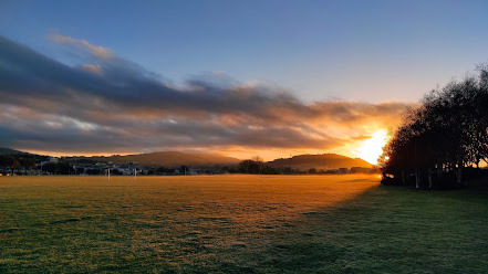
I enjoyed the lovely sunny, Autumn morning today by finishing walking around the Unversity and student housing area. I walked 13 streets
748. Butts Road
749. Logan Park Drive
750. Anzac Avenue
751. Minerva Street
752. Parry Street West
753. Forth Street
754. Leithbank
755. Union Street East
756. St David Street
757. Harbour Terrace
758. Agnew Street
759. Clyde Street
760. Trent Avenue
I started walking along Butts Road which runs around the outside of the University Oval. Butts Road runs around the base of the hill that circled Lake Logan. In 1913 reclamation of the lake began and the land became the site for the 1925 South Seas Exhibition. The road today has large trees and is quite picturesque in the spring and autumn.
The University Oval is a series of sports grounds including the Caledonian track and field grounds, Otago Cricket test cricket ground,Otago Rugby Football training grounds, hockey turf, soccer fields and tennis courts. Once owned by the University of Otago the fields are now owned by the Dunedin City Council.
As I continued walking around the Unversity Oval, I was able to get some good views looking towards Flagstaff with local teams practicing on the sports fields. Being next the Unversity, there are student flats almost on the edge of the fields.
I walked up St David Street which gave me a good view looking back down to the University Oval. This was a good place to see how big the University Oval is and how many sports fields there are.
I walked over the Water of Leith a couple of times today. The part of the Leith that flows through the University is a lovely peaceful place. I saw a number of ducks enjoying the water today.
As I walked around the Unversity Oval and then towards the Unversity of Otago, I was able to get a closer view of Flagstaff. It is also easy to see the town belt in this picture where the green trees split the houses on the closer hills.
Today on my walk I passed Logan Park High School. The school was opened in 1975 after the closure of King Edward Technical College in Stuart Street. The high school is set in a lovely wooded valley with easy access to the University Oval and Caledonian track and field grounds.
As I mentioned earlier, after Lake Logan was filled in, the land was used for the South Seas Exhibition. The South Seas Exhibition was a world fair held in Dunedin from November 1925-May 1926. The exhibition was very popular with over 3 million visitors, considering there were only 1.25 million people in all of New Zealand at the time. This building is all that is left of the great exhibition halls and was the exhibitions art gallery.
This building gives no hint of the grandeur of the South Seas Exhibition as shown in the picture below.
Another building of note that I walked past today is the Forsyth Barr Stadium. Built in 2011, the stadium is the world's only permanently covered stadium to have a natural turf playing field. The stadium is predominately a rugby stadium but is also a popular concert stadium.
The stadium is next to the University of Otago and the University partly funded the stadium so they can have use of the facilities.
Near the stadium, I walked past the Logan Point quarry. Quarrying began at this site in 1880 and a lot of the rock was used to fill in Lake Logan. Today the rock is used to make concrete.
While there is very little to see from the outside, the hill has been eaten away and is presently 60m below sea level. It floods during heavy rain but is usually dry and is still being quarried today.
One of the historical buildings that I walked past today is the Gregg's factory in Forth Street. The factory has operated on the same site since 1925 and the original building (on the left) is dwarfed by the newer part of the factory.
During my walk of the streets, I came across this plaque in the footpath. It commemorates the first women's refuge in Dunedin which was opened in 1976 and is also the second refuge to operate in New Zealand.
Distance walked: 12.1 km Walking time 2 hr 9 mins
Total distance: 489.1 km Total walking 91 hr 28 mins


