Wednesday, December 8, 2021

Day 120 Ocean View

With Ocean View having only a few streets, I thought it would be a good place to walk in the evening.  I walked 7 streets.

1627. Edna Street
1628. Kayforce Road
1629. Bennett Road
1630. Hare Road
1631. Creamery Road
1632. John Street
1633. Brighton Road
 
I had missed walking the streets in Ocean View when I walked Brighton a couple of days ago as it seemed like a good area to finish walking one evening and tonight was a good night to complete the streets.  I started walking on the flat, not far from the Ocean View domain and beach.
The first street I walked took me up a hill where I was rewarded with a view looking down towards the beach and some of the streets that I was walking tonight.
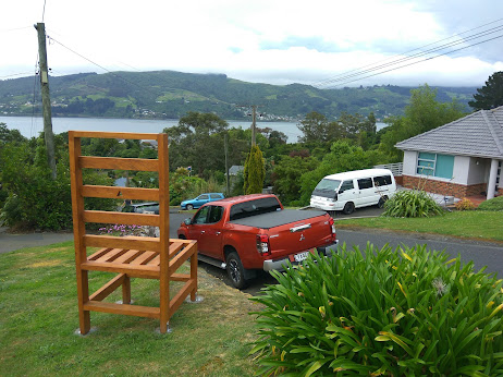
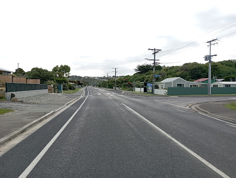
Ocean View is a lovely seaside township that has the sea on one side and farmland on the other. I walked streets that took me to the edge of the township. 
There is a main street through Ocean View which runs along the flat with a few houses between it and the beach.  There are a few side streets which take you up into the hills. 
There are a number of nicely painted bus stops in Ocean View.  Most of them have scenes relating to the sea or beach and the wildlife that that can be found in the area. 


There were some interesting letterboxes - one was made from an actual surf board and the other was made from wood in the shape of a surf board.  Both very appropriate for being near the beach.
 
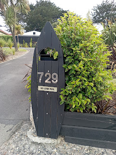
I really liked this letterbox and guess that it belongs to a family who like motorbikes
And this is the map of the streets that I have walked in Brighton and Ocean View. 

Distance walked:  4.9 km         Walking time   56 mins    

Total distance: 991.8  km          Total walking  185 hr 22 mins 

Monday, December 6, 2021

Day 119 Company Bay

Today I continued to walk streets further down the peninsula and walked the streets in Company Bay, Mission Cove and Cosy Dell.  I walked 16 streets.

1611. Luss Road
1612. Lauder Street
1613. Raynbird Street
1614. Glenfinlass Street
1615. Brenton Street
1616. Hinkley Terrace
1617. McLelland Street
1618. Porterfield Street
1619. Kellas Street
1620. Gorman Street
1621. Ngaio Street
1622. Bewley Avenue
1623. Bayne Terrace
1624. Mission Cove
1625. Castlewood Road
1626. McTaggart Street
 
The plan for today's streets seemed to be up and so I started at the edge of the harbour with the first street I walked taking me up the hill.  It rose steeply quite quickly.  Of course as I walked up, I took a rest stop to see the view of the harbour opening up.
And the higher I walked, the better the view became.  The residents of the houses on these streets get amazing views looking down the harbour towards the city.
And if I thought the streets weren't steep enough, they became so steep that they were sealed in concrete.  Concrete is used when it is too steep for asphalt to be used.  I have walked a few concrete streets around the city but this was something I was not expecting here.

Where ever I walked today, I was rewarded with wonderful views.  That is one of the good things about walking streets on the hills - the views! 

And then there were times that I was able to look across to the streets where I had been walking earlier in the day.  It is fair to say that I was surprised by how steep some of these streets are. 

Next thing I knew, I was back walking down near the harbour.  From here I was able to look across to Macandrew Bay where I had walked yesterday. 

The harbour is popular for recreation.  During my walking today, I saw lots of cyclists and walkers using the harbour cycle/walkway and on the water I saw a number of kayakers, paddle boarders and small sailboats.  This is a group of stand up paddle boarders.

I walked past this bus shelter painted with the likeness of John Noakes who lived in Broad Bay (the next bay around).  John Noakes spent  years painting murals on bus shelters around the city.  I have walked past many of the bus shelters that he painted and have featured them in this blog. John Noakes died in 2006 but not before he had painted 65 bus shelters.
And this is one of the bus shelters painted by John Noakes that I walked past today.
Something unusual that I walked past today was this Donald Duck sign.  I am not sure why it has been put there but it looks like it's been there for a while.
Another unusual thing that I walked past today was this huge wooden chair, positioned to take in the view looking across the harbour.  The large chair is near the top of one of the steep streets that I walked up today and was a good place for a rest.
 
 
I walked past a couple of interesting letterboxes today.  I really liked the letters on one of the letterboxes because they were made from Oamaru Stone and I thought the house letterbox looked fun.  I wondered if the people painted in the windows of the house represented the people who live at the house that the letter box belongs to. 
 This map shows the streets in red that I have walked.  On the left side of the harbour is Macandrew Bay and Company Bay where I have been walking the last couple of days and on the left side of the harbour are streets that I have walked a few weeks ago.
 Distance walked:  9.6 km         Walking time  1 hr 53 mins    

Total distance: 986.9  km          Total walking  184 hr 26 mins 


Saturday, December 4, 2021

Day 118 Macandrew Bay

Being a calm morning, I headed down the peninsula to walk the streets of Macandrew Bay.  I walked 14 streets today.

1597. Wharfdale Street
1598. Gracemount Place
1599. Marett Street
1600. Dickson Street
1601. Greenacres Street
1602. Roger Street
1603. Conway Street
1604. Marion Street
1605. Hellyer Street
1606. Jane Street
1607. Featherston Street
1608. Howard Street
1609. Barling Street
1610. Marine Parade

I started walking by the edge of the harbour in Macandrew Bay and very soon was walking uphill where the views down the harbour towards the city started to open up.  The day was overcast and the temperatures were very warm. 

While Macandrew Bay is a suburb of Dunedin, it is 10km down the harbour from the city.  Macandrew Bay has an isolated, rural feel to it.  The township of Macandrew Bay is surrounded by the hills of the peninsula.

Most of the streets head up the hill directly behind Macandrew Bay and as a result, have fantastic views of the harbour.  I was able to look across the harbour to the steep streets of Ravensbourne where I had been walking a few weeks ago.


Either the houses are looking at the harbour view or they are looking towards the hills and farmland behind Macandrew Bay.  I found this a good place to be able to look over to the streets where I was headed during my walk today.

After walking the streets on the hill, I found myself back down by the water of the harbour.  The beach at Macandrew Bay is popular with families, although the sand has to be trucked in each year as there is no natural sand in any of the bays in the harbour.

 
I had only a short respite from walking the streets on the hills because as soon I reached the bottom of the hill, I turned around and walked back up the next street.  The good thing about walking streets on the hills are the views.  From here I was able to look across the harbour to Mt. Cargill. 

 
Further around the hill, I was able to look back over all the streets that I had just walked. 

The streets in Macandrew Bay were steeper than I had anticipated but the views were stunning.  The residents of these streets are lucky to have such a great outlook.

After walking the streets on the hills, I ended back down by the harbour which is very picturesque with the boat houses resting on the waters edge.

 
The final street I walked today was Marine Parade which had uninterrupted views of the harbour, beach and parts of Macandrew Bay. 

 
I saw only two interesting letterboxes today.  One was nicely painted and the other had a starfish with a large eye??

The map below of Macandrew Bay shows the streets in red that I walked today


 Distance walked:  7.8 km         Walking time  1 hr 36 mins    

Total distance: 977.3  km          Total walking  182 hr 33 mins 

Friday, December 3, 2021

Day 117 Brighton

 I headed South to walk the streets of seaside suburb of Brighton.  I walked 14 streets.

1583. Cole Street
1584. Trecastle Street
1585. Queen Street
1586. Pearse Street
1587. Taylor Street
1588. Bath Street
1589. Bedford Parade
1590. Hastings Street
1591. Copeland Street
1592. Wells Street
1593. Morse Street
1594. McIntosh Road
1595. Seaview Road
1596. Scroggs Hill Road
 
 Brighton is a small seaside town on the southern boundary of Dunedin and has a popular beach.  I started walking over the Otokia Creek.  A one lane bridge crosses the creek. 
Then I walked along Brighton Road which has houses on one side and the beach on the other.  This coastal road takes you to Taieri Mouth and further south. 
 
After walking the coastal road, I walked up the hill where I was able to look down to where I had been walking only a few minutes earlier.  I was able to see the down the coast towards Taieri Mouth and also see where there was beach across the road from the houses.

One of the streets that I walked along was Marine Parade which was unusual in that it had large grass fields with trees in the middle of the street.  The houses on the left in this picture are on one side of the Marine Parade with the houses on the right also on Marine Parade.  

After walking Marine Parade, I walked some streets that gave me a good view over wetlands.  This is a lovely place to live with a quiet, almost holiday feel to the town.

 
Then I was back down the hill and crossed the Otokia Creek.  This kayaking/boating place is part of the camping ground which has been sold and no longer operates. The boats were once popular to hire and paddle around the wetlands behind the camping ground. 

 
 I followed the road around the side of the hill and was able to look down onto Brighton Beach. This is a safe beach that is patrolled by the surf lifesavers and is a good beach for swimming.  It has plenty of white sand and rock pools further around for exploring.
 
Looking the other way, I was able to look down the coast towards Dunedin.  Unfortunately it started to rain and some of the coast was obscured by the rain.  I haven't had to walk in the rain very often during my challenge and this time really made up for it with very loud thunder, lightening and heavy rain.
As I followed Brighton Road around the cliffside I was able to look across to the streets that I was going to be walking

Despite the rain, the views were still worth stopping for, although the rain did mean that the photos didn't come out so well. This was a good place to stop and look at where I had been walking today.

 
I walked past these huge macrocarpa trees that dwarfed the cars and houses nearby.  The trunks on these trees are massive and would have made a fantastic play fort.

 
Brighton has a number of nicely painted bus stops.  Each one has pictures relating to the area with the sea and sea creatures being the most popular. 

 
There was only one interesting letterbox on my walk and that was this mailbox letterbox

 
Lastly, this map shows that streets that I have walked in Brighton highlighted in red.  I still have a few more streets to walk but these ones will be in Ocean View.

 Distance walked:  9 km         Walking time  1 hr 45 mins    

Total distance: 969.5  km          Total walking  180 hr 56 mins 


Otago Harbour Cycleway 30 October 2023

With my sister in town, it seemed a shame to waste a calm, sunny day so the two of us hopped on a bike each to enjoy the recently opened 32k...