Having finished walking the streets in the suburbs on the outskirts of the city yesterday, I started walking the streets of Mosgiel. I walked 9 streets today.
1326. Paterson Road
1327. Haggart Street
1328. Crossan Street
1329. Magazine Road
1330. Friends Hill Road
1331. Puddle Alley
1332. Henderson Street
1333. White Hart Lane
1334. Soper Road
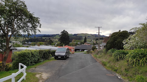
Mosgiel is a satellite town of Dunedin with a population of over 14,000 people within the Dunedin City Boundary. Mosgiel was founded in the early 1850's on the flat land of the Taieri Plains and while most of the town is flat, the eastern boundary runs along the low hills dividing Mosgiel from the rest of the city and this is where I started my walking today.
Mosgiel is a growing town with a lot of new homes being built on the fringes. Only a few years ago, most of this area was farmland.
The houses that have been built on the slightly elevated land of the hills have a view looking over the Taieri Plans and towards Three Mile Hill which is one of the main roads over the hill into Dunedin's hill suburbs.
Once off the slight hill, I was walking the long, straight streets on the edge of Mosgiel. Because the streets are long and straight, I did not walk many streets although I did walk a reasonable distance today.
The road I walked along today runs beside the railway line. This railway line travels the length of the South Island and I have crossed the railway line a number of times during my challenge to walk every street in Dunedin.
I walked past the Wingatui Railway Station on my walk today. This station was opened in 1875 with this particular stating being built in 1914. The station was closed in 1983 with both the station and signal box being preserved. The inside of the signal box still has all the levers once used to manually change the track points.
But mostly the streets that I walked today were long and straight with only a few shorter side streets.
And to show that I did manage to walk some shorter streets, this is looking down Henderson Street from the railway embankment where there is a walking track beside the train track. I walked one way along the footpath beside the road and then back along the embankment.
And at the end of the short streets was open farmland, which I am sure will not remain as farmland for long with all the new houses being built. This will mean that in a few years, there will probably be new streets for me to walk.
On the railway line embankment is this cleverly planted and maintained hedge spelling out the name of the suburb. A popular myth for the name was when William Stevenson, an early settler in the area, shot a Tui in the wing. Liking the sound of
“Wing-a-tui”, William Stevenson named his property Wingatui in the mid 1850’s or the name could be the English spelling of the area which has the Maori name Whiringatua meaning the place of plaiting of straps
These hens became excited as I walked past their home today, coming out onto the road to greet me and see if I had any food for them.
Distance walked: 7.8 km Walking time 1 hr 26 mins
Total distance: 818.6 km Total walking 153 hr 33 mins


