Tuesday, December 14, 2021

Day 124 Normanby

Today I completed the last few streets in my challenge to walk every street in Dunedin. I walked 8 streets today.

1680. North Road
1681. Ribbonwood Close
1682. Cleghorn Street
1683. Corsall Street
1684. Clava Street
1685. Nisbet Street
1686. Norwood Street
1687. Potters Road
1688. Cotter Road

While walking the streets, yesterday I looked across the harbour to see Mt. Cargill.  Today I walked the streets that would take me closest to Mt. Cargill.  I grew up with this view of Mt. Cargill. 

My walk today took me up the hill and I was able to look down to the streets at the bottom of the hill.  My plan for today's streets is taking me on a large loop and I will be finishing my walk on the street at the bottom of this hill.


As I walked further up the hill, Mt. Cargill (hill on the left with the transmitter) got closer and I was able to see how much further up I had to walk.  The group of trees on the skyline in the middle of the picture is as far up the hill that I needed to walk.
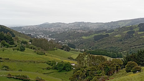
Today I was walking on the northern edge of the city and could look back over farmland.  At the bottom of the field is the Forrester Park sports fields that include a dog park and BMX track.  This used to be an old city dump and was covered over to create recreational facilities for the city many years ago.

As I walked around the side of the hill, I could look back over the northern part of the city.  From here, I was able to see the town belt easily.  The town belt is the 'belt' of trees through the middle of the city.  The town belt was planned in Scotland around 1848 and is one of only three town belts in the world. It is an example of the native bush that would have covered the hills before the settlers arrived and the city was built.

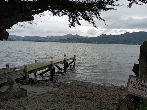
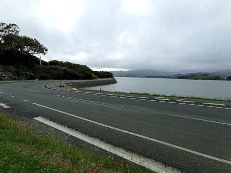
I walked a number of short side streets today and one of those side streets took me around the hill to a view of the harbour and the hills of the peninsula.  I was able to look down to where I was walking yesterday, around the road at the base of the hills.  This view was a nice surprise. 

Then I was back to the main road and onto the top of the hill.  This is as close to Mt. Cargill as I got and from here it is easy to see why the Maori legend tells of  Kapukataumahaka /Mt. Cargill being a warrior lying down.  Mt. Cargill has the transmitter on the top and is the body of the warrior while Buttars Peak to the right is the head with the legs of the warrior to the right of Mt. Cargill.


As I reached the top of the hill, I had one final view of the city before I walked down the hill to the street at the bottom (in the middle of this picture).  I had started walking from this street and walked up the hill around the left before walking down on the right back to where I started walking.

The road down the hill was a lot steeper and narrower than the one that I had walked up.  This road is mainly used by the local farmer but it made a nice loop to walk and had houses near the bottom.

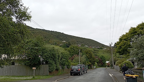
The final view I had was at the bottom of the hill, looking back up to where I had walked earlier.  The houses in the middle of the hill are on streets that I had been on as I walked up the hill.

 
One place of interest that I walked past today is the Upper Junction School war memorial. The large macrocarpa trees were part of the school grounds and there has been a lot of work done recently to tidy the once overgrown site.
There is no school here as it was burnt down in 1945 but the war memorial site is still maintained   The memorial is for seventeen former pupils of the school who were killed during the first world war.

This memorial site is of particular interest to me as one of the memorials is for my fathers uncle who died aged 20 during the first world war.  A beech tree has recently been planted beside each memorial. 

 
At the view of the harbour, I saw how some enterprising locals have made their own seats and bar leaner.  I could see how this would be a great spot on a warm summer evening with a glass or two to drink. 

There were only two interesting letterboxs that I walked past today.  I really liked that it is shaped like the house that it belongs to and I thought the microwave was a good letterbox was a good use for something that was no longer needed. 


Distance walked:  8.4 km         Walking time  1 hr 40 mins    

Total distance: 1032.7  km          Total walking  189 hr 53 mins 

Monday, December 13, 2021

Catch up of streets not counted

As I am finishing my challenge to walk every street in Dunedin, I had a look at the list of streets and I see that I have missed a few off.  Most of these streets didn't get counted as I started and then walked parts of them over different days. Then there are small number of streets that got walked and just didn't get ticked off the list.  Whatever the reason, this is my catch up list of streets. I am adding 11 streets to my total of streets walked.

1689. Burma Road
1690. Dalziel Road
1691. Emerson Street
1692. Hawea Street
1693. Kauri Street
1694. Morris Road
1695. Osborne Terrace
1696. Rata Street
1697. Saint Ronans Road
1698. Eton Drive
1699. Brookside Place

Day 123 Harwood

Today was my longest day of walking as I walked from Company Bay to Harwood, then walked the streets in Harwood.  I walked 14 streets today.

1666. King George Street
1667. Camp Street
1668. Portobello Road
1669. Tily Street
1670. Hanson Street
1671. Weir Road
1672. Harrington Point Road
1673. Harwood Street
1674. Carnock Road
1675. Stepney Avenue
1676. Kokomuka Avenue
1677. Michael Avenue
1678. Ide Street
1679. Tidewater Drive

I started my walk along a wet cycle/walkway at the edge of the harbour.  The weather was overcast with no rain and I knew I had a long way to go today.  I walked around the shared cycle/walkway that runs along the side of Portobello Road and unlike last time when I walked part of the cycle/walkway, I saw only a handful of cyclists and very few walkers/runners.  Today my aim was to walk the rest of the cycle/walkway.

It has taken a number of years for the harbour cycle/walkway to be built and is a real asset to the city.  There has been a lot of work gone into the cycle/walkway with some lovely bridges around some parts of the route.

 
Along the way there are seats placed with great views looking down the harbour towards the city.  A lot of effort has gone into making this shared cycle/walkway appealing for both walkers and cyclists.

There was the odd side street that I needed to walk up and from these streets, I was able to gain a bit of height and look across the harbour towards Mt. Cargill.

But mostly I walked along the side of the harbour along the shared cycle/walkway beside Portobello Road.  I was able to join some of the suburbs up that I had been in walking over the last few days together.

Commonly referred to as Pineapple Rock, this rock with a macrocarpaea tree on top and looks like a pineapple.  The walkway goes around the outside of the rock.  I had been lucky with my walk today as the weather kept improving, the further down the harbour I walked.

With the improving weather, came improving views.  I was able to look across the harbour to Port Chalmers and Mt. Cargill behind it.  Mt Cargill is the hill on the far left. 

Walking beside the harbour was very pleasant as the weather was calm and with very few cyclists, I could wander along at my own pace without having to continuously look around for cyclists.  There was also not a lot of traffic.

 
And then I reached Portobello where I had been walking yesterday. From Portobello, I continued walking around the harbour to Harwood. 

Once past Portobello, the cycle/walkway ended and I continued walking along on the edge of Harrington Point Road.  The edge of this road is wide and there is plenty of room to walk safely.  The views down habour are stunning. 

 
Eventually I walked all the way to Harwood.  There are only a few streets in Harwood with a lot of them having houses on side and the harbour on the other.

An enterprising local has created a seat using the pole.  The seat is a nice place to have great views of the harbour.  On a calm day like today, it is a magical place to sit.
Not all houses in Harwood have harbour views, some look out over rural farmland.  There are a lot of houses with horses in paddocks close by in Harwood. 
But mostly the views in Harwood are of the harbour and Mt Cargill.  This was a good opportunity to see Mt. Cargill from a distance as tomorrow is my final walk and I will be walking the streets as close to Mt. Cargill as I can get.  
I saw this 'mile peg' on the shared cycle/walkway.  This is the last of the old mile pegs remaining on the Portobello Road.  Originally there was a post every mile along the road from Portobello to Vauxhall and each post had the number of miles to Vauxhall engraved on it.  This is the only 'mile peg' left and marks 7 miles to Vauxhall.
If you are wanting to buy a Merry-go-round then I know of where one is on the side of the road.  This Merry-go-round is for sale. Somehow I don't think there is a big market for merry-go-rounds.
 I have seen some unusual signs during my challenge to walk all of the streets.  While I have seen the 'watch out for children' sign, I have not seen one with a cat as well.  
I walked past a number of nicely painted bus shelters.  These bus shelters have been painted by artist John Noakes who lived in Broad Bay.  John Noakes spent  years painting murals on bus shelters around the city.


There were a couple of interesting letterboxes today.  One is shaped like a telephone box and the other is a metal man.  Both are quite large and would hold a lot of mail.

Distance walked:  17.7 km         Walking time  3 hr 06 mins    

Total distance: 1024.3  km          Total walking  191 hr 19 mins 

Saturday, December 11, 2021

Day 122 Portobello

I am nearing the end of my challenge to walk every street in Dunedin and tonight I walked all the streets in Portobello.  I walked 17 streets tonight.

1649. Tree Top Drive
1650. Sherwood Street
1651. Blackwell Street
1652. Hereweka Street
1653. Geary Street
1654. Ridley Road
1655. 1663Seaton Road
1656. Beaconsfield Road
1657. Densem Street
1658. Arnott Street
1659. Ryan Street
1660. Moss Street
1661. Nicholas Street
1662. Landreth Street
1663. McAuley Road
1664. Hatchery Road
1665. Allans Beach Road

Like many suburbs and streets in Dunedin, Portobello is named after a location in Edinburgh, Scotland.  Portobello has a number of streets that are surrounded by farmland.

Harbour Cone can be seen from many of the streets in Portobello.  The aptly named Harbour Cone is part of the hills that form the long extinct Dunedin Volcano.  There is a walking track that goes from sea level to the top of the cone. 

 
As I walked further up the streets that climbed towards Harbour Cone, the views started to open up.  I could see that it looked like rain on the other side of the harbour but it was dry where I was walking.

This is the closest I got to Harbour Cone, although if I had kept walking up the road for quite a few more kilometres, I would have gotten closer but this is where I turned down Seaton Street.

Seaton Street took me down  to the harbours edge.  It was a good street to walk down as I had great views looking across the habour all the way down the street.

 
And before I knew it, I was back beside the water of the habour.  The combined cycle/walkway continues around the harbour from the city and this is where I will be walking tomorrow.

But in the meantime, I turned around and walked back up the hill via another street.  This time my view was harbour cone which towers above Portobello.

 
Finally I was able to walk down the hill for the last time.  A lot of the streets in Portobello have views of the harbour. 

Then I followed a street around the side of the hill which took me back to the township where the shops are and back to where I had started my walk.  This is a popular place for day trippers from the city.

My final view of Harbour Cone is with the Portobello Hotel in front.  The hotel was built in 1874 and has been operating continously as a hotel since.

 
This building is Roy's Store and was one of two shops operating in Portobello in the early 1900's  the unusual corner of the building is where the door to the shop used to be.


An unusual piece of art that I walked past today is this old boat that has been filled with plants and resides on a bank on the side of the road. 

 
I walked past the Happy Hens premises.  Happy Hens is a Dunedin business that has been making happy hens for more than 35 years.  Each hen is hand made and painted with happy hens being sold around the world. 
I walked past one very nicely painted cabinet.  It has the hills of the peninsula and Harbour Cone painted on it. 
While walking the streets tonight, I walked past a few interesting letterboxes.  The first looked a bit like a lopsided house with moss growing on it and the second was an ammunition can.

I thought that you would get a lot of mail in the wine barrel and someone had a bright a cheerful letterbox with elves painted on it.

Distance walked:  7.2 km         Walking time  1 hr 23 mins    

Total distance: 1006.6  km          Total walking  188 hr 13 mins 

Otago Harbour Cycleway 30 October 2023

With my sister in town, it seemed a shame to waste a calm, sunny day so the two of us hopped on a bike each to enjoy the recently opened 32k...