Showing posts with label town belt. Show all posts

Saturday, April 29, 2023

#48 of 100 trips for 100 years - Dunedin Town Belt 22 April 2023 (by Jade Pettinger)


Today’s trip was the largest we have had on the 100 Trips programme so far, with over 40 people in attendance! The OTMC led a trip through Dunedin’s town belt in conjunction with Wild Dunedin as part of the annual Festival of Nature, which saw more than two dozen non-members join us for the traverse from the Southern Cemetery to Woodhaugh Gardens. It was a perfect autumn morning - clear and crisp with not a breath of wind. After checking everyone off the list and giving the necessary health and safety talk, we set off through the Southern Cemetery. This trip was ably led by the knowledgeable and entertaining Antony Hamel and it soon became evident we were in for a fun trip.
We began on a slightly morbid note as we took a detour to check out Antony’s favourite graves in the Southern Cemetery, however it was fascinating to hear the tragic stories. One grave was that of the Campbell family, who, in 1863, were on the last stretch of their three month voyage from London to Dunedin for Rev. Thomas Campbell to take up his role as the first rector of the Dunedin High School (now Otago Boys High School) when the ship they were travelling on, the Yarra, collided with a paddle boat off Sawyers Bay and sank. 13 people drowned that day, including Rev Campbell, his wife Marian and their five young children. As they were immigrants they had no family in Dunedin, however in true southern style the city embraced them and 2000 people turned out for the funeral procession - nearly the whole population of the new Dunedin settlement at the time!
After exiting the cemetery, we had the slog up Eglinton Road to Unity Park ahead of us, which thankfully passed quickly as we chatted away to both new and old friends. We regrouped at Unity Park and heard the story of Admiral Byrd who is immortalised in a statue overlooking the city. Admiral Richard Byrd was an American naval officer and explorer who has caused controversy with his claims that he was the first to reach the North Pole by air in 1926. After receiving the Medal of Honour for his feat, doubts were raised as to whether he actually reached the North Pole or not and to this day historians still cannot agree to whether his claims are true or not.
We headed cross-country from here through the town belt, the damp autumn leaves on the ground turned out to be quite the hazard as they made the footpath slippery underfoot. We are incredibly lucky in Dunedin to have such a large green space in the heart of the city. The Dunedin Town Belt is one of only three Victorian town belts in the world and provides the city with over 200 hectares of native bush. It was originally conceived when the settlement of Dunedin was being planned in the 1840s in Scotland with the idea of having a divide between the city centre and the suburbs.
Our guided tour continued through several more notable places such as Queens View and the beautiful Olveston House. After meandering along Queens Drive, we arrived at our final point of interest, Prospect Park. At Prospect Park, we paid our respects to the late Ben Rudd, with whom the OTC forged a strong relationship and eventually purchased his property on the hills of Flagstaff which the club still manages to this day. Antony Hamel read a poem written by Charles Brasch titled Ben Rudd aloud and with feeling.
From here we headed down the Bullock Track to Woodhaugh Gardens and headed our separate ways - some had rides organised, some headed back to the start point by bus and some walked along the main street of Dunedin back to the Southern Cemetery. Five of us opted to walk along George and Princes Streets. Even though the terrain was flat, having to dodge pedestrians and wait for the pesky green man at the road crossings slowed us down considerably

It took us around 30 minutes to walk from Woodhaugh Gardens to the Oval, and to our surprise, we met some fellow OTMC members getting off a bus at the same time we were walking past. They blamed it on having to transit through the bus hub, however it just goes to show that walking can be a very time-efficient way to get from A to B! 

by Jade Pettinger

Friday, April 23, 2021

Day Fifty Eight Leith Valley

 I've had a week off walking the streets and was back today walking 5 streets.

712. Duke Street
713. Rockside Road
714. Clarewood Avenue
715. McGlashan Street
716. Woodhaugh Street
 
I started by walking Duke Street then I took the Bullock Track up the hill.  The Bullock Track is a cliff side path that cattle were lead along on their way to the works in the early days of  Dunedin.  Now there are no cattle but the pathway is still known as the Bullock Track and is a steep climb from Woodhaugh to Maori Hill.  The views from partway up the Bullock Track look towards Pine Hill and are worth a rest stop. 

I have already walked the streets of Maori Hill but I wanted to carry on walking Burma Street which winds it's way through the town belt and around the Ross Creek Reservoir. 

I walked only part of Burma Street before taking a short cut through Ross Creek Reservoir to meet up with Rockside Road.  I will walk the rest of Burma Street another day.  Ross Creek Reservoir is one of the oldest artificial lakes in New Zealand and was created in 1867 to provide water for the city of Dunedin.  It is the oldest water supply reservoir still in use in the country. Ross Creek Reservoir is surrounded by native bush and has many walking tracks and is a haven for birds.

Once onto walking Rockside Road, I followed it down the hill to Leith Valley.  The views from Rockside Road are a good place to see the town belt with the houses nestled amongst the trees.
The bottom of Rockside Road was a good place to look back up the hill where I had walked down to see the colours of Autumn putting on a good show on the hillside.

I walked over the Water of Leith twice on my walk along Malvern Street, crossing it in different places on my way back to where I had started my walk.  The Leith starts near the Northern Motorway and flows down Leith Valley and through the Unversity of Otago before reaching the harbour. 
Most of the time the Water of Leith is a quiet stream, however during heavy rain and steep sides, this quiet stream becomes a roaring river. Over the years there have been a series of engineering modifications along the length of Leith in an attempt to control the flooding. 


While I did not complete many streets on my walk today, I walked past a number of interesting areas.  I walked past the site of New Zealand's first paper mill today.  The Otago Paper Mills Company was established on this site in 1876.  The factory was destroyed by fire in 1911 and was rebuilt but eventually closed in 1936.  A camping ground is now on the site. 

I walked past some interesting pieces of art today.  This one is on the side of a garage near the Water of Leith.  It shows the river with a morepork. 

More art I walked past today was at the Ross Creek Reservoir.  In 2010 cracks were discovered in the reservoir.  The base of the dam was strengthened and the dam face was rebuilt and an artwork has been installed on the dam face.  

The artwork is a sculpture of 77 steel stars with the inspiration being the night sky reflecting in the water of the reservoir.  The stars have been placed to represent the southern constellations. 
 
 
There were a number of interesting buildings that I noticed on my walk.  The Woodhaugh Hotel is on the corner of Woodhaugh Street was a hotel during from 1882-1893.  It has been a restaruant, a brothel and now is a student flat.

I walked around this lovely old stone cottage that has a street on three sides with the house taking up the whole section. 
Another interesting building that I walked past is this old church that is now home to the NZ Deer Stalkers Association and the Dunedin Rock and Mineral Club.

Distance walked:  5.3 km      Walking time   59 mins    

Total distance: 456.1 km       Total walking  85 hr 45 mins


Friday, March 12, 2021

Day Thirty Eight Balmacewan

The weather and life have stopped me from getting out walking for a week and I was pleased to have blue sky today.  I walked 12 streets today

486. Dudley Place
487. Stonelaw Terrace
488. Brownville Crescent
489. Spylaw Street
490. Passmore Crescent
491. Grater Street
492. Sim Street
493. Prestwick Street
494. Pilkington Street
495. Cannington Road
496. Cairnhill Street
497. Braeview Crescent

I started by walking along Cannington Road towards Prospect Park.  It was good to get glimpses of Pine Hill from between the houses and I was really enjoying walking the streets again. 


Prestwick Street is a good street to walk along as it has great views looking towards Wakari.  I have walked none of the streets that I could see. 

I walked down (and back up) part of Balmacewan Road.  There are good views of Flagstaff (the hill in the background) from Balmacewan Road.  Flagstaff is a popular walking area and has some of the best views of the city. 

Balmacewan Road is unusual in that it dissects the Balmacewan Golf Course (at the bottom of the hill in the photo above).  Golfers need to stop playing, pick up their golf ball and clubs to cross the road to and continue playing. 

After Balmacewan Road, I walked along Pilkington Street past John McGlashan College, a state intergrated high school for boys.  John McGlashan College was opened in 1918 and is named after John McGlashan who was a Presbyterian lawyer, politician  and educationalist.  

Part of the school borders Cannington Road where I could see sports teams practicing on the school fields. 

The last street I walked today was Braeview Crescent and I was rewarded with fantastic views looking down to Leith Valley and over to Pine Hill where I am looking forward to walking more streets.

There were a few interesting parts of my walk today.  The first is this 'public art' on the side of a garage.  I am enjoying discovering all these hidden paintings around the city. 

Braeview Crescent is a hidden gem of a street with houses on both ends and in the middle is a narrow, winding street with trees closing in. 

There are gaps in the trees of Braewview Crescent and it is easy to see how the town belt curls around Ross Creek, under Pine Hill and finishing at the Dunedin Botanical Gardens.  Dunedin is very green looking from this part of the city.

Distance walked:  7.1 km      Walking time  1 hr 19 mins    

Total distance: 316.4 km       Total walking  59 hr 28 mins


Thursday, March 4, 2021

Day Thirty Six Maori Hill

 I enjoyed my walk winding around the streets of Maori Hill and I walked 12 streets today.

462. Claremont Street
463. Maheno Street
464. Hamel Street
465. Lynwood Avenue
466. Wallace Street
467. Newington Avenue
468. Burwood Avenue
469. Grendon Street
470. Brent Street
471. Baxter Street
472. Tolcarne Avenue
473. Drivers Road 
 
Today I continued to walk the streets skirting the edge of the town belt and joining onto Highgate.  This meant some hills to walk up and down but not as steep as my last walk.  The views from Maheno Street were worth a stop.  

I have really enjoyed walking around the town belt area as the streets are much quieter and it is hard to believe that I am in the middle of the city.  Newington Avenue is one of those quiet, green streets.  

Tolcarne Street is a street with a seat overlooking an uninterrupted view of the city.  I spent quite a bit of time here looking at the wonderful view of the city with the town belt in the foreground. 

The final street I walked today was Drivers Road which crosses the town belt. I walked down to where Drivers Road joined Queens Drive then I walked back up to Highgate.  Drivers Road can be very busy with traffic at times but today it was reasonably quiet.  

 I saw a couple of interesting things I saw today, one was this neat painting of two animals on a residential fence

I walked past this lovely gate on Drivers Road.  Behind the gate is a large house built in 1935.  

On my walk today I passed the Highgate Presbyterian Church.  Like so many older buildings and in particular, churches, the Highgate Church is closed to the public including church meetings due to safety questions around the building's structure. 


Distance walked:  6.6 km      Walking time  1 hr 14 mins    

Total distance: 303.4 km       Total walking  56 hr 55 mins


Saturday, February 27, 2021

Day Thirty Four Town Belt

It's been nearly a week since my last walk of the city streets but back walking today with my goal being to walk all of the town belt.  Today I walked 6 streets. 

447. Queens Drive
448. Montpellier Street
449. Lane End
450. Braid Road
451. Duchess Avenue
452. Bute Street

The Dunedin Town Belt is over 200 hectares of native bush across several suburbs in central Dunedin.  It is one of only three Victorian Town Belts in the world.  The town belt is a good example of what Dunedin would have been like before the first settlers arrived and started cutting down the bush to build their homes.  Today the town belt is an important habitat for many birds including the kereru, tui, bellbird and rifleman.  It was a pleasure to hear many birds on my walk today

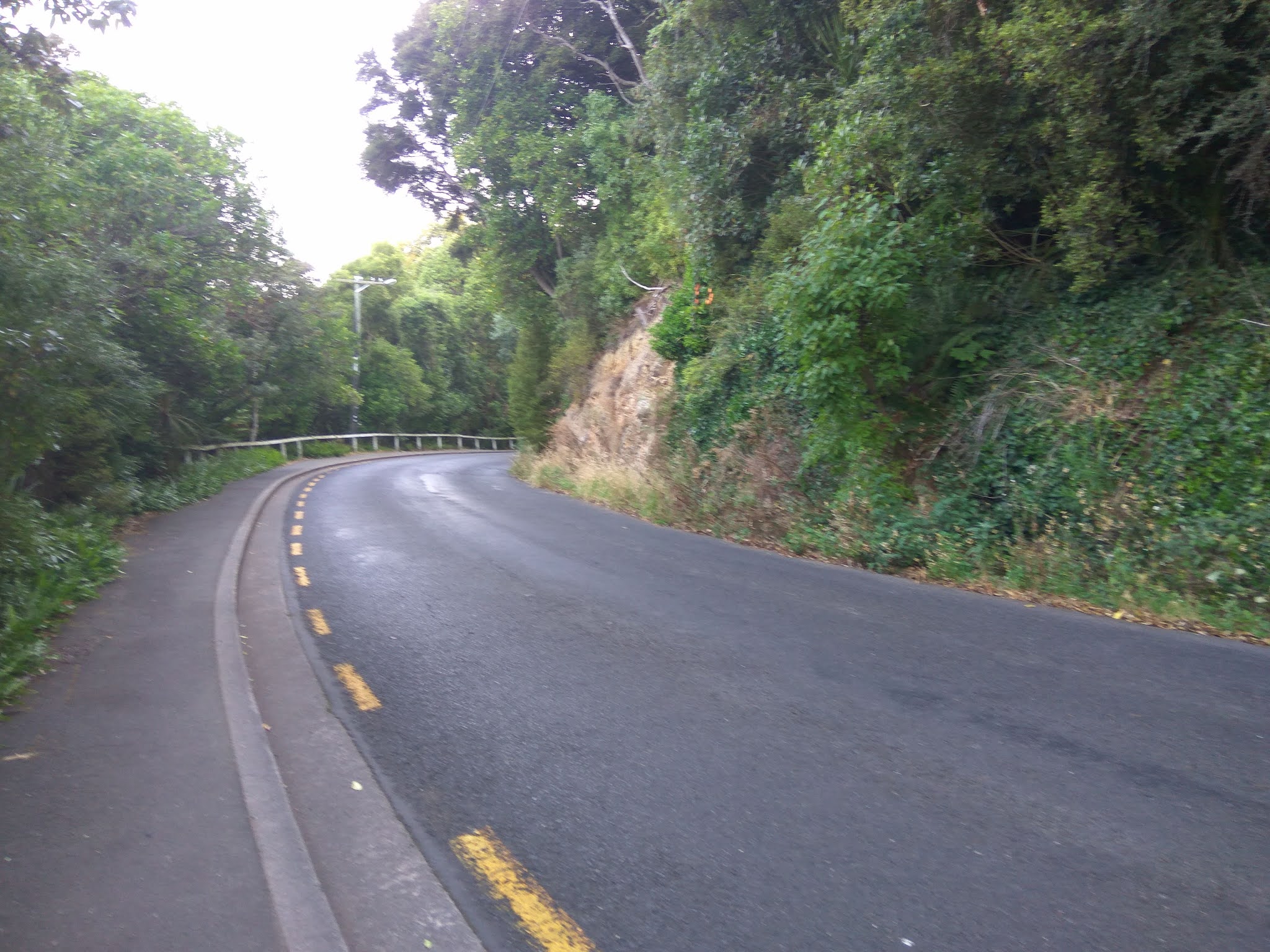
Queens Drive is the road that runs the length of the town belt and as it is narrow and windy, there is little traffic making it a great place to walk.  I started my walk on Queens Drive  from Eglington Road, Mornington and walked all the way to Prospect Park, Maori Hill.  There are open grass areas in the town belt giving the opportunity for views of the city.  

During my last walk, I walked past the front of Otago Boys High School today I walked past the back of the school.

The next bit of Queens Drive past Otago Boys High School is busy I walked past the city's public swimming pool.  Moana Pool was opened in 1964 and was one of the countries first Olympic sized swimming pools.  In the early 2000's the hydro slide was added.  

It was good to get past Moana Pool and back into the quiet and the green of the town belt.  The town belt has a number of walking tracks through the bush making it popular with walkers and runners. No  cars passed me during my walk today. 

As Queens Drive traverses a number of suburbs, the views of the city kept changing .  The residents of the houses that border the town belt are very lucky to have this quiet, green space so close. 

As I neared the end of Queens Drive, I came across a gap in the trees allowing me a great view of the University of Otago campus with all it's tall buildings and the stadium and harbour behind it. 

Once at the end of Queens Drive, it loops around the playing fields of Prospect Park giving great views down to Leith Valley and over to Pine Hill, North East Valley and Opoho.  I have not walked any of these streets yet and looking at them today,  I can see that I still have quite a few hills to walk up. 

I really enjoyed my walk of the town belt today and there were a few interesting things I noticed along the way. I came across this lovely big tree with it's commemorative stone telling how William Thomson had planted it and many others in the town belt from 1888 to 1923.

I also passed this old style post box outside Olveston.  It is one of only a few of it's type remaining in New Zealand

 It is great to see families making use of the green spaces along the town belt with areas for children to play. 

Distance walked:  8.0 km      Walking time  1 hr 32 mins    

Total distance: 291.2 km       Total walking  54 hr 36 mins


Otago Harbour Cycleway 30 October 2023

With my sister in town, it seemed a shame to waste a calm, sunny day so the two of us hopped on a bike each to enjoy the recently opened 32k...