Showing posts with label Kaikorai Valley. Show all posts

Sunday, March 28, 2021

Day Forty Five Kaikorai

 The streets I walked today completed an area that I have been walking the last few days.  Today I walked 11 streets.

578. Ferntree Drive
579. Dean Street
580. County Road
581. Ayr Street
582. Wairoa Street
583. Chapel Street
584. Swanson Street
585. Culloden Street
586. Greenock Street
587. Fife Street
588. Nairn Street

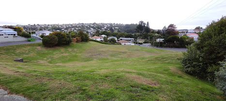
The residents of Dean Street, County Road and Waiora Street have a large green space which is a good place for playing and dog exercising.  It looks like it is part of land that can not be built on and an added bonus of the open area are good views looking towards Roslyn.

The good views of Roslyn continued on most of the streets I walked today.  I have walked all the streets that I could see on the hills opposite and it is a good feeling knowing that I don't have to walk them again as some were quite steep.

The streets that I walked today wound their way around the side of hill with a diverse range of streets ranging with some being wide and others quite narrow with very little parking .  

There were a couple interesting things I saw on my walk today.  The first was this large tree in Ferntree Drive.  It is such a significant tree that the footpath is extended around it and out into the road.

And the other is this clever cow letterbox.  It is a very happy looking cow. 


Distance walked:  4.8 km      Walking time   48 mins    

Total distance: 367.2 km       Total walking  68 hr 55 mins 


Saturday, March 13, 2021

Day Thirty Nine Wakari

 Today I had another lovely, sunny day for walking the streets. I walked 21 streets and today is a milestone with having walked over 500 streets. 

498. Munro Street
499. Butler Street
500. Burt Street
501. Rosebank Avenue
502. Chapman Street
503. Cohen Place
504. Craighall Crescent
505. Dale Street
506. Kinsman Street
507. Mardale Street
508. Font Street
509. Wright Street
510. Walton Street
511. School Street
512. Tyne Street
513. Oban Street
514. Dunblane Street
515. Sargood Street
516. Wales Street
517. Fairfax Street
518. McMillan Street

I started my walk by going downhill then straight back up which seemed to be the theme of my walking today - down then up, back down then up again.  I walked down Lynn Street past the sports fields of Balmacewan Intermediate and then up the hill after the sports fields.

Once past Balmacewan Intermediate I was able to connect back up with Balmacewan Road where I had been walking yesterday, then it was back down Lynn Street and I was able to look back at streets I had walked recently. 

One of the benefits of walking on the hills is the views.   I am always happy to stop and look back to where I have come from (past the round about) and also to see all the streets that I still have to walk (everything behind the round about). 

I was able to join up some streets onto Kaikorai Valley Road where I had finished walking a couple of weeks ago.I have walked everything on the left of Kaikorai Valley Road but I have not walked any of the streets on the right.

Once I was onto walking Tyne Street I was able to look over to Wakari and see some of the streets I had walked earlier today but most of what I could see are streets that I have not been to yet. I also enjoyed the view of Flagstaff again.  Flagstaff is the hill behind the houses. 

The area I walked today has a number of quiet green spaces that are worth exploring further.  I passed the community garden which I will need to visit another time and the Kaikorai Reserve which has been developed into a lagoon/wetlands area.  Again I didn't have the time to stop and explore further but I will be making a return visit soon. 


I also passed the Craighall Crescent Recreation Reserve hidden on Craighall Crescent which is one of over a hundred reserves within the Dunedin City boundary.

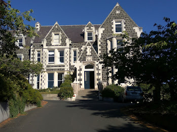
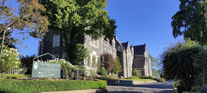
Today I walked past Columba College which is a high school established in 1915 by the Presbyterian Church as a boarding and day school for girls.  Parts of the school date back to it's start with impressive stone buildings.


Distance walked:  10.8 km      Walking time  2 hr 2 mins    

Total distance: 327.2 km       Total walking  61 hr 30 mins

Wednesday, February 17, 2021

Day Thirty Two Kaikorai Valley

Today I was back walking in Kaikorai Valley completing all the streets up to Stuart Street, where I finished yesterday.  Today I walked 15 streets.

426. Manchester Street
427. Ipswich Street
428. St Albans Street
429. St Albans Close
430. Glenelg Street
431. Lixmont Street
432. Hector Street
433. Hermond Street
434. Frasers Road
435. Coleridge Street
436. Malta Street
437. Hereford Street
438. Kaikorai Valley Road
439. Oates Street
440. Falcon Street

Kaikorai Valley Road is about 6km end to end and since I had walked about half of it, today I had plans to finish walking all of it.  The first street off Kaikorai Valley Road that I walked today was Manchester Street which wound it's way uphill and gave me good views looking along where I was headed on Kaikorai Valley Road.


Further along Kaikorai Valley Road I walked up Glenelg Street and it was great looking back at the streets on the top of the hill where I had been only yesterday. You can see the top of the church I mentioned yesterday and the houses below the church are on Northview Crescent while the houses on the hill straight above the street I am walking are on Pitcairn Street, which is where I had been walking only a couple of days ago.  

 
It wasn't long before I was walking Frasers Road which leads to Frasers Gully.   The gully follows Frasers Stream  through native bush up towards Dalziel Road.  There are a number of short walks in Frasers Gully that are popular with dog walkers and families.  At the start of Frasers Road is Ellis Park which are sports fields that can be busy with sport  at the weekends. . 
 
I continued walking along Kaikorai Valley Road until I reached Stuart Street then headed along Oates Street.  It was good to look towards Helensburgh with Flagstaff rising behind.  
 
As I walked further along Oates Street the view changed to looking towards Mount Cargill and the streets near my home.  I have not walked any of these streets yet. 

I also got to look down on Ellis Park where I had been earlier in my walk.  The fields of Ellis Park looked large when I was beside them and they also looked big from Oates Street

On the corner of Oates and Falcon Street  (I had walked the top of the Falcon Street yesterday) there is a plaque to commemorate the British Antartic Expedition of 1912 lead by Robert Falcon Scott and supreme sacrifice of Capt. Oates to the expedition.  Falcon Street is a very steep street and I was pleased to be walking down it. 


Today on my walk I saw some ducks in Glenelg Street and sheep in Frasers Road.  It is a bit unusual to see sheep in the middle of the city and this is the first sheep I have seen.


Today I also saw this cleverly painted telephone cabinet.  I am enjoying discovering all the painted telephone cabinets around the city. 


Distance walked:  8.6 km      Walking time  1 hr 35 mins    

Total distance: 278.2 km       Total walking  52 hr 07 mins

Monday, February 8, 2021

Day Twenty Seven Kaikorai Valley

Today was one of my longer walks where I walked half of Kaikorai Valley Road, and all the side streets.  Today I walked 17 streets

336. Ensor Street
337. Short Street
338. McLeod Road
339. Eclipse Road
340. Townleys Road
341. Donald Street
342. McNab Street
343. Salisbury Road
344. Marshall Street
345. Bradford Street
346. Mulberry Street
347. Stone Street
348. Mataora Road
349. Borthwick Street
350. Hocken Street
351. Bryant Street
352. Fels Street

The first part of my walk today, took me through the industrial part of Kaikorai Valley with lots of car sale yards and commercial premises.  Once through this part, it was up Ensor Street to join onto the motorway near the Lookout Point Fire Station. Luckily there is a walkway that took me through to the top of Short Street.  The residents of Short Street have good views looking towards Saddle Hill. 


Once back at the bottom of the hill, it was a short walk to the bridge over the South Island Main Trunk Line.  From the rail bridge I could look down to where the Burnside Railway Station was. There is no station there now. 


The Burnside Railway Station was a local station used by commuters up until it's closure in 1982.  The train used the tunnel to cut out the hills making the journey to the city quite fast.  As cars became more reliable, the train was less popular and eventually the station closed. This picture shows how the station looked not long before it's closure. 

From here I walked back along Kaikorai Valley Road and past Kaikorai Valley College.  Kenmure Intermediate and Kaikorai Valley High School merged in 1996 to become Kaikorai Valley College.  

I turned onto Stone Street and headed up the hill.  It was good to be back on the hill as I was able to see the mix of residential houses and commercial buildings on Kaikorai Valley Road.

Once back on the hill I finished some of the side streets off on Kenmure Road then followed a set of steep steps down onto Hocken Street so I could complete a few more streets. 


Kaikorai Stream flows through Kaikorai Valley with the road crossing the stream in places.  Through walking the valley, I discovered the pathway that runs alongside part of the stream.  It is good to see the restoration of the stream with native plants.  


On my walk today I saw these two painted telephone cabinets.  I particularly like the kakapo looking out through the flax.  


Distance walked:  13.4 km      Walking time  2 hr 29mins    

Total distance: 231.7 km       Total walking  43 hr 15 mins


Saturday, February 6, 2021

Day Twenty Five Balaclava

 Today I reached another milestone - walking 300 streets which is 20% of the total number of streets in Dunedin.  Today I walked 12 streets

300. Agnes Street
301. Mercer Street
302. Leary Street
303. Barr Street
304. Shirley Place
305. Bowler Avenue
306. English Avenue
307. Blair Street
308. Stanley Street
309. Stansfield Street
310. Bernard Street
311. Elgin Road

I also walked part of a number of streets but I won't count them until I have walked all of the street.  I started my walk by going down Barr Street and completing the streets that run off Barr Street. 

Barr Street took me down to Kaikorai Valley with the residents having semi-rural views.  We are lucky to have a lot of green space in Dunedin. 

Once at the bottom of Barr Street, it was onto Kenmure Road which took me back up the hill to the height where I had started.  The bottom part of Kenmure Road looks down on the car yards and industrial part of Kaikorai Valley.


As I walked up Kenmure Road the views opened out and I was able to look over towards the streets I had walked earlier in my walk today, Barr Street, Agnes Street and Mercer Street.

Once at the top of hill again, I walked along Kenmure Road to Mailer Street then back along Elgin Road and completed all the side streets between Kenmure Road and Elgin Road.  One of the good things about being on top of the hill is being able to see where I will be walking soon.  From Kenmure Road I could look down to Kaikorai Valley and over towards Brockville on the hill opposite.

Today, one of the interesting things I saw on my walk was this lovely ANZAC painting on a power pole.  It would have been painted by a talented resident during lockdown in April last year. 

And there were two letter boxes that I noticed during my walk today.  The first was this sunshine letterbox (how could you not smile when you see it) and the other one reminded me of a key or something, not sure what it is but it is interesting.


Distance walked:  7.8 km      Walking time  1 hr 34 mins    

Total distance: 208.1 km       Total walking  38 hr  44mins


Otago Harbour Cycleway 30 October 2023

With my sister in town, it seemed a shame to waste a calm, sunny day so the two of us hopped on a bike each to enjoy the recently opened 32k...