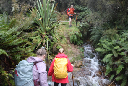
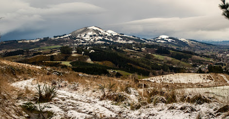
Today's trip started like any of the other #100 trips but little did we know that it was to be like no other of trip so far. The idea for the trip was to explore Flagstff using some of the lesser known tracks and it must have appealed because 12 of us left the Booth Road car park along a forestry road, past the McGowans Track to an indistinct trail on the right that could easily be overlooked if you didn't know it was there. Right from the start we were given a taste of things to come as the native bush appeared to swallow us. The track was overgrown with trees pressing in around us and the ferns hiding the mud that threatened to engulf us.There was a creek to negotiate before the track slopped upwards and here the fun really began. It pays to bear in mind that it is mid-winter and there has been snow and rain recently which meant the track had a layer of mud on a harder surface below which made it difficult, at times, to keep the uphill momentum going, especially when it felt like we were walking with an inch of mud stuck to the tread of our boots. At times it felt like one step forward then two back and it was only thanks to being able to grab the trees and pull ourselves up that we were able to keep moving forward. Thankfully the mud didn't last for the whole 450m climb but it did continue for at least half of that height gain. Eventually the Davies Track leveled out and the track condition improved meaning we were able to make good progress to the bush line where we emerged into the golden tussock with the top beckoning us on. Despite a cold wind we decided this was a good spot for a snack break and we each found a sheltered spot amongst the tussock to nestle into and enjoy the great view of Saddle Hill/Makamaka and coast line towards Taieri Mouth while enjoying our snacks. It wasn't long before the cold wind pushed us on and upwards to the top of the hill. The upper part of the Davies Track winds it's way through the tussock, over rocks and around giant flax bushes while continually gaining height. The problem with walking through tussock is that you can't see your feet so it is easy to loose the obscure track. There were a couple of times that we needed to caste around before finding the track again and we could continue on. Eventually coming out on the Flagstaff Walkway, we were able to relax and turn our attention to the wonderful views of the city that had opened out before us. I have often felt that this is the best place to see Dunedin/Otepoti with harbour and city laid out so clearly and today that feeling was reinforced with views extending as far as Hereweka/Harbour Cone and Mt Charles/Poatiri in the distance. We had been up both these high points on the peninsula during the #100 trips in March and it was good to be able to see them standing out so clearly.
The biting cold wind pushed us on and we took the cross track onto the Firebreak Track where we turned right and followed it towards the Moon Track. Despite the odd muddy patch we were able to make good time along the wide, easy to navigate track while taking the time to admire the views of Silver Stream and the Silver Peaks in the distance. We could also see as far as the Rock & Pillar Range which had a sprinkling of snow on the top which would account for the bitterly cold wind,It is a good couple of kilometres of this easy walking, being chased along by the cold wind, before we reached the Moon Track. I am unsure of the reason behind the name of the Moon Track but the tranquil name does not reflect the true nature of the track because we were straight back into the mud although most of us didn't seem to mind too much as the upper part of the track is very picturesque as it follows an historic fence through the golden tussock.
The Moon Track deteriorates for a bit before it connects with the newly built mountain bike track and the condition changes from a muddy, rutted track to a gravelled, slightly sloping bike track. We stopped at a rocky view point to enjoy lunch and compare mud everyone had on their legs before the cold wind again, pushed us on. We continued to follow the mountain bike track which gently zig zags down the hill past a number of lovely, large moss covered rocks. The easy gradient gave us time to admire the views and took us into the sheltered side of the hill and we marveled at how warm it was in the sun, out of the wind.
After easy walk on the mountain bike track, we took the Pepper Tree Track which is the first walking track on the right and we were straight back into the mud. There were a couple of small streams to cross and plenty of mud to avoid as best as we could. The deceiving thing about the Pepper Tree Track is that drops almost 100m in height then has to regain that height to reach the Pineapple Track. Once on the Pineapple Track we took the small detour to Pineapple Point to admire the city view from this unique vantage point. From Pineapple Point the party split into two groups with one group opting to take the 'easy' way down by following the Pineapple Track while the other group elected to go down the 'Old Pineapple Track' also known as The Ross Bush Track. This track was not as muddy as we thought it might be but it was overgrown in places with your feet having to find the track through the ferns. The lack of mud meant that the group moved quite fast dropping 200m to meet up with the other half of the group at the water treatment station. Then it was an easy walk back to the cars. With around 650m of climbing over 10.5km it was a memorable and muddy trip on some of the lesser traveled Flagstaff tracks.
.jpg)


